
A remote sensing-based method for extracting forest and grass vegetation information in soil and water loss areas of the Loess Plateau

A loess plateau, information extraction technology, applied in the field of environmental remote sensing, can solve the problems of extensive coverage classification, failure to obtain forest and grassland area information, and failure to eliminate crops, etc., to achieve the effect of avoiding duplication

Active Publication Date: 2022-03-04
YELLOW RIVER INST OF HYDRAULIC RES YELLOW RIVER CONSERVANCY COMMISSION
View PDF11 Cites 0 Cited by
  • Summary
  • Abstract
  • Description
  • Claims
  • Application Information

AI Technical Summary

Problems solved by technology

[0006] However, in general, the application of the above-mentioned forest and grass vegetation information based on satellite remote sensing data to the analysis of soil and water loss in the Loess Plateau still has several shortcomings: First, the results of vegetation coverage extracted based on remote sensing technology do not exclude the crops on the cultivated land , and the area information of forest and grassland cannot be obtained
The second is the forest and grass vegetation information in the land use data obtained by remote sensing. Although the forest and grassland areas of different coverage levels are included, the vegetation coverage is only high, medium, and low. The coverage classification is too extensive to meet the requirements of loess. The need for the analysis of plateau soil erosion and the change of water and sediment in the Yellow River

Method used


Image

  • A remote sensing-based method for extracting forest and grass vegetation information in soil and water loss areas of the Loess Plateau
  • A remote sensing-based method for extracting forest and grass vegetation information in soil and water loss areas of the Loess Plateau
  • A remote sensing-based method for extracting forest and grass vegetation information in soil and water loss areas of the Loess Plateau

Examples


Embodiment Construction

[0059] The present invention will be described in further detail below in conjunction with the accompanying drawings and embodiments.

[0060] Table 1 is the main data source information table used in the embodiment. Embodiments Take the Tuwei River Basin, a typical watershed in the Loess Plateau, as an example, and there are no rocky mountains in this watershed.

[0061] Table 1 Information table of main data sources

[0062]

[0063]

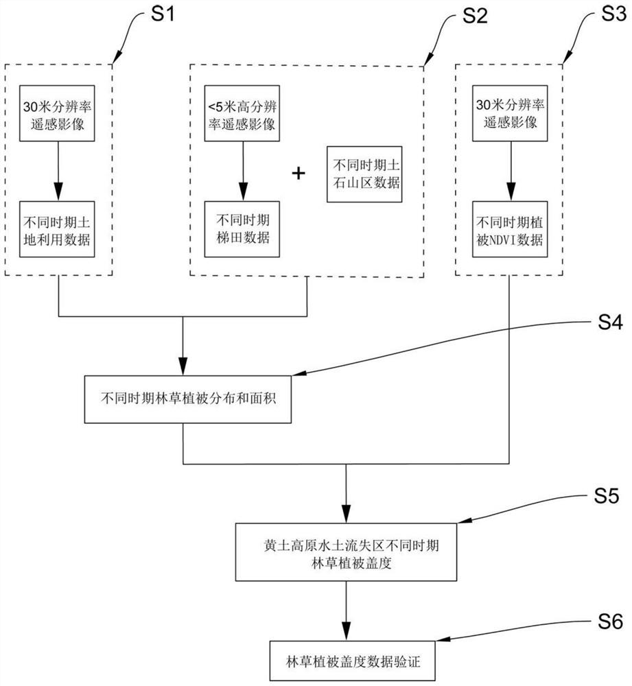
[0064] Based on remote sensing image data in different periods, the information collection and processing of forest and grass vegetation in the Loess Plateau, the flow chart is as follows figure 1 shown, including:

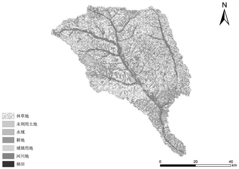
[0065] S1: Extract the vector data of land use in different periods in the soil erosion area.

[0066] Specifically include:

[0067] S1.1: Download the 30-meter Landsat TM remote sensing data, use ENVI and ARCGIS as the platform, preprocess the satellite remote sensing data, and obtain the surface albedo data, including...


PUM


Abstract

The invention provides a remote sensing-based method for extracting forest and grass vegetation information in a soil erosion area of ​​the Loess Plateau. Including: S1: Extract land use data in different periods of soil erosion areas; S2: Extract data of terraced fields and rocky mountainous areas in different periods of soil erosion areas; S3: Extract data of normalized difference vegetation index in different periods of soil erosion areas; S4: Eliminate cultivated land and terraced fields , towns and villages, rivers, waters, and rocky mountainous areas to obtain the spatial location and area of ​​forest and grassland in different periods; S5: Obtain the vegetation coverage of forest and grassland in soil erosion areas in different periods; S6: Analyze the obtained forest and grass vegetation coverage data verify. The invention does not rely on statistical data and avoids the overlapping problems of terraced fields and forest and grass vegetation; it is more detailed in classification of vegetation coverage than in the past; it strips away information such as earth and rock mountains, urban and village land, river land, and water areas that have little impact on water and soil erosion. Accurately obtaining forest and grass vegetation information in soil erosion areas on the Loess Plateau can scientifically evaluate the important role of forest and grass vegetation in reducing water and sediment in different periods.

Description

technical field [0001] The invention belongs to the technical field of environmental remote sensing, and relates to a technology for collecting and processing forest and grass vegetation information on the Loess Plateau, in particular to a method for extracting forest and grass vegetation information in soil and water loss areas on the Loess Plateau based on remote sensing. Background technique [0002] The topography of the Loess Plateau is complex, the topography is broken, and the soil erosion is serious, which is directly related to the change of water and sediment in the Yellow River Basin. Vegetation is an important factor affecting watershed hydrological processes and soil erosion. On the one hand, soil infiltration and surface runoff are affected by changes in surface cover type and coverage, thereby affecting the regional hydrological cycle; on the other hand, changes in vegetation can also affect soil erosion and sediment transport in watersheds. Therefore, vegeta...

Claims


Application Information

Patent Timeline
Patent Type & Authority Patents(China)
IPC IPC(8): G06V20/10G06V20/13G06F16/29
Inventor 董国涛刘晓燕高云飞杨胜天党素珍夏润亮殷会娟郭欣伟程春晓李皓冰韩金旭白乐刘姝芳张楠贾培刘启兴谷佳贺周俊利
Owner YELLOW RIVER INST OF HYDRAULIC RES YELLOW RIVER CONSERVANCY COMMISSION
Learn More