Image terrain radiation correction method and device

A terrain radiation correction and image technology, which can be used in measuring devices, image enhancement, image analysis, etc., can solve the problems of quantitative remote sensing application difficulties, etc.

Active Publication Date: 2019-08-16
INST OF REMOTE SENSING & DIGITAL EARTH CHINESE ACADEMY OF SCI +4
View PDF0 Cites 3 Cited by
  • Summary
  • Abstract
  • Description
  • Claims
  • Application Information

AI Technical Summary

Problems solved by technology

However, as the resolution increases, the image radiation distortion caused by terrain undulations becomes more and more obvious. For example, the same type of ground objects on the...

Method used


Image

  • Image terrain radiation correction method and device
  • Image terrain radiation correction method and device
  • Image terrain radiation correction method and device

Examples


Embodiment Construction

[0069] The following will clearly and completely describe the technical solutions in the embodiments of the application with reference to the drawings in the embodiments of the application. Apparently, the described embodiments are only some of the embodiments of the application, not all of them. Based on the embodiments in this application, all other embodiments obtained by persons of ordinary skill in the art without making creative efforts belong to the scope of protection of this application.

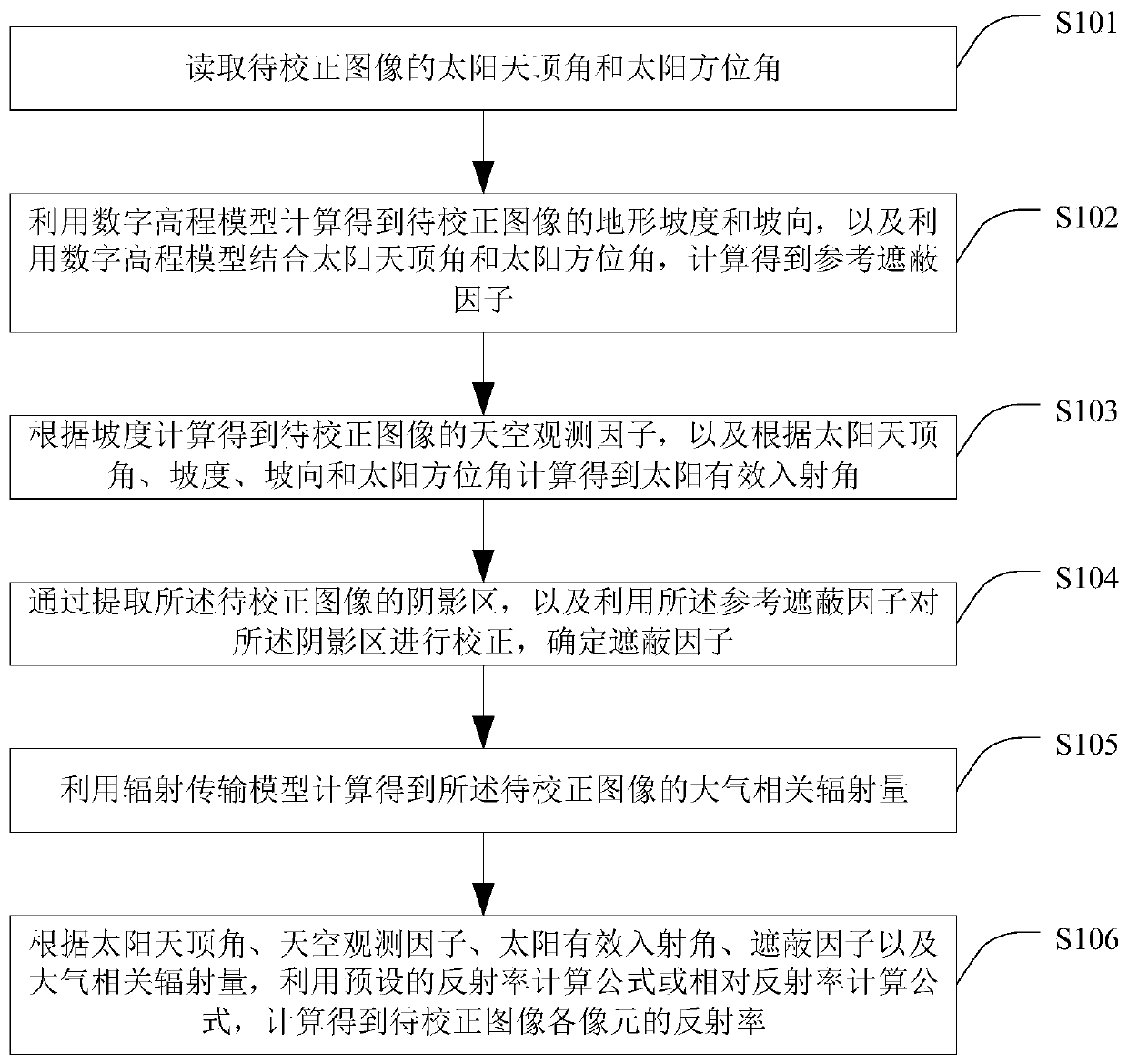
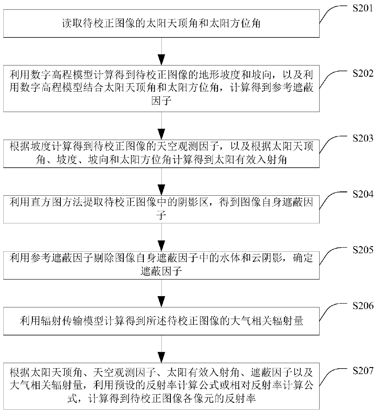
[0070] The embodiment of the present application discloses a method for image terrain radiation correction, see figure 1 As shown, the method includes:

[0071] S101. Read the solar zenith angle and solar azimuth of the image to be corrected;

[0072] Specifically, general remote sensing images will directly give the solar zenith angle θ s and solar azimuth φ s Therefore, it is enough to directly read the solar zenith angle and solar azimuth angle from the image to be corrected a...


PUM


Abstract

The present invention provides an image terrain radiation correction method and a device. The method comprises the following steps: reading a solar zenith angle and a solar azimuth angle of an image to be corrected; calculating and obtaining slope, aspect and a reference shadowing factor by using a digital elevation model; calculating and obtaining a sky observation factor according to the slope,and calculating and obtaining a solar effective incidence angle according to the solar zenith angle, the slope, the aspect and the solar azimuth angle; extracting a shadow zone of the image to be corrected, correcting the shadow zone by using the reference shadowing factor, and determining a shadowing factor; calculating and obtaining an atmospheric correlated radiation amount by using a radiationtransmission model; and according to the solar zenith angle, the sky observation factor, the solar effective incidence angle, the shadowing factor and the atmospheric correlated radiation amount, calculating and obtaining reflectivity rates of all image elements of the image to be corrected by using a preset reflectivity rate calculation formula or a relative reflectivity rate calculation formula. The method can be used for performing terrain radiation correction on the image, and thus the terrain radiation correction on the image is realized.

Description

technical field [0001] The present application relates to the technical field of image radiation processing, and more specifically, to a method and device for image terrain radiation correction. Background technique [0002] With the development of remote sensing technology, high-resolution images are increasing, and related applications are becoming more and more extensive. However, as the resolution increases, the image radiation distortion caused by terrain undulations becomes more and more obvious. For example, the same type of ground objects on the shady and sunny slopes of the mountain show significant differences in the image, and the image classification or other quantitative remote sensing application poses great difficulties. [0003] Therefore, it is an urgent need for high-resolution images to be applied in remote sensing technology to perform terrain radiation correction processing on images. Contents of the invention [0004] Based on the above requirements...

Claims


Application Information

Patent Timeline
IPC IPC(8): G01C1/00G06T5/00
CPCG01C1/00G06T5/007G06T2207/10032G06T2207/30181
Inventor 张浩丁一帆闫东川陈正超赵广宁王霁云
Owner INST OF REMOTE SENSING & DIGITAL EARTH CHINESE ACADEMY OF SCI
Why Eureka
Try Eureka