DEM water flow direction calculation method based on elevation deviation transmission

A technology of water flow direction and deviation transfer, applied in calculation, 3D modeling, complex mathematical operations, etc., can solve problems such as only considering local slope and large deviation of water flow path, and achieve the effect of simple data processing structure

Active Publication Date: 2019-11-15
HOHAI UNIV
View PDF3 Cites 5 Cited by
  • Summary
  • Abstract
  • Description
  • Claims
  • Application Information

AI Technical Summary

Problems solved by technology

[0005] The technical problem to be solved by the present invention is to solve the problem that only local slope is considered in the existing single-flow method applied to DEM terrain, the overal...

Method used


Image

  • DEM water flow direction calculation method based on elevation deviation transmission
  • DEM water flow direction calculation method based on elevation deviation transmission
  • DEM water flow direction calculation method based on elevation deviation transmission

Examples


Embodiment Construction

[0033] In order to clearly illustrate the technical features of the solution, the solution will be described below through specific implementation modes.

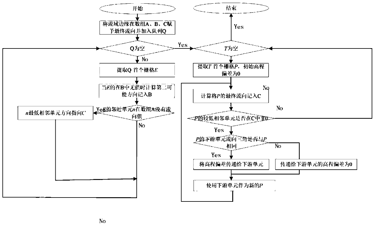
[0034] see figure 1 As shown in Fig. 8, the present invention is: a DEM water flow direction calculation method based on elevation deviation transmission, mainly comprising the following steps:

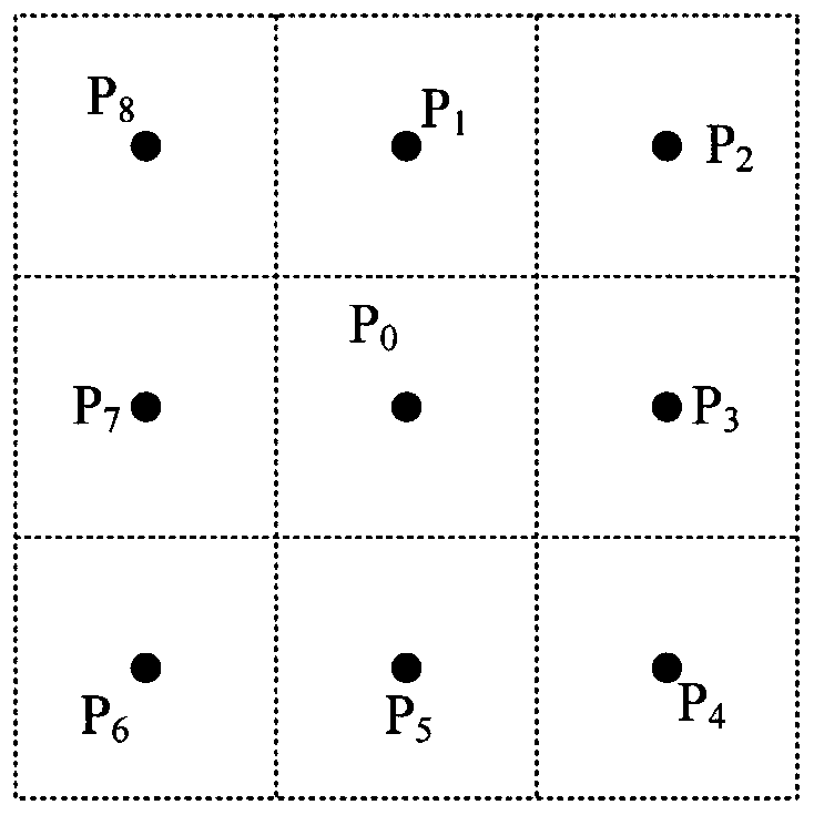
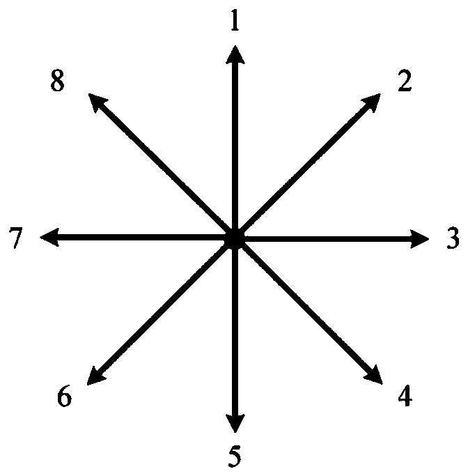
[0035] Step S1: Load the DEM data, the DEM is in a two-dimensional array format, construct three arrays A, B, and C with the same size as the DEM data, array A is used to store the direction of the lowest adjacent unit, and array B is used to store the second possibility The flow direction and array C are used to save the final determined flow direction, and the initial values ​​of all positions in the three arrays are set to 0, and then construct a three-dimensional coordinate information that can save the grid unit (radius X, latitude Y, elevation Z) , and according to the priority queue Q arranged from low to high grid elevatio...


PUM


Abstract

The invention provides a DEM water flow direction calculation method based on elevation deviation transmission, and belongs to the technical field of digital terrain analysis. According to the technical scheme, the DEM water flow direction calculation method based on elevation deviation transmission is characterized in that a water flow path formed by water flow directions is close to a real moving path of water flow on the ground surface; a method for acquiring a higher-precision water flow path by using a DEM (Digital Elevation Model) is used for a hydrological physical model of a numericalsimulation water and pollutant transportation process. The method has the beneficial effects that the height deviation between the real elevation of the water flow reaching the downstream unit and thecentral elevation of the downstream unit is used as a transmission parameter to correct the water flow direction. Compared with a D8 method, the water flow path formed by the water flow direction iscloser to the real moving path of the water flow on the ground surface.

Description

technical field [0001] The invention relates to the technical field of digital terrain analysis, in particular to a method for correcting the direction of water flow by using the true elevation of the water flow reaching the downstream unit and the height deviation of the center elevation of the downstream unit as transmission parameters. Background technique [0002] Flow direction is an important hydrogeomorphological parameter, which is widely used in many numerical models for simulating the transport process of water flow and pollutants. The current calculation of water flow direction is mainly based on the digital elevation model (Digital ElevationModel, DEM). DEM is a generalized description of the terrain, which simplifies the terrain into a large number of grid units in the positive direction, and assigns an elevation value to each unit as the average height of the unit. In the current research on the calculation of water flow direction, the elevation of each unit i...

Claims


Application Information

Patent Timeline
IPC IPC(8): G06F17/50G06T17/05G06F17/11
CPCG06T17/05G06F17/11
Inventor 吴鹏飞刘金涛费俊源刘杨洋姚杰夫
Owner HOHAI UNIV
Why Eureka
Try Eureka