
Method and system for feeding back land utilization changes based on land space-time model

A space-time model and land technology, applied in data processing applications, instruments, forecasting, etc., can solve problems such as inability to predict land use changes, inability to conduct inductive analysis of land use changes, and the results of land use changes are too simple

Active Publication Date: 2019-12-17
深圳市数字城市工程研究中心
View PDF8 Cites 6 Cited by
  • Summary
  • Abstract
  • Description
  • Claims
  • Application Information

AI Technical Summary

Problems solved by technology

[0003] Most of the traditional land models that feed back land use change use the simplest purely numerical statistical method for numerical monitoring and statistics. Prediction of land use change in a future period

Method used


Image

  • Method and system for feeding back land utilization changes based on land space-time model
  • Method and system for feeding back land utilization changes based on land space-time model
  • Method and system for feeding back land utilization changes based on land space-time model

Examples


Embodiment Construction

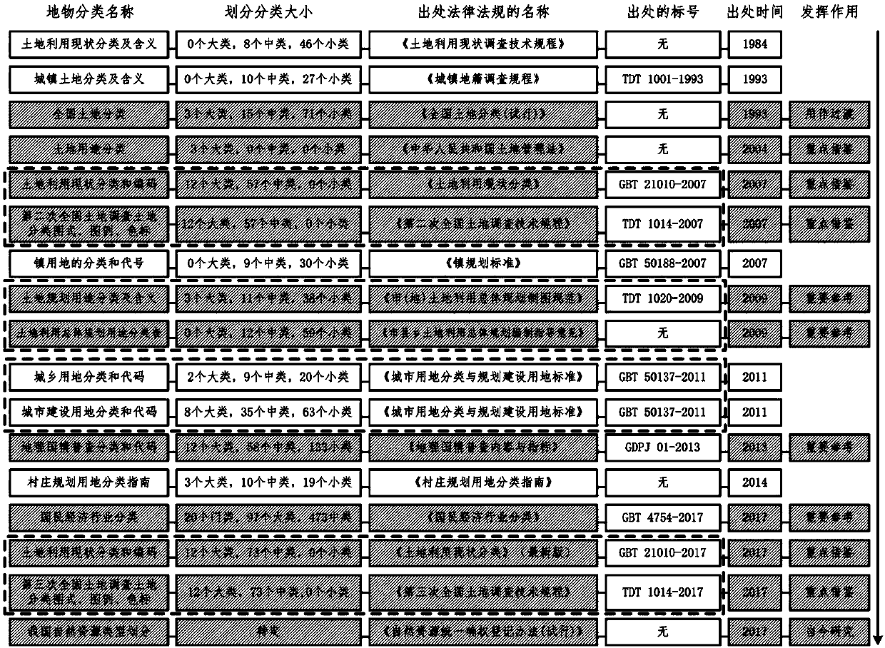
[0060] The present invention first proposes a spatio-temporal analysis model construction method, which can serve for the monitoring of land use change. Most of the traditional land monitoring models use the simplest purely numerical statistical method to provide numerical monitoring (often just calling regression analysis); some may also take the spatial distribution into account, but often simply use the spatial distribution as a comparison of numerical statistics, There is no systematic time series comparison and cause exploration on the time series; some may consider the time information and spatial distribution information comprehensively, but the influence of various factors in the space within the period of time is not considered uniformly. Typical, such as national (or provincial, or municipal) major events in the economy (or administration, or transportation) and other aspects of the impact on land use change.

[0061] Different from the traditional land monitoring mo...


PUM


Abstract

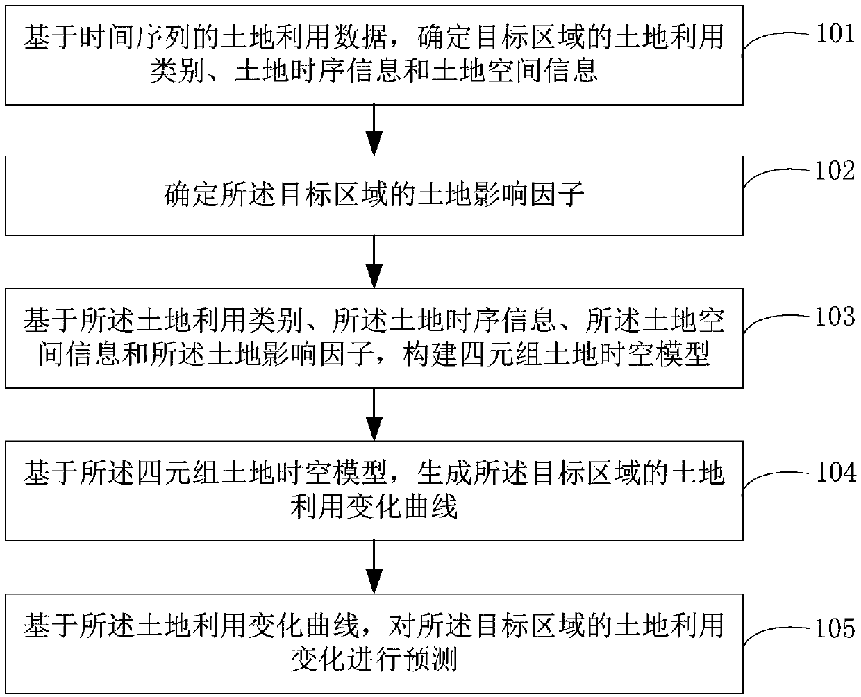
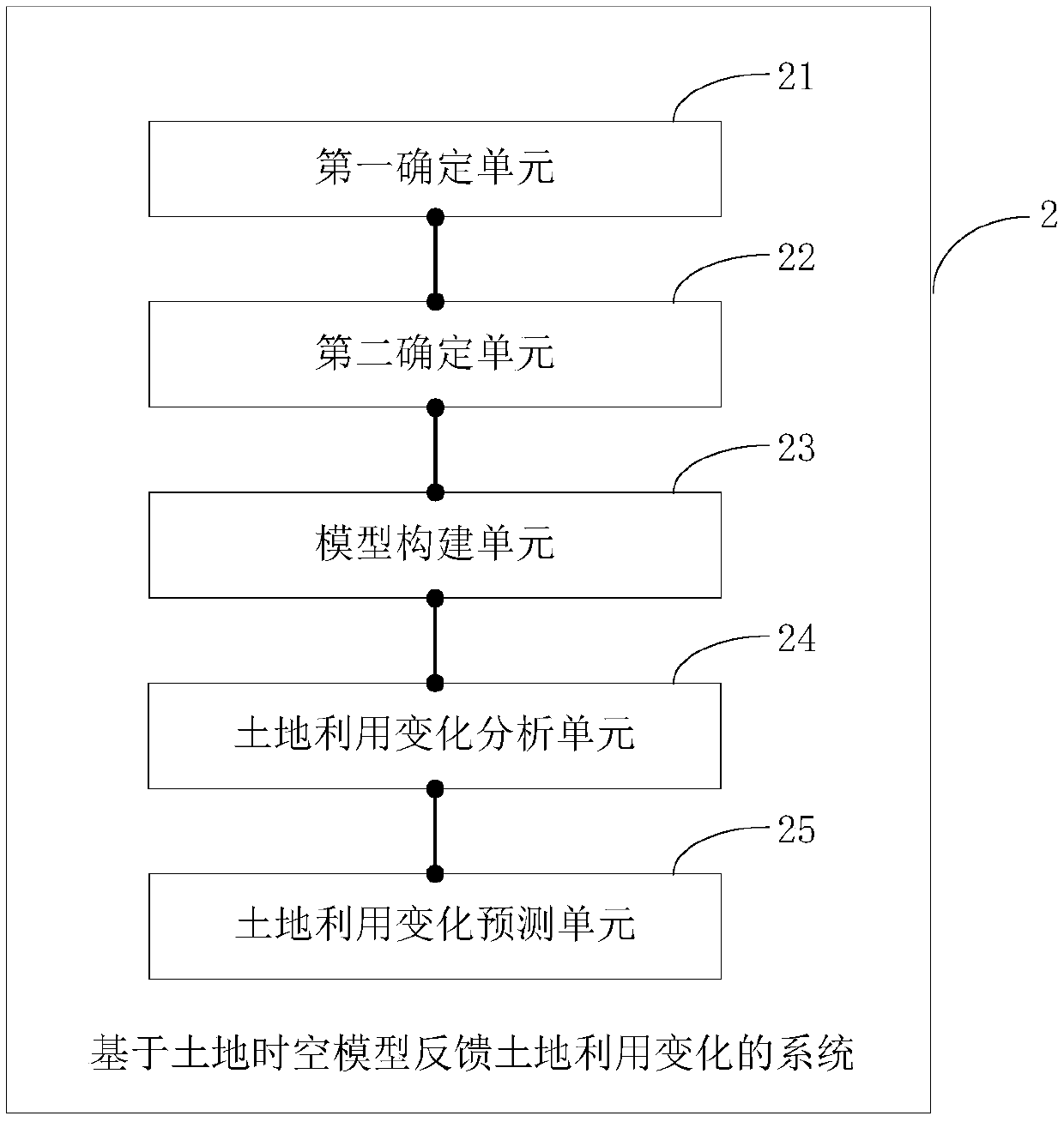
The invention is applicable to the technical field of land management, and provides a method for feeding back land utilization changes based on a land space-time model, which comprises the following steps: determining a land utilization category, land time sequence information and land space information of a target area based on land utilization data of a time sequence; determining a land influence factor of the target area; constructing a quadruple land space-time model based on the land utilization category, the land time sequence information, the land space information and the land influence factor; generating a land utilization change curve of the target area based on the quadruple land space-time model; and predicting the land utilization change of the target area based on the land utilization change curve. According to the method, the recent land utilization change condition of the corresponding region can be comprehensively disclosed, and the land utilization change of the region in a future period can be predicted, so that reliable auxiliary information can be provided for land utilization and land planning decision of the country or the region.

Description

technical field [0001] The invention belongs to the technical field of land management, and in particular relates to a method and system for feeding back land use changes based on land space-time models. Background technique [0002] In my country's current rapid urbanization process, the economy is developing rapidly, the quality of the population is improving rapidly, and the population in rural towns is migrating to cities and towns at an unprecedented speed. As a result, many advantageous resources (including educational resources, medical resources, leisure and entertainment resources) have gathered Land resources on which to carry out various economic behaviors and social activities in economically more developed regions have become typical scarce resources, which is especially reflected in the central urban areas of top-ranked first-tier or second-tier cities and new cities and new districts that are developing rapidly obvious. In the face of the increasingly scarce la...

Claims


Application Information

Patent Timeline
Patent Type & Authority Applications(China)
IPC IPC(8): G06Q10/04G06Q50/26
CPCG06Q10/04G06Q50/26
Inventor 虞昌彬袁海波周继业袁尚德董玉鹏吴春岐张毅赵志刚贺彪
Owner 深圳市数字城市工程研究中心
Learn More