Method and system for feedbacking land use change based on land space-time model
A space-time model and land technology, applied in data processing applications, forecasting, instruments, etc., can solve problems such as inability to conduct inductive analysis of land use change, too simple results of land use change, and inability to predict land use change
- Summary
- Abstract
- Description
- Claims
- Application Information
AI Technical Summary
Problems solved by technology
Method used
Image
Examples
Embodiment Construction
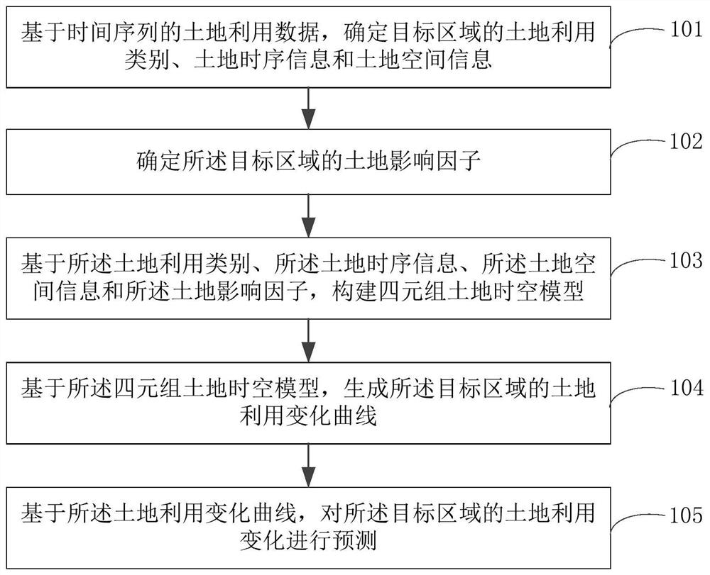
[0060] The present invention first proposes a spatio-temporal analysis model construction method, which can serve for the monitoring of land use change. Most of the traditional land monitoring models use the simplest purely numerical statistical method to provide numerical monitoring (often just calling regression analysis); some may also take the spatial distribution into account, but often simply use the spatial distribution as a comparison of numerical statistics, There is no systematic time series comparison and cause exploration on the time series; some may consider the time information and spatial distribution information comprehensively, but the influence of various factors in the space within the period of time is not considered uniformly. Typical, such as national (or provincial, or municipal) major events in the economy (or administration, or transportation) and other aspects of the impact on land use change.
[0061] Different from the traditional land monitoring mo...
PUM
 Abstract
Description
Claims
Application Information
 - R&D
- Intellectual Property
- Life Sciences
- Materials
- Tech Scout
- Unparalleled Data Quality
- Higher Quality Content
- 60% Fewer Hallucinations
Browse by: Latest US Patents, China's latest patents, Technical Efficacy Thesaurus, Application Domain, Technology Topic, Popular Technical Reports.
© 2025 PatSnap. All rights reserved.Legal|Privacy policy|Modern Slavery Act Transparency Statement|Sitemap|About US| Contact US: help@patsnap.com


