
Near-surface sulfur dioxide concentration estimation method based on geographically weighted regression model

A regression model, sulfur dioxide technology, applied in the field of remote sensing data application, can solve problems such as expensive instruments and complex analysis procedures

Active Publication Date: 2020-03-27
JINAN UNIVERSITY
View PDF5 Cites 0 Cited by
  • Summary
  • Abstract
  • Description
  • Claims
  • Application Information

AI Technical Summary

Problems solved by technology

[0003] Aiming at the existing problems of complex analytical procedures, expensive instruments, and only the atmospheric composition information in a very small vertical height near the ground, the present invention provides A Method for Estimating Sulfur Dioxide Concentration Near Surface Based on Geographically Weighted Regression Model

Method used


Image

  • Near-surface sulfur dioxide concentration estimation method based on geographically weighted regression model
  • Near-surface sulfur dioxide concentration estimation method based on geographically weighted regression model
  • Near-surface sulfur dioxide concentration estimation method based on geographically weighted regression model

Examples


Embodiment Construction

[0035] The present invention will be further described below in conjunction with drawings and embodiments.

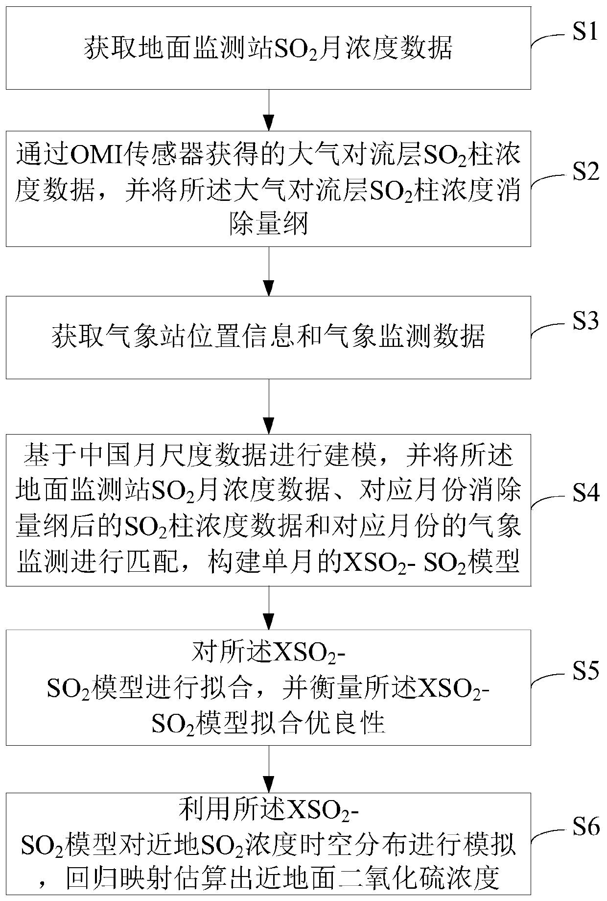
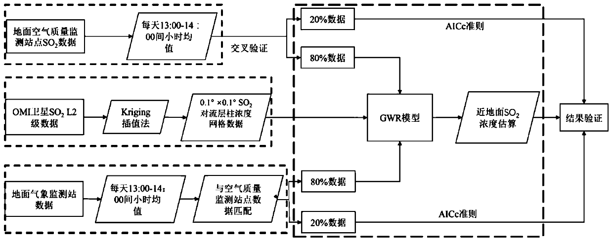
[0036] see Figure 1-2 , a method for estimating the concentration of sulfur dioxide near the ground based on a geographically weighted regression model, comprising:

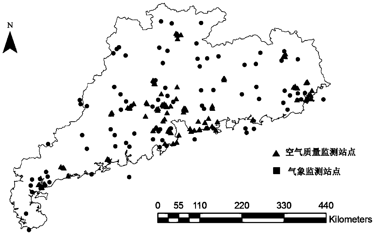
[0037] S1, Obtain the SO of the ground monitoring station 2 monthly concentration data; more specifically, step S1 includes: obtaining SO 2 Monitoring station location information and monitoring data, using VBA program code to extract daily SO from 13:00-14:00 2 hourly data. SO 2 The distribution of ground monitoring stations is as follows: image 3 shown.

[0038] S2, atmospheric tropospheric SO obtained by the OMI sensor 2 Column concentration data (XSO 2 ), and the tropospheric SO 2 The column concentration eliminates the dimension; specifically, step S2 includes: the atmospheric tropospheric SO obtained by the OMI sensor 2 The column concentration data was geometrically corrected using IDL l...


PUM


Abstract

The invention relates to a near-surface sulfur dioxide concentration estimation method based on a geographically weighted regression model. The near-surface sulfur dioxide concentration estimation method comprises the following steps: S1, acquiring SO2 monthly concentration data of a ground monitoring station; s2, obtaining atmospheric troposphere SO2 column concentration data through an OMI sensor, and eliminating dimensions of the atmospheric troposphere SO2 column concentration; s3, acquiring meteorological station position information and meteorological monitoring data; s4, carrying out modeling based on the Chinese month scale data, matching the SO2 month concentration data of the ground monitoring station, the SO2 column concentration data after dimension elimination of the corresponding month and meteorological monitoring of the corresponding month, and constructing an XS2-SO2 model of a single month. The spatial-temporal change characteristics of the SO2 concentration can be accurately indicated, the defects of few ground monitoring stations and non-uniform distribution are overcome, and the data provides a scientific basis for SO2 exposure health assessment and influence assessment of SO2 on a land ecosystem.

Description

technical field [0001] The invention relates to the technical field of remote sensing data application, in particular to a method for estimating the concentration of sulfur dioxide near the surface based on a geographic weighted regression model (GWR model). Background technique [0002] Legacy for SO 2 The observation methods are mainly carried out through ground spectrometer observation, aircraft aerial survey, and atmospheric fixed-point sampling, but these traditional observation methods are more or less limited in time and space: for example, based on ground monitoring station fixed-point sampling, obtained The data can only reflect the air pollution degree of the site and the surrounding small area, and the observation of fixed-point ground atmospheric trace gases usually requires auxiliary chemical analysis instruments, the analysis procedures are complicated, the instruments are expensive, and only near Atmospheric composition information within a very small vertica...

Claims


Application Information

Patent Timeline
Patent Type & Authority Applications(China)
IPC IPC(8): G06F17/18
CPCG06F17/18Y02A90/10
Inventor 霍霞叶凯徐锡金戴情园
Owner JINAN UNIVERSITY
Learn More