

Signal green wave coordination route optimization control method and system based on real-time road condition
A technology of real-time road conditions and optimal control, applied in the field of transportation, can solve problems such as aggravated traffic congestion and ineffective green wave coordination schemes
- Summary
- Abstract
- Description
- Claims
- Application Information
AI Technical Summary
Problems solved by technology
Method used
Image

Examples
Embodiment 1
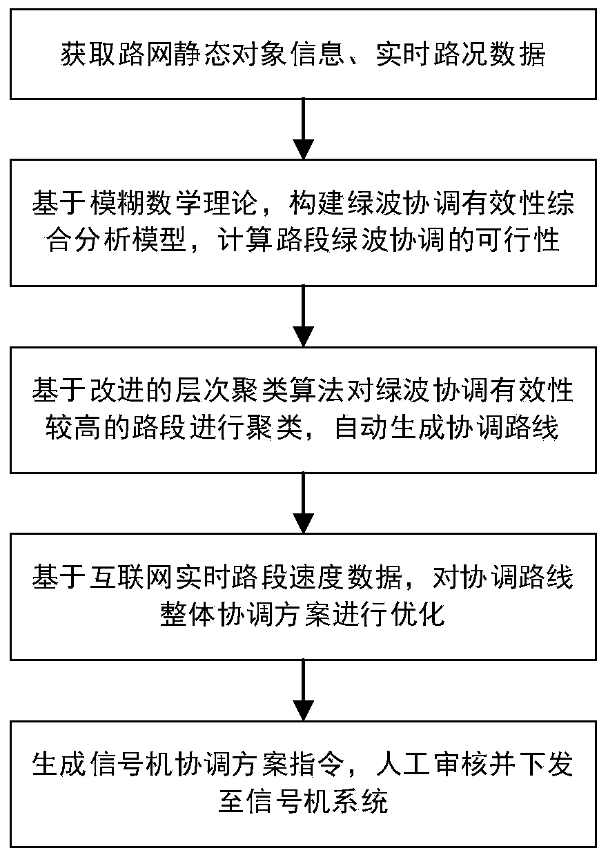
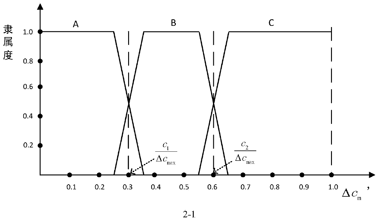
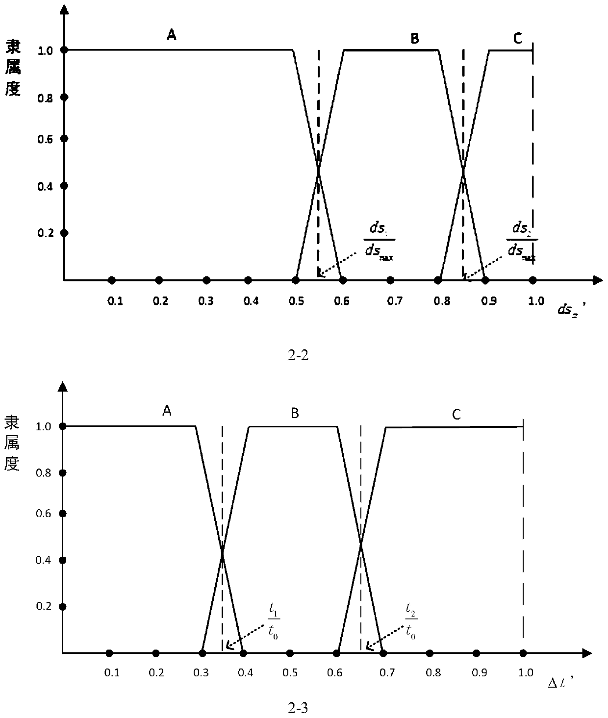
[0113] see figure 1 , the present invention provides a signal green wave coordination route optimization control method based on real-time road conditions, the steps are as follows:
[0114] S1. Obtain road network information, real-time road condition traffic data, and signal control scheme data.
[0115] Specifically: Obtain the traffic attributes of intersections, road sections, lanes and other objects from the ITS system (Intelligent Transportation System), real-time traffic data of road conditions and signal control scheme data.
[0116] The urban road network information specifically includes intersection attributes, road section attributes, lane attributes, and affiliation data among the three.
[0117] The real-time road condition and traffic data include road section vehicle speed data, traffic flow of each flow lane, saturation and so on. Sample data looks like this:
[0118]
[0119] The signal control scheme data is specifically signal coordination scheme dat...
Embodiment 2
[0220] see Figure 4 , this embodiment provides a system for realizing the signal green wave coordination route optimization control method based on real-time road conditions described in Embodiment 1, including:
[0221] The data acquisition module is used to obtain the relevant data required for the generation of coordinated route clustering, including detector flow, saturation, signal control scheme, Internet vehicle travel speed, time and other dynamic data, as well as static information of the urban road network.
[0222] The data storage module and preprocessing module are used to unify the source data format, perform static association processing of road network objects, and uniform processing of time granularity on the data.
[0223] The coordinated route clustering generation module is used to construct a comprehensive analysis model for the effectiveness of coordinated routes offline, calculate the green wave effectiveness of road sections online, and generate coordi...
PUM
 Abstract
Description
Claims
Application Information