Supercharge Your Innovation With Domain-Expert AI Agents!

Interactive physical terrain display system and method

An interactive and topographical technology, applied in the field of virtual reality, can solve problems such as difficulty and poor display effect, and achieve the effect of improving the effect of terrain display

Pending Publication Date: 2021-02-02
北京软通智慧科技有限公司
View PDF0 Cites 0 Cited by
  • Summary
  • Abstract
  • Description
  • Claims
  • Application Information

AI Technical Summary

Problems solved by technology

However, when performing physical terrain sand table demonstrations for multiple people, it is usually necessary to organize personnel to disperse around the sand table, resulting

Method used


Image

  • Interactive physical terrain display system and method
  • Interactive physical terrain display system and method
  • Interactive physical terrain display system and method

Examples


Embodiment Construction

[0025] The present invention will be further described in detail below in conjunction with the accompanying drawings and embodiments. It should be understood that the specific embodiments described here are only used to explain the present invention, but not to limit the present invention. In addition, it should be noted that, for the convenience of description, only some structures related to the present invention are shown in the drawings but not all structures.

[0026] Before discussing the exemplary embodiments in more detail, it should be mentioned that some exemplary embodiments are described as processes or methods depicted as flowcharts. Although the flowcharts describe various operations (or steps) as sequential processing, many of the operations (or steps) may be performed in parallel, concurrently, or simultaneously. In addition, the order of operations can be rearranged. The process may be terminated when its operations are complete, but may also have additional...


PUM


Abstract

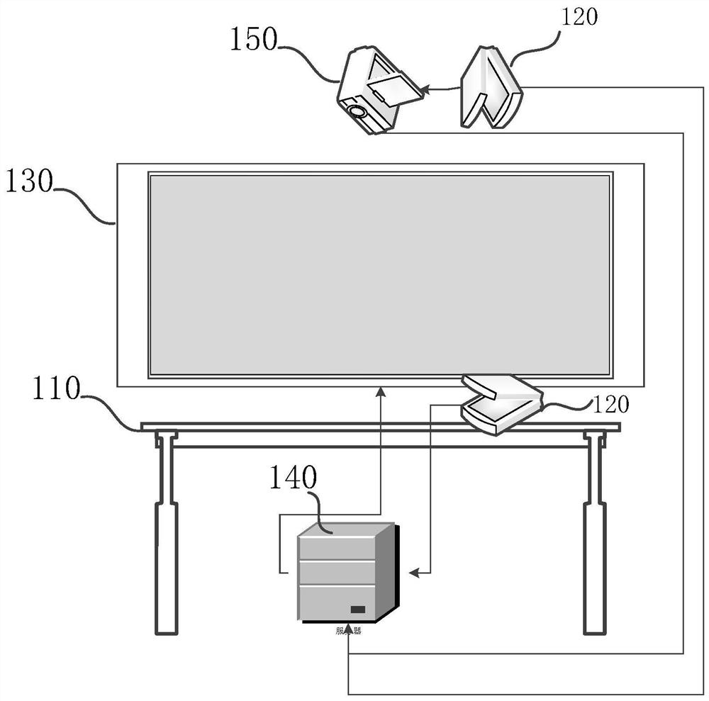
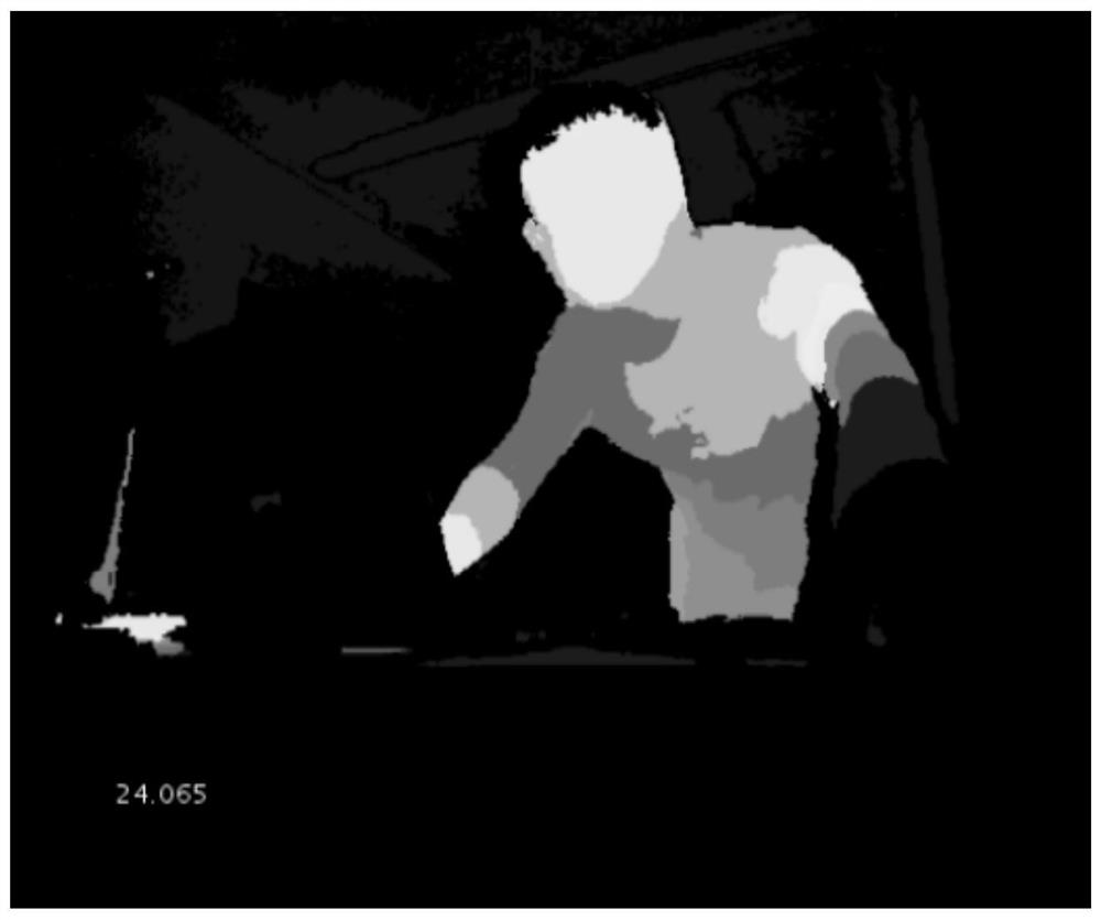
The embodiment of the invention discloses an interactive physical terrain display system and method. The system comprises an operation table, a Kinect somatosensory sensor, a display and a main control processor; the Kinect somatosensory sensor is configured to scan to obtain terrain depth data of a real object terrain on the operation table and send the terrain depth data to the main control processor; the main control processor is configured to perform calculation according to the terrain depth data to obtain a terrain 3D model of the physical terrain, and send the terrain 3D model to the display for display; the Kinect somatosensory sensor is further configured to obtain terrain control gesture information by scanning human skeleton data sent by an operator and send the terrain controlgesture information to the main control processor; and the main control processor is further configured to control and switch the display view angle of the terrain 3D model on the display according tothe terrain control gesture information. By the adoption of the scheme, the landform of the physical landform can be scanned and displayed in real time, interaction can be conducted through gesturesaccording to needs to switch the display view angle of the landform 3D model, and the same landform can be displayed to different persons.

Description

technical field [0001] The embodiments of the present invention relate to the field of virtual reality technology, and in particular to an interactive physical terrain display system and method. Background technique [0002] At present, the physical terrain sand table has been widely used in various fields, and the physical terrain information can be displayed to users through the physical terrain sand table. However, when performing physical terrain sand table demonstrations for multiple people, it is usually necessary to organize personnel to disperse around the sand table, resulting in differences in the terrain displayed to different personnel, and it is difficult to display the terrain at a suitable angle according to the needs, making the display effect poor. Contents of the invention [0003] Embodiments of the present invention provide an interactive physical terrain display system and method to realize interactive display of physical terrain and improve the displ...

Claims


Application Information

Patent Timeline
IPC IPC(8): G06F3/01G09B25/06
CPCG06F3/011G06F3/017G09B25/06
Inventor 史清锋陈滨兰宋朝宁
Owner 北京软通智慧科技有限公司
Features
  • R&D
  • Intellectual Property
  • Life Sciences
  • Materials
  • Tech Scout
  • Unparalleled Data Quality
  • Higher Quality Content
  • 60% Fewer Hallucinations
Learn More