Automatic map building and automatic map update system for port unmanned logistics vehicles
A technology for map update and logistics vehicles, applied in radio wave measurement systems, using re-radiation, re-radiation of electromagnetic waves, etc., can solve problems such as slow environmental changes in port unloading areas and failure of unmanned vehicle positioning
- Summary
- Abstract
- Description
- Claims
- Application Information
AI Technical Summary
Problems solved by technology
Method used
Image
Examples
Embodiment Construction
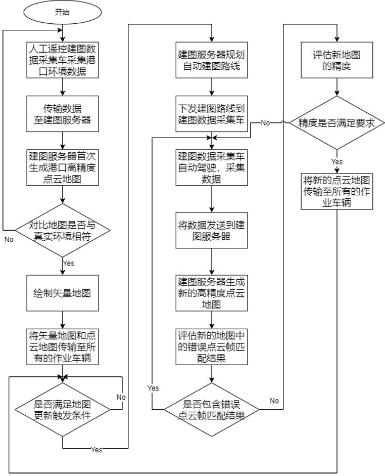
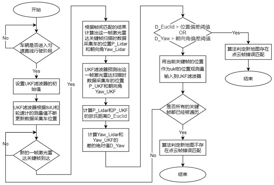
[0049] The automatic map building and automatic map update system of the present invention is made up of software and hardware:
[0050] software such as figure 1 As shown, it consists of five parts: on-board data acquisition unit, data transmission unit, data storage unit, calculation unit and vector map drawing unit, among which:
[0051] The vehicle-mounted data acquisition unit is deployed on the mapping data acquisition vehicle. The function of the vehicle-mounted data acquisition unit is to collect lidar point cloud frames, collect vehicle speed data, collect IMU direction angle (Yaw) data, and collect GPS (consumer-grade GPS, meter level precision) data, and collect the acceleration and angular velocity data of the IMU.
[0052] The data transmission unit is deployed on the mapping data acquisition vehicle and the mapping server at the same time. The data transmission unit has three functions. The first function is to transmit the data collected by the vehicle data acq...
PUM
 Abstract
Description
Claims
Application Information
 - R&D
- Intellectual Property
- Life Sciences
- Materials
- Tech Scout
- Unparalleled Data Quality
- Higher Quality Content
- 60% Fewer Hallucinations
Browse by: Latest US Patents, China's latest patents, Technical Efficacy Thesaurus, Application Domain, Technology Topic, Popular Technical Reports.
© 2025 PatSnap. All rights reserved.Legal|Privacy policy|Modern Slavery Act Transparency Statement|Sitemap|About US| Contact US: help@patsnap.com


