
Data acquisition device for unmanned aerial vehicle for geological exploration

A data acquisition and geological exploration technology, applied in the field of geological exploration, can solve the problem of low working efficiency of data acquisition devices, achieve sufficient sample data, accurate analysis results, and improve work efficiency

Pending Publication Date: 2022-01-14
SHANDONG GEO-SURVEYING & MAPPING INST
View PDF0 Cites 2 Cited by
  • Summary
  • Abstract
  • Description
  • Claims
  • Application Information

AI Technical Summary

Problems solved by technology

[0002] When the data acquisition device of the unmanned aerial vehicle for geological exploration works on the unmanned aerial vehicle, it usually flies to a certain location by remotely controlling the unmanned aerial vehicle and lands, and uses the data acquisition device on the unmanned aerial vehicle to collect soil samples, while the existing geological exploration When collecting soil samples, the unmanned aerial vehicle data acquisition device cannot achieve the classification and storage of geological soils in different geological environments, which leads to the low efficiency of the data acquisition device.

Method used


Image

  • Data acquisition device for unmanned aerial vehicle for geological exploration
  • Data acquisition device for unmanned aerial vehicle for geological exploration
  • Data acquisition device for unmanned aerial vehicle for geological exploration

Examples


Embodiment Construction

[0029] In order to make the technical means, creative features, goals and effects achieved by the present invention easy to understand, the present invention will be further elaborated below in conjunction with specific embodiments, but the following embodiments are only preferred embodiments of the present invention, not all. Based on the examples in the implementation manners, other examples obtained by those skilled in the art without making creative efforts all belong to the protection scope of the present invention. The experimental methods in the following examples, unless otherwise specified, are conventional methods, and the materials, reagents, etc. used in the following examples, unless otherwise specified, can be obtained from commercial sources.

[0030] Example:

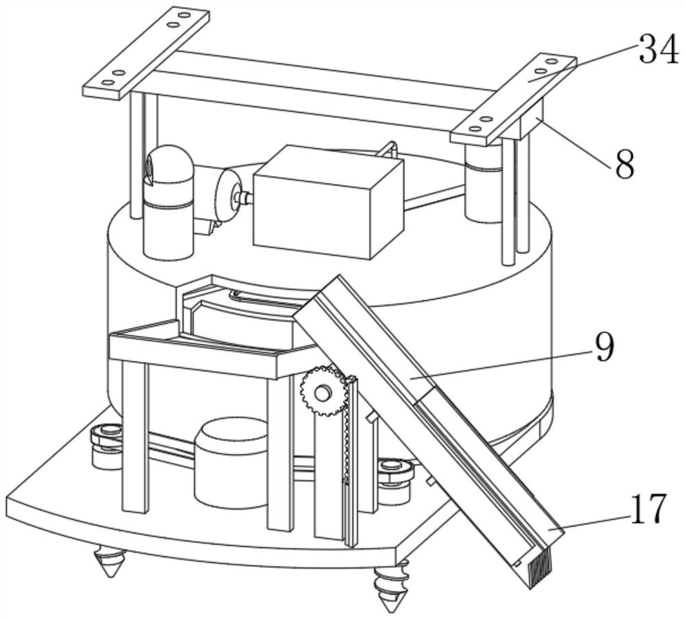
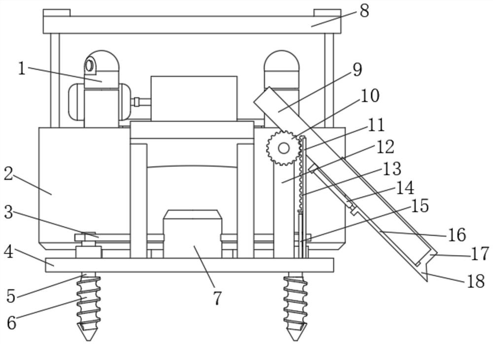
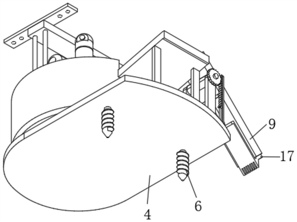
[0031] Such as Figure 1-8 As shown, the present invention provides a data acquisition device for unmanned aerial vehicles for geological exploration, including a base plate 4, on which a cylindrical ou...


PUM


Abstract

The invention discloses a data acquisition device for an unmanned aerial vehicle for geological exploration. The data acquisition device comprises a bottom plate, an outer housing fixed on the bottom plate and a soil sampling device. The telescopic soil sampling device is located on one side of the outer housing, a stepping positioning device is arranged in the outer housing, a plurality of soil storage tanks are placed in the stepping positioning device, a conveying hopper connected with the output end of the soil sampling device is fixedly arranged on one side of the top of the outer housing, an overturning driving mechanism for driving the soil sampling device to overturn is arranged on one side of the conveying hopper; and a drilling positioning device is arranged on one side of the top surface of the bottom plate. According to the data acquisition device for the unmanned aerial vehicle for geological exploration, during geological exploration, soil samples in different geological environments can be obtained and stored in a classified mode, it is guaranteed that sample data is sufficient, the analysis result of geological exploration is more accurate, and the working efficiency of the geological exploration data acquisition device for the unmanned aerial vehicle is improved.

Description

technical field [0001] The invention relates to the field of geological exploration, in particular to a data acquisition device for unmanned aerial vehicle used in geological exploration. Background technique [0002] When the unmanned aerial vehicle for geological exploration uses a data acquisition device to work on the unmanned aerial vehicle, it usually flies to a certain location by remotely controlling the unmanned aerial vehicle and lands, and uses the data acquisition device on the unmanned aerial vehicle to collect and obtain soil samples. When collecting soil samples, the unmanned aerial vehicle data acquisition device cannot realize the classification and storage of geological soils in different geological environments, which leads to the low working efficiency of the data acquisition device. Contents of the invention [0003] In order to overcome the deficiencies of the prior art, the present invention provides a data acquisition device for unmanned aerial vehi...

Claims


Application Information

Patent Timeline
Patent Type & Authority Applications(China)
IPC IPC(8): G01N1/08G01N1/12B65G65/32
CPCG01N1/08G01N1/12B65G65/32B65G2201/04
Inventor 李传生刘济南王斌斌
Owner SHANDONG GEO-SURVEYING & MAPPING INST
Learn More