

A remote sensing detection and evaluation method for the area and production of large-area crop raising
A large-area, crop technology, applied in the field of remote sensing detection and estimation, can solve the problems of difficult to meet the requirements of the application, the characteristics of the training sample cannot be well grasped, and the definition of mixed pixels is inaccurate, so as to save time and effort, The effect of convenient and reliable automatic high-precision detection
- Summary
- Abstract
- Description
- Claims
- Application Information
AI Technical Summary
Problems solved by technology
Method used
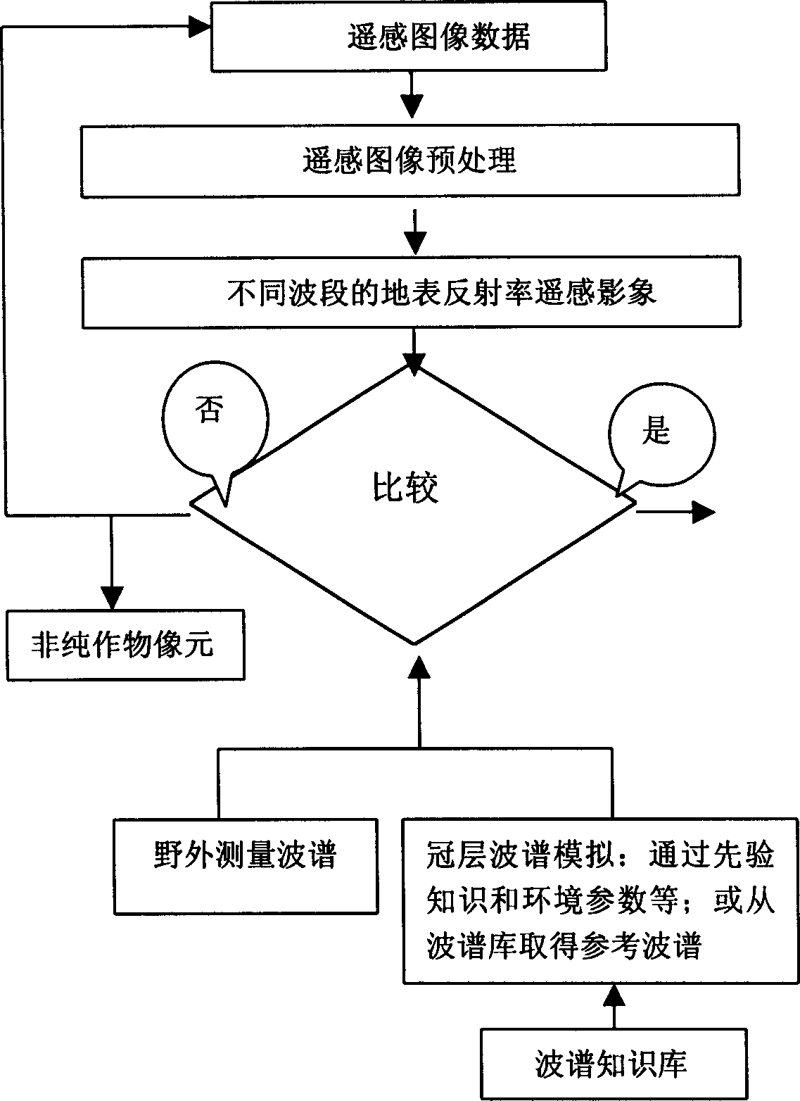
Image

Examples
Embodiment Construction
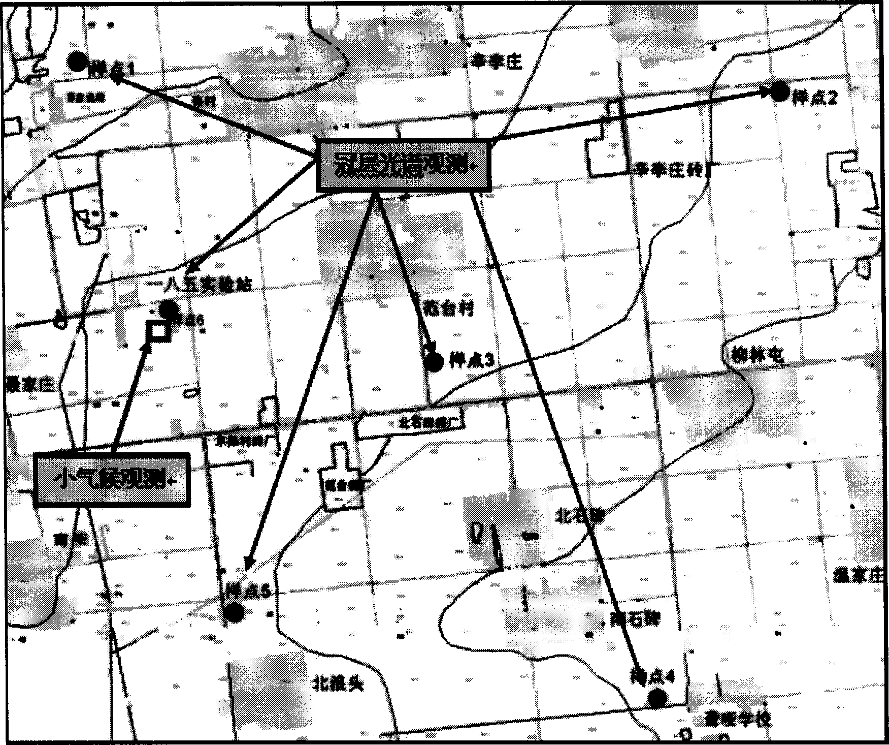
[0042] 1. Experimental location: at the Luancheng Agricultural Ecosystem Experimental Station of the Chinese Academy of Sciences (such as diagram 2-1 ), the station is located at latitude 37°53' north, longitude 114°40' east, and an altitude of 50.1m. It is located 3KM east of Luancheng County in the southeast of Shijiazhuang City. . The area of the test area is 5km×5km, and it is connected with the surrounding farmland. It is a large area of uniform summer corn, which is conducive to the quasi-synchronous collection of spectral data and ensures the accuracy and reliability of instantaneous data. The tested summer maize varieties were "Zhengdan 958" and "Nongda 108", which were managed according to local conventional cultivation measures.
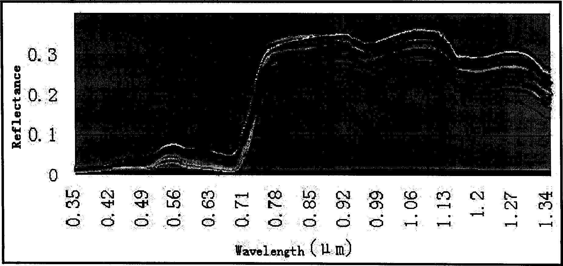
[0043] 2. Acquisition of measured spectral data
[0044] In order to make the data sample of the experimental observation have a certain representativeness, the area of the experimental area is 5*5 square kilometers, and six measur...
PUM
 Abstract
Description
Claims
Application Information