
A remote sensing detection and evaluation method for the area and production of large-area crop raising

A crop and area technology, applied in the field of remote sensing detection and estimation, can solve the problems of difficult to meet the requirements of the application, the characteristics of the training sample area cannot be well grasped, and the training area has a great influence, so as to achieve time-saving and labor-saving benefits, convenience and reliability The effect of automatic high-precision detection

Inactive Publication Date: 2008-06-11
GUANGZHOU INST OF GEOGRAPHY GUANGDONG ACAD OF SCI
View PDF1 Cites 1 Cited by
  • Summary
  • Abstract
  • Description
  • Claims
  • Application Information

AI Technical Summary

Problems solved by technology

[0002] At present, for the pure pixel recognition of a single crop, except for the small-scale field investigation method, most of them are supervised or unsupervised classification methods using remote sensing images. These methods either involve a large number of field work, or define mixed pixels It is very inaccurate, and the training area is also greatly affected by human factors when the supervised classification is selected, and the characteristics of the training sample area cannot be well grasped, so that it is difficult to meet the application requirements in the image conversion of different scales in remote sensing applications. make it necessary to use less accurate traditional classification data in large-scale crop area and yield estimates

Method used

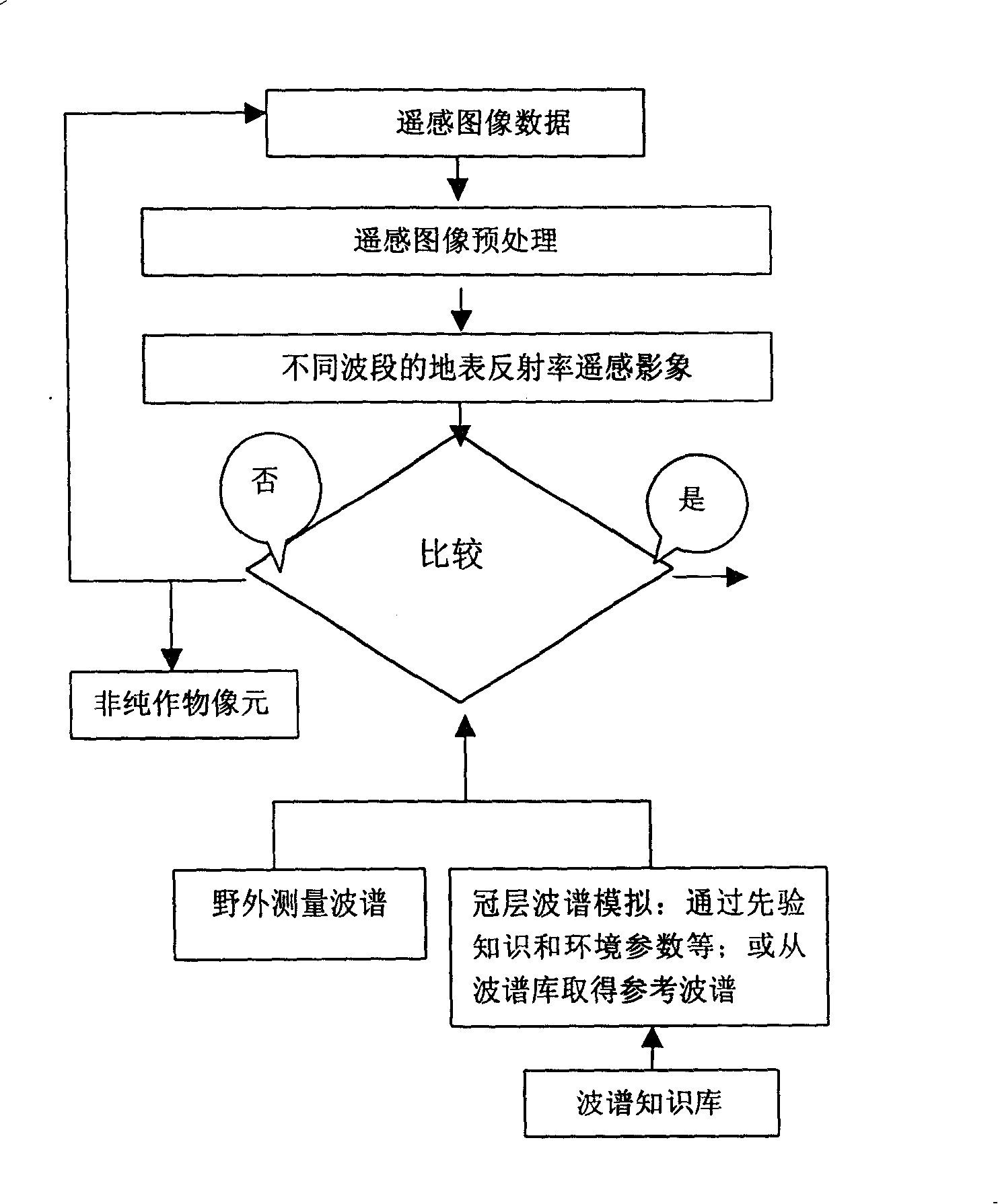
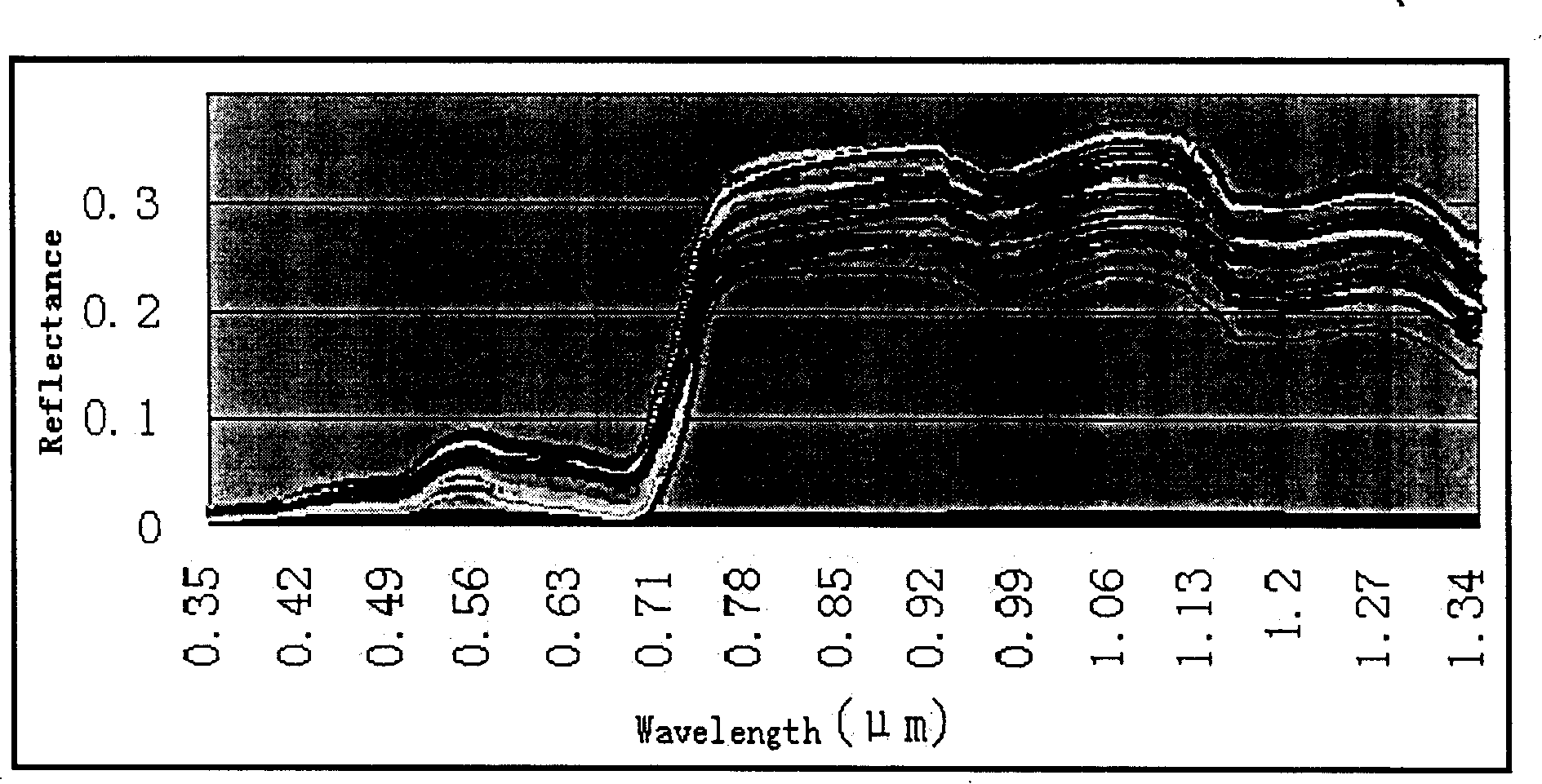

Image

  • A remote sensing detection and evaluation method for the area and production of large-area crop raising
  • A remote sensing detection and evaluation method for the area and production of large-area crop raising
  • A remote sensing detection and evaluation method for the area and production of large-area crop raising

Examples


Embodiment Construction

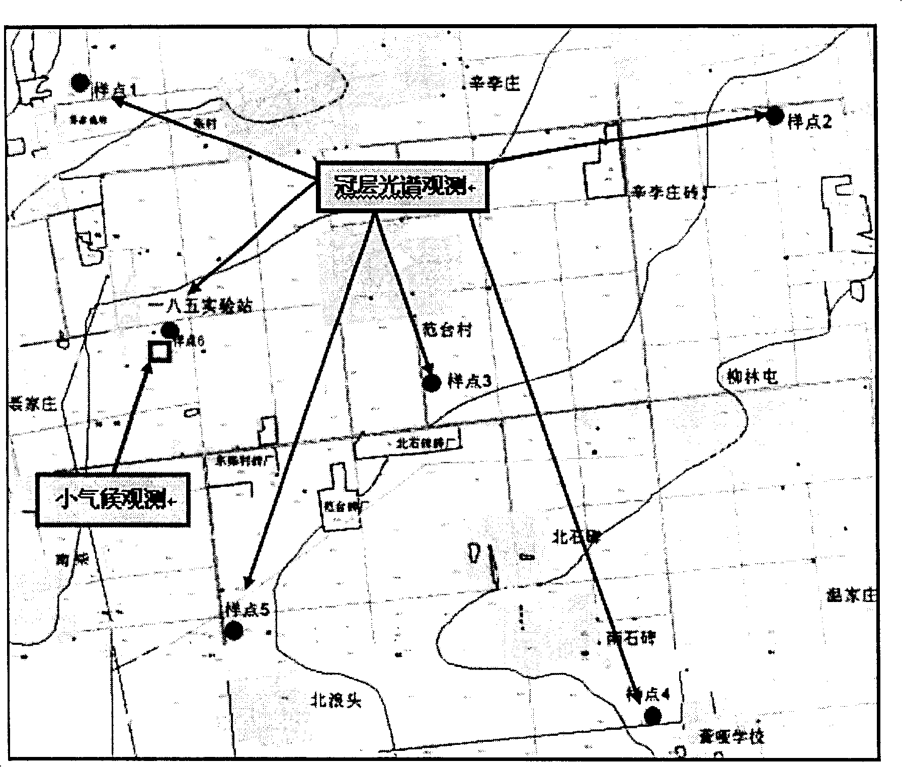
[0042] 1. Experimental site: conducted at the Luancheng Agricultural Ecosystem Experimental Station of the Chinese Academy of Sciences (e.g. picture 2-1 ), the station is located at 37°53' north latitude, 114°40' east longitude, with an altitude of 50.1m. It is located 3KM east of Luancheng County in the southeast of Shijiazhuang City. The planting system is a high-yield area of ​​winter wheat-summer maize with one-year two-cropping rotation . The test area is 5km×5km, and it is connected to the surrounding farmland to form a large area of ​​uniform summer corn, which is conducive to the quasi-synchronous collection of spectral data and ensures the accuracy and reliability of instantaneous data. The tested summer corn varieties were "Zhengdan 958" and "Nongda 108", which were managed according to local conventional cultivation measures.

[0043] 2. Acquisition of measured spectrum data

[0044] In order to make the data sample of the experimental observation have a certain represe...


PUM


Abstract

The invention provides a remote sensed estimating method of the large area planting area and the output, which establishes a spectrum which has the same growing stage and is correspondent with the field crown layer at the base of doing normal radiation and atmosphere adjustment to the remote sensed image, and computes the distance threshold value of the spectrum and compares the distance threshold value with the image initial wave spectrum and the reference wave spectrum to obtain TM plant unit, it then statistics the quantity of the TM plant unit from each image unit of middle resolution ratio imaging spectrum data MODIS with the same period and region to ascertain the planting number of the MODIS image, it then ascertains the planting area of the MODIS image according to each image unit area of the planting number and the MODIS.

Description

Technical field [0001] The invention relates to a remote sensing detection and estimation method for the planting area of ​​a large single crop and its yield. Background technique [0002] At present, for single-crop pure pixel identification, in addition to small-scale field investigation methods, most of them use supervised or unsupervised classification methods of remote sensing images. These methods either involve a lot of field work or the definition of mixed pixels It is very inaccurate, and the training area is also greatly affected by human factors when selecting the supervised classification, and the characteristics of the training sample area cannot be grasped well. As a result, the image conversion of different scales in the remote sensing application is difficult to meet the requirements of the application. Therefore, traditional classification data with low accuracy has to be used in large-scale crop area and yield estimation. Summary of the invention [0003] The p...

Claims


Application Information

Patent Timeline
Patent Type & Authority Patents(China)
IPC IPC(8): G01S17/88
Inventor 陈水森柳钦火陈良富谭启宇方立刚
Owner GUANGZHOU INST OF GEOGRAPHY GUANGDONG ACAD OF SCI
Learn More