Programmatically calculating paths from a spatially-enabled database
a database and programmatic technology, applied in the field of spatially enabled computer databases, can solve the problems of high cost of support, large amount of system resources, and complex application program logi
- Summary
- Abstract
- Description
- Claims
- Application Information
AI Technical Summary
Problems solved by technology
Method used
Image
Examples
Embodiment Construction
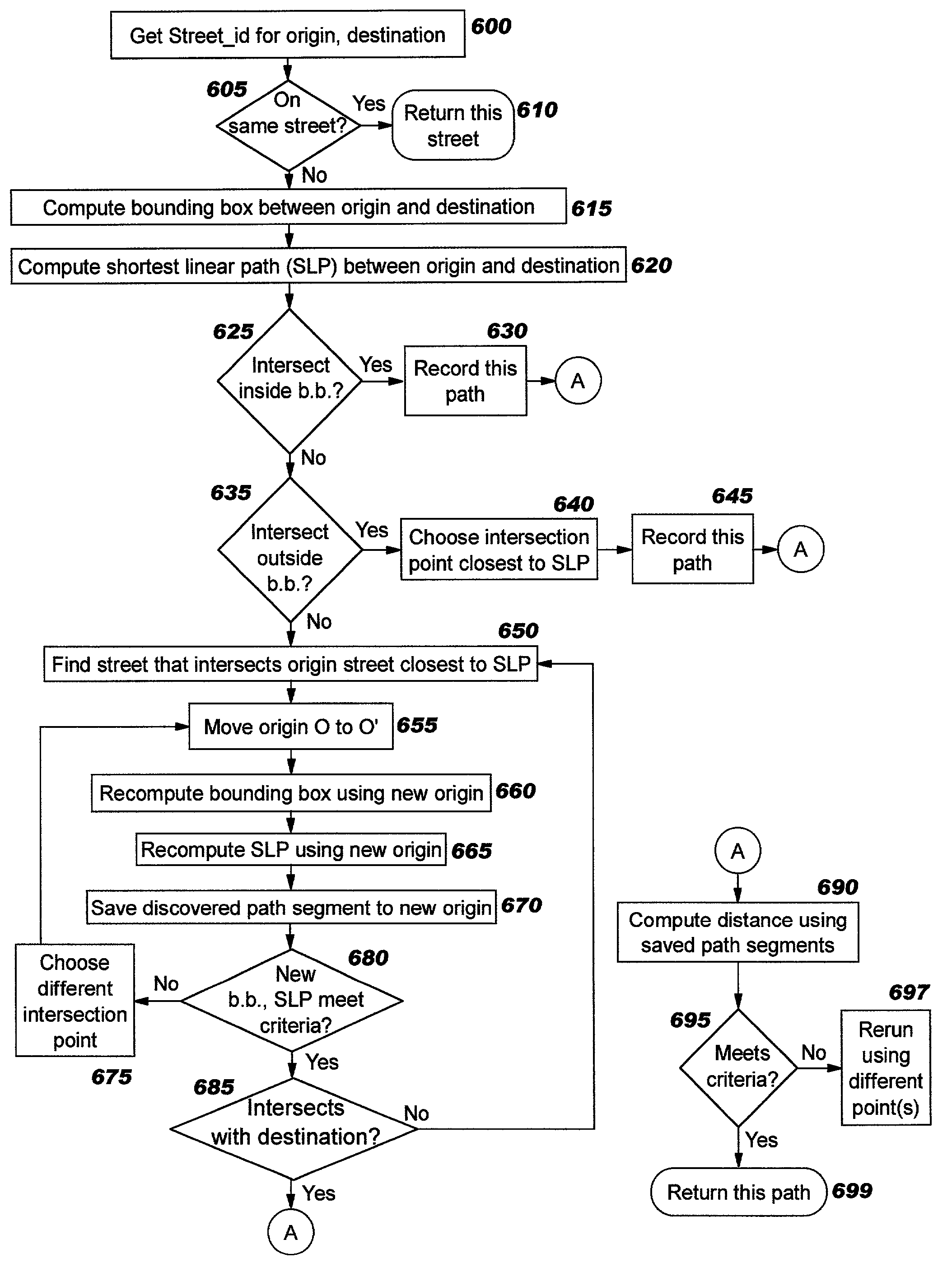
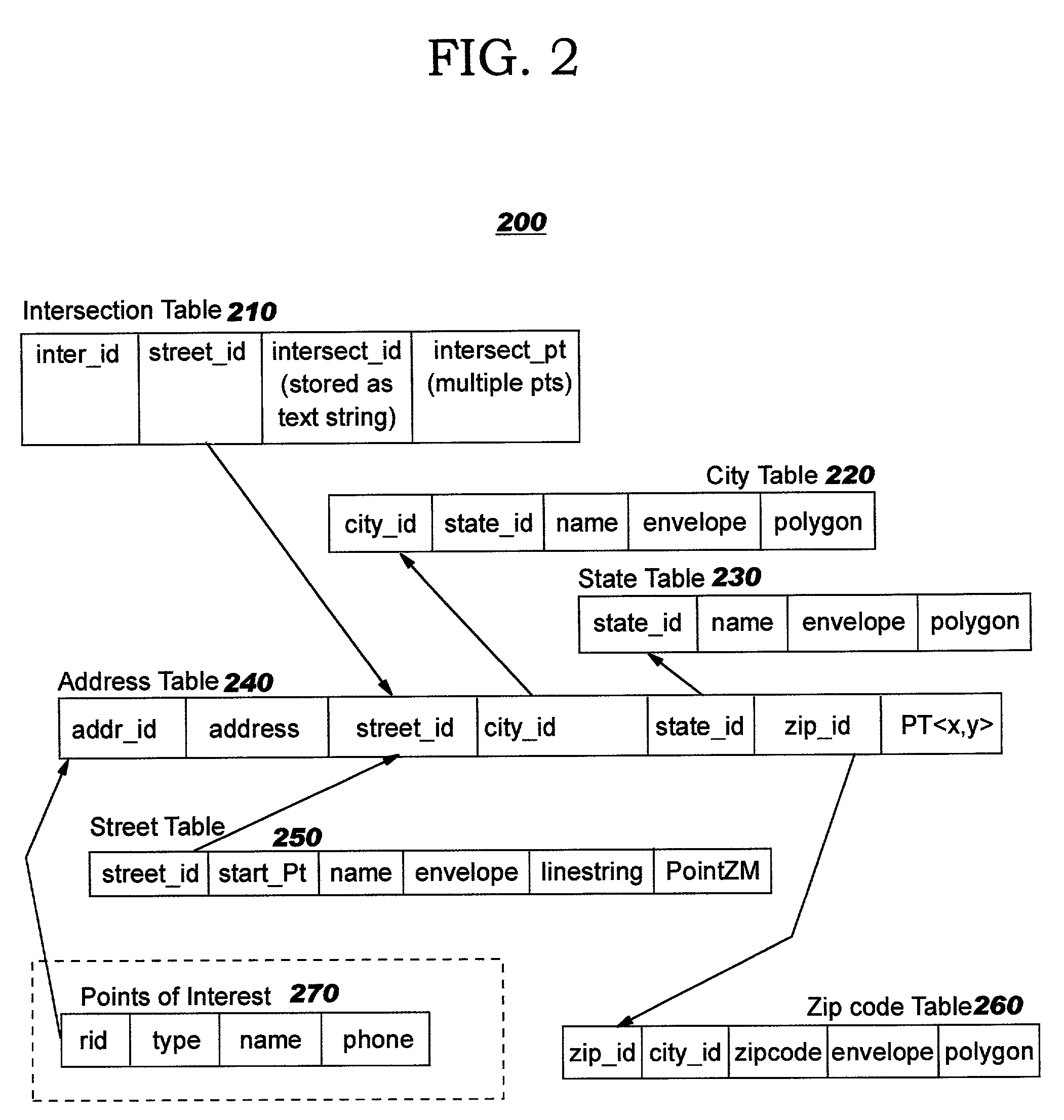
[0043] The present invention discloses techniques whereby data stored in a spatially-enabled database can be used to programmatically calculate directions (or other types of paths) between points without reliance on proprietary file formats or binary shape files. Preferred embodiments use an algorithm which does not require application programmers to perform complex manipulations of directed graphs. In contrast to prior art techniques, the address data is not required to be in WKT, WKB, or ".shp" shape form, and street addresses do not need to be looked up in proprietary ".EDG" files; by avoiding a reliance on these file types, the amount of storage required may be greatly reduced, and information is more readily available. Preferably, the address data used by preferred embodiments of the present invention is obtained from a spatially-enabled database having tables which are populated according to the related inventions.
[0044] Using the spatially-enabled relational database of the r...
PUM
 Abstract
Description
Claims
Application Information
 - R&D
- Intellectual Property
- Life Sciences
- Materials
- Tech Scout
- Unparalleled Data Quality
- Higher Quality Content
- 60% Fewer Hallucinations
Browse by: Latest US Patents, China's latest patents, Technical Efficacy Thesaurus, Application Domain, Technology Topic, Popular Technical Reports.
© 2025 PatSnap. All rights reserved.Legal|Privacy policy|Modern Slavery Act Transparency Statement|Sitemap|About US| Contact US: help@patsnap.com


