System and method for associating aerial images, map features, and information
a technology of aerial images and map features, applied in the field of electronic commerce and global network information management services, can solve the problems of large market for commercial real estate information, no meaningful national research, and large real estate industry
- Summary
- Abstract
- Description
- Claims
- Application Information
AI Technical Summary
Benefits of technology
Problems solved by technology
Method used
Image
Examples
Embodiment Construction
[0295] I. Introduction
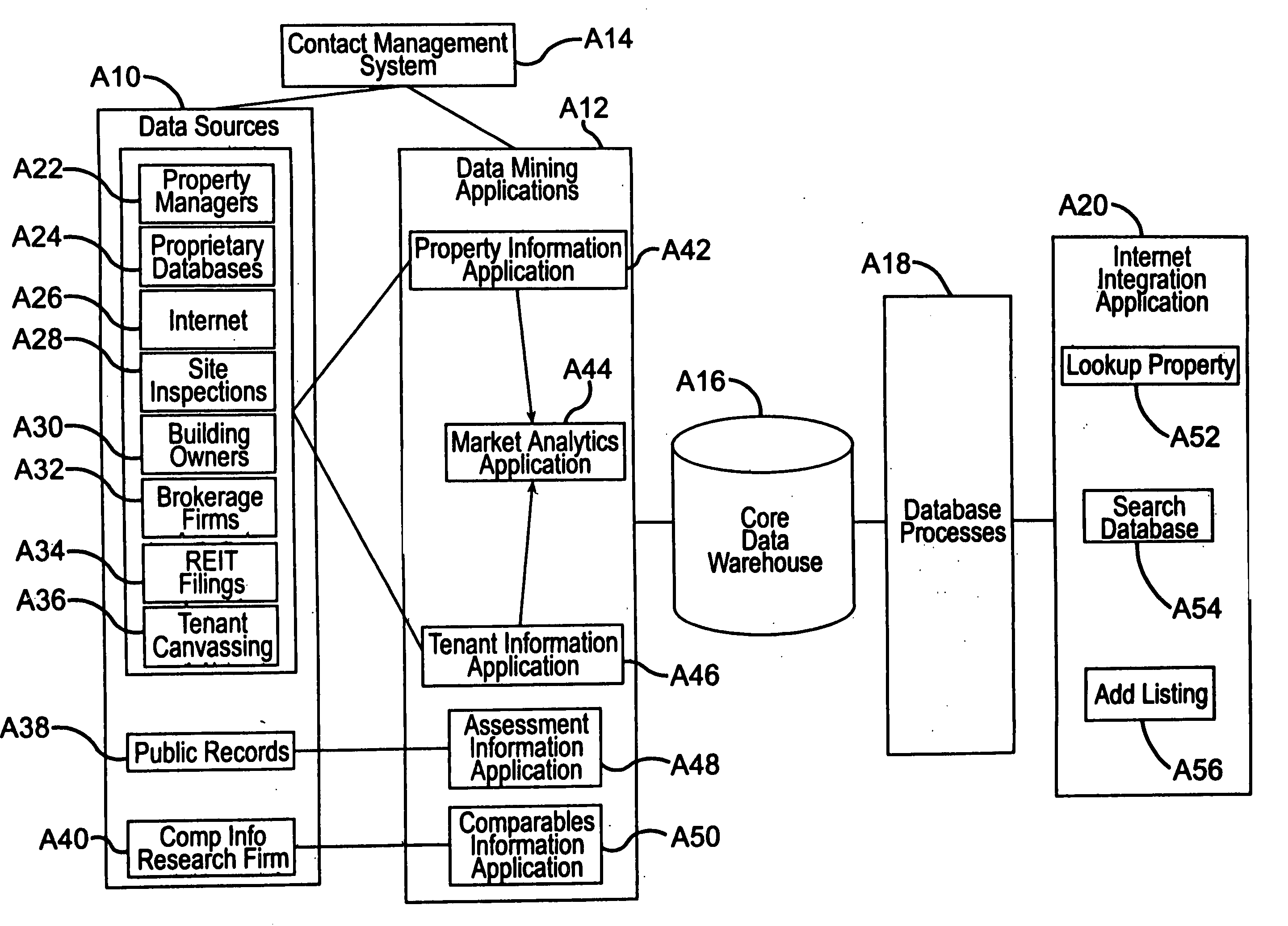
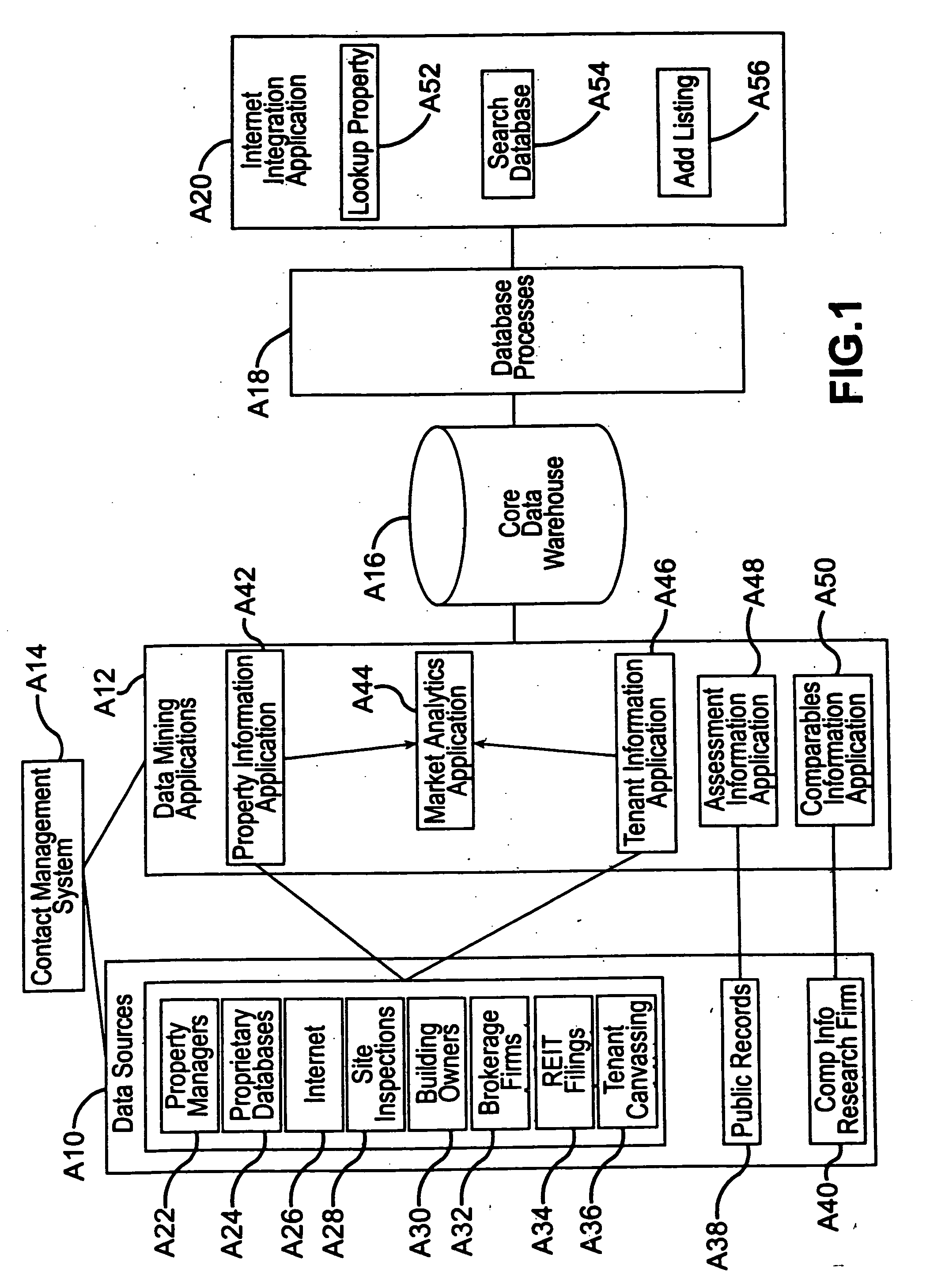
[0296] The present invention, an embodiment of which is sometimes referred to herein as COSTAR EXCHANGE™, facilitates a web-based marketplace that efficiently and securely facilitates the buying and selling of commercial properties.
[0297] The invention includes, but is not limited to the following: a large-scale database of commercial properties for sale (over 38,000 commercial properties with a combined asset value in excess of $40 billion in one embodiment); a secure web service, an embodiment of which is known as COSTAR EXCHANGE™, for distributing the information; and communication and data processing equipment that allow sellers of properties to list extensive information about their properties for sale on the site at no cost. The site affords an efficient means for these sellers to reach a large universe of potential buyers. In one embodiment, potential buyers pay a subscription fee to access the system. Sellers of investment-grade properties have the ad...
PUM
 Abstract
Description
Claims
Application Information
 - R&D
- Intellectual Property
- Life Sciences
- Materials
- Tech Scout
- Unparalleled Data Quality
- Higher Quality Content
- 60% Fewer Hallucinations
Browse by: Latest US Patents, China's latest patents, Technical Efficacy Thesaurus, Application Domain, Technology Topic, Popular Technical Reports.
© 2025 PatSnap. All rights reserved.Legal|Privacy policy|Modern Slavery Act Transparency Statement|Sitemap|About US| Contact US: help@patsnap.com


