
Route shaping systems and methods

a technology of route shaping and route, applied in surveying and navigation, navigation instruments, instruments, etc., can solve problems such as the inability to provide alternate routes for routes

Inactive Publication Date: 2008-08-28
GARMIN
View PDF5 Cites 28 Cited by
  • Summary
  • Abstract
  • Description
  • Claims
  • Application Information

AI Technical Summary

Benefits of technology

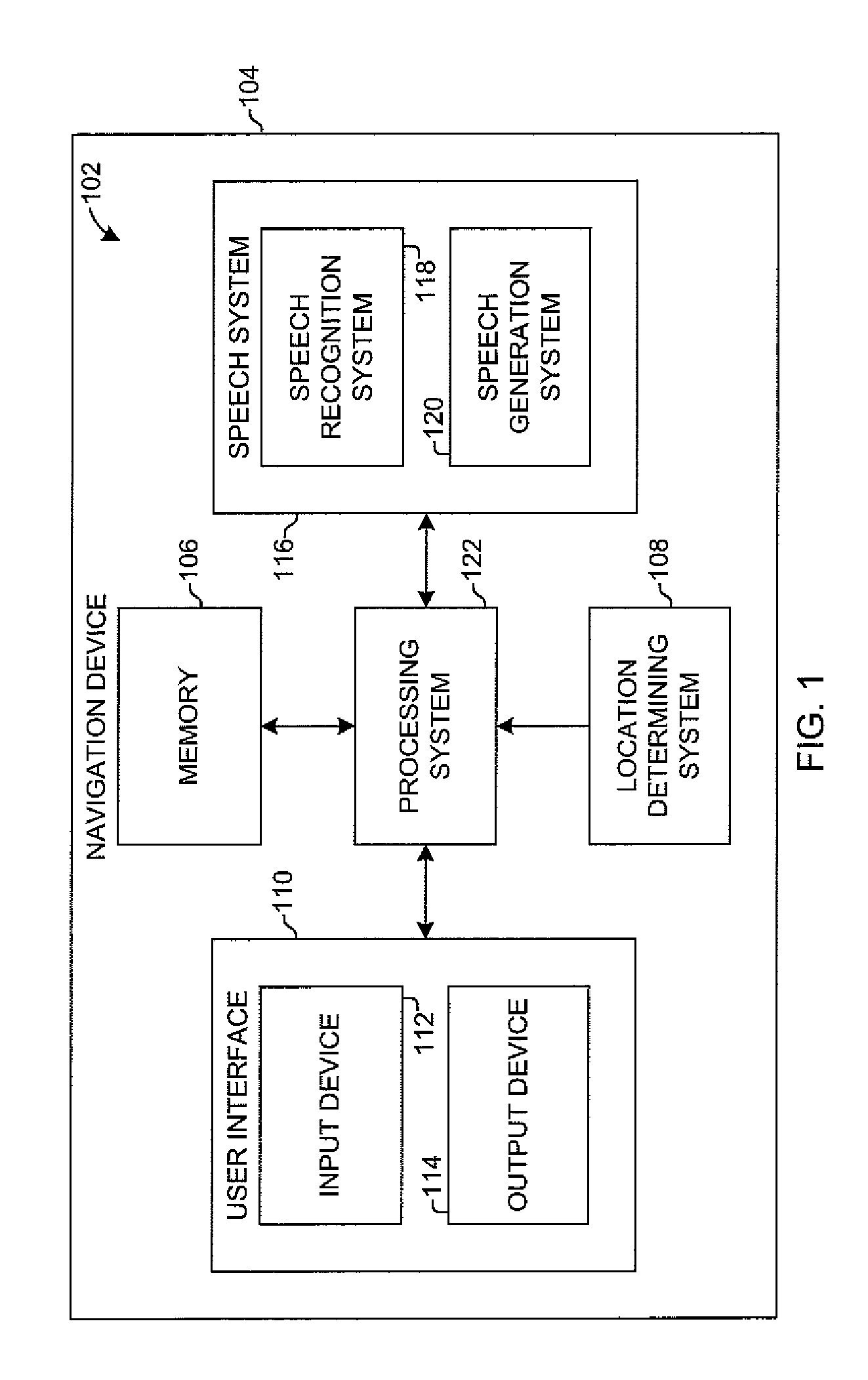
The present invention is about a system and method for determining a route from a current location to a destination using the highest road class of one or more road segments through the shape location. The invention allows for voice entry, display, or other input technology to receive the shape location and destination, and uses map data and GPS signals to determine the current location. The technical effect of the invention is to provide an efficient and effective navigation system that optimizes route selection based on road class and shape location.

Problems solved by technology

Such a route may not be available as an alternate route, and the user would have to enter Des Moines as an additional stop.

Method used


Image

  • Route shaping systems and methods
  • Route shaping systems and methods
  • Route shaping systems and methods

Examples


Embodiment Construction

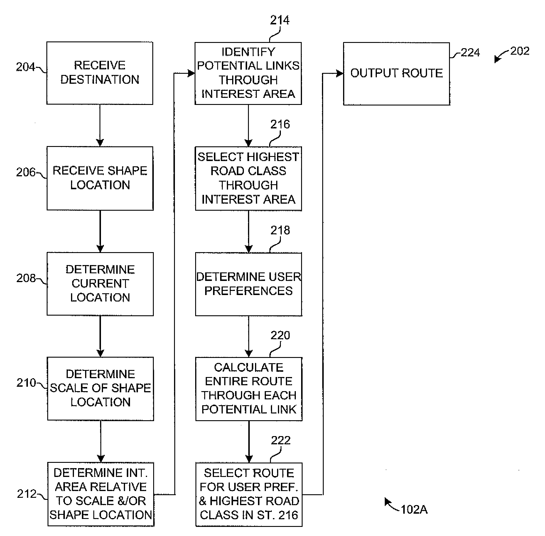
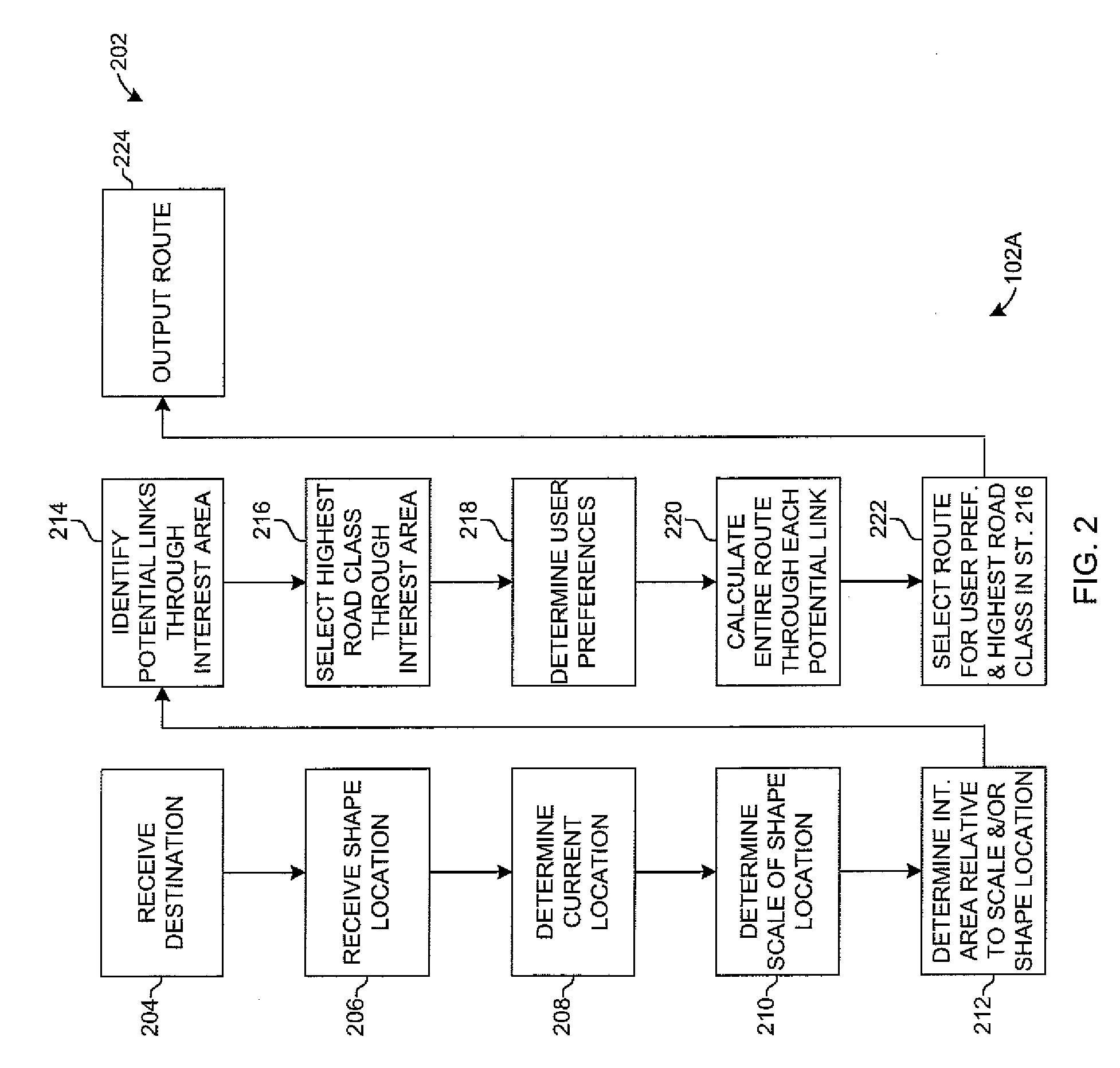
[0022]Systems and methods of the present invention enable a user to shape a navigation route through a selected location without requiring the route to navigate to the location as a destination point or conditional stop. In one aspect, a navigation device determines a route that gravitates toward a selected shape location while not routing to the location. In this aspect, the route generally is pulled toward the shape location, but the most efficient route through or near the shape location is selected. For example, a route is selected that skirts a city identified as a shape location so that highway travel is maintained to a final destination. In another example, a route is selected that navigates through an intersection or by a point of interest (POI) identified as a shape location, but does not require a stop or deviation to the intersection or POI. A shape location can be an address, an intersection, a city, a state, a point of interest, such as a park, a store, a restaurant, a ...


PUM


Abstract

Route shaping systems and methods determine a route from a current location through a shape location to a destination. An area of interest is determined for the shape location, and a highest road class for road segments through the interest area is identified. A route is calculated from a starting location through the interest area to the destination, and the route includes a selected road segment through the interest area with the highest road class.

Description

CROSS-REFERENCE TO RELATED APPLICATIONS[0001]The present application claims the benefit of U.S. Provisional Application No. 60 / 892,146, entitled “ROUTE SHAPING SYSTEMS AND METHODS,” filed Feb. 28, 2007, which is herein incorporated by reference in its entirety.BACKGROUND OF THE INVENTION[0002]The present invention is related to navigation devices that enable a user to navigate a road network from a starting point to a destination and more particularly to a system and method suitable for used by a navigation device for shaping a route through a location, while not routing the user to that location as a destination.[0003]Navigation devices, particularly those designed for use in automobiles; enable a user to navigate a road network from a starting point to a destination. The devices monitor their current position and provide turn-by-turn instructions to the user. Many navigation devices allow a user to identify a starting point and a destination and later add an intermediate stop betw...

Claims


Application Information

Patent Timeline
Patent Type & Authority Applications(United States)
IPC IPC(8): G01C21/34G01C21/20G01C21/26
CPCG01C21/3614G01C21/3461
Inventor BOLTON, KENNETH A.LAZARUS, GREGORY L.LUTZ, PASCAL M.CAIRE, JACOB W.
Owner GARMIN
Learn More