

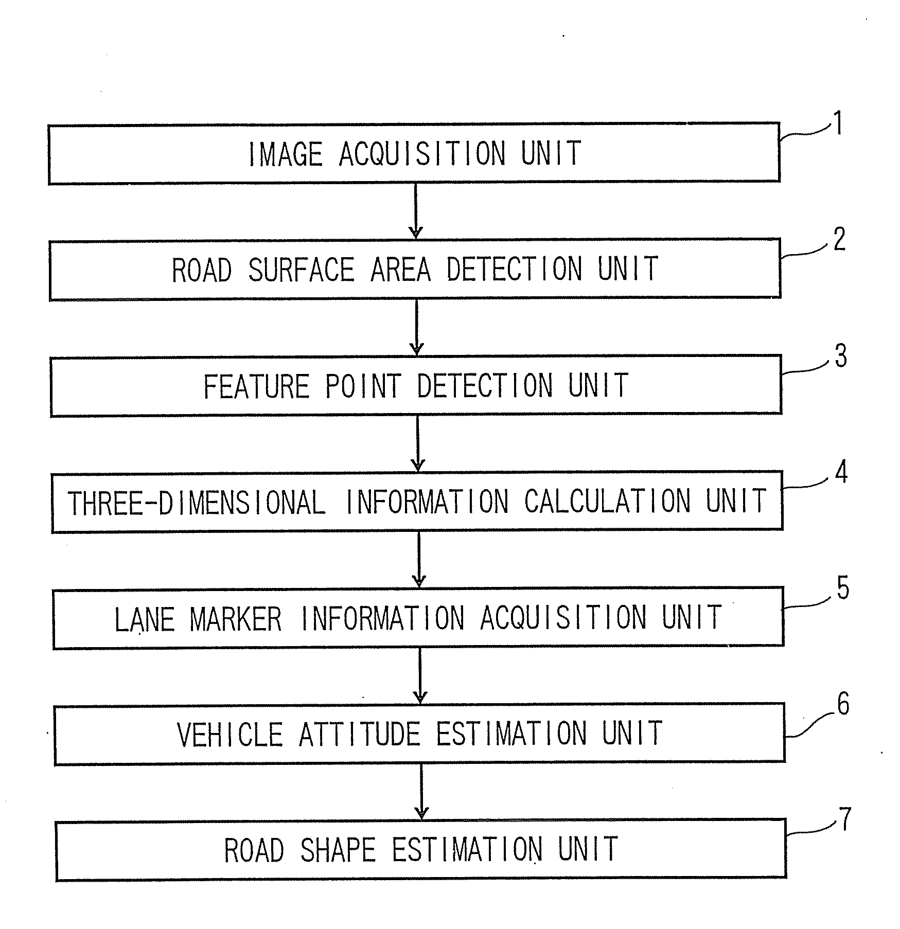
Image processing apparatus and method
a technology of image processing and apparatus, applied in the field of image processing apparatus and method, can solve the problems of erroneously estimating the shape of the road, becoming difficult to distinguish between the road area and the other area,
- Summary
- Abstract
- Description
- Claims
- Application Information
AI Technical Summary
Benefits of technology
Problems solved by technology
Method used
Image

Examples
Embodiment Construction
[0003]To date, as a method of estimating an attitude of a vehicle or the like and an incline of a road, JP-A-2006-234682(Kokai) discloses a target object determination apparatus. JP-A-2006-234682(Kokai) calculates three-dimensional position information of feature points from an image acquired from a stereo camera. By projecting the feature points onto a lateral direction and depth direction plane using the three-dimensional position information of the feature points, the image is divided into a road area and the other area from a magnitude of a projection value. A short range road incline and a vehicle attitude are estimated from short range feature points belonging to a detected road area, and furthermore, by calculating a longitudinal curvature using long range distance information, the road incline is estimated.
[0004]Also, a method of a dynamic contour road model for a road tracking and a three-dimensional road shape restoration is disclosed in Yagi et al. “Dynamic Contour Road M...
PUM
 Abstract
Description
Claims
Application Information