Positioning method

a positioning method and positioning technology, applied in surveying and navigation, instruments, navigation instruments, etc., can solve the problems of poor positioning accuracy and affecting the signal of gps satellites

Inactive Publication Date: 2010-08-26
SEIKO EPSON CORP
View PDF4 Cites 0 Cited by
  • Summary
  • Abstract
  • Description
  • Claims
  • Application Information

AI Technical Summary

Problems solved by technology

On the other hand, GPS satellite signals are affected by a multipath to a different extent in a reception environment with poor positioning accuracy (e.g., multipath environment).

Method used


Image

  • Positioning method
  • Positioning method
  • Positioning method

Examples


Embodiment Construction

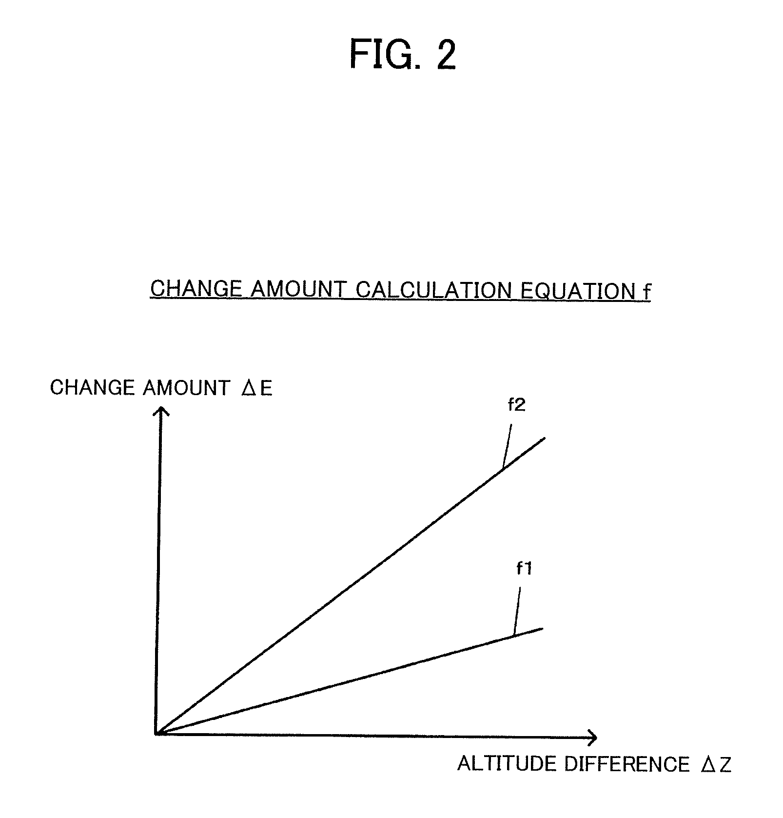
[0030]Several embodiments of the invention may enable the candidate present position of each satellite set to be appropriately evaluated corresponding to the reception environment.

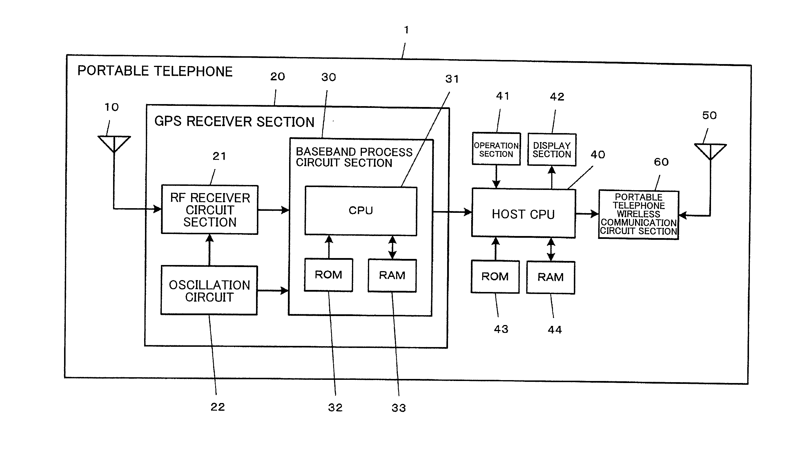
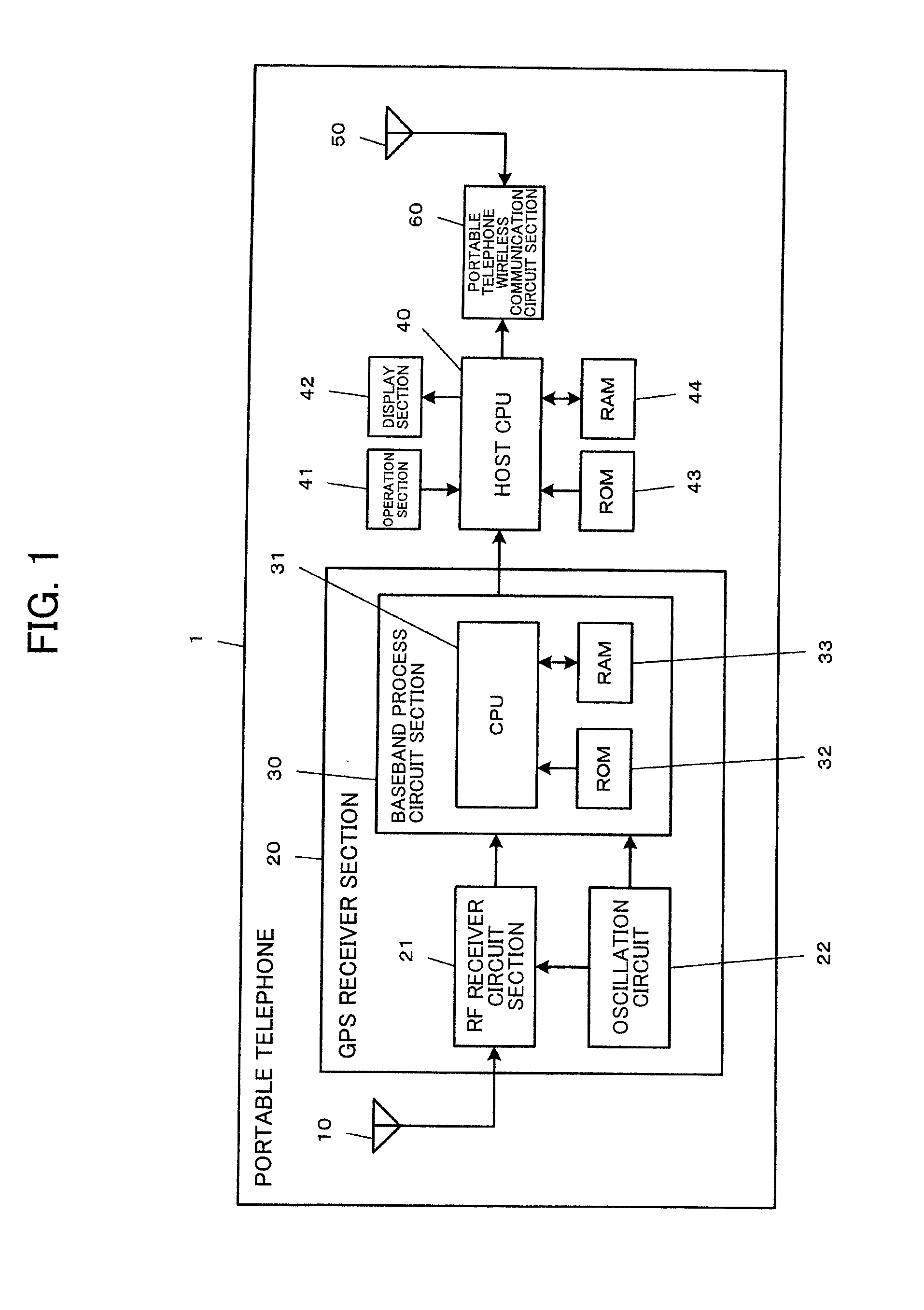
[0031]According to one embodiment of the invention, there is provided a positioning method when receiving satellite signals transmitted from positioning satellites and repeating present position positioning calculations based on the received satellite signals, the positioning method comprising:

[0032]selecting satellite sets based on the received satellite signals, each of the satellite sets being a combination of satellites used for present positioning calculations;

[0033]calculating candidate present positions including a present position altitude corresponding to the respective satellite sets using the satellite signals from the satellites included in the respective satellite sets;

[0034]determining a reception environment based on a dispersion of the present position altitudes of the respective satellite ...


PUM


Abstract

A reception environment is determined to be a multipath environment when the difference (positioning altitude difference) between the maximum value (maximum altitude) and the minimum value (minimum altitude) of the altitudes of candidate present positions P of respective satellite sets exceeds a given threshold value (e.g., 200 m), and is determined to be an open-sky environment when the positioning altitude difference is equal to or less than the given threshold value. When the reception environment is the open-sky environment, an evaluation point E of each satellite set is calculated using a known evaluation method based on the number of satellites, a PDOP value, and the like. When the reception environment is the multipath environment, the evaluation point E of each satellite set is calculated in the same manner as in the open-sky environment, and a change amount ΔE corresponding to the difference (altitude difference) between the altitude corresponding to the preceding located position acquired from an altitude table and the altitude of the candidate present position of the target satellite set is subtracted from the evaluation point E.

Description

[0001]This is a continuation application of U.S. patent application Ser. No. 12 / 104,584 which claims priority to Japanese Patent Application No. 2007-112609 filed on Apr. 23, 2007 and Japanese Patent Application No. 2008-37117 filed on Feb. 19, 2008. The entire disclosure of U.S. patent application Ser. No. 12 / 104,584 and Japanese Patent Application Nos. 2007-112609 and 2008-37117 is hereby incorporated herein by reference.BACKGROUND OF THE INVENTION[0002]The present invention relates to a positioning method, a storage medium, a positioning device, and an electronic instrument.[0003]The global positioning system (GPS) is widely known as a satellite positioning system, and is utilized for a car navigation system and the like. In the GPS, GPS satellite signals are respectively transmitted from a plurality of GPS satellites which orbit the earth, and a GPS receiver calculates (locates) its present position based on the received GPS satellite signals.[0004]A GPS satellite signal affecte...

Claims


Application Information

Patent Timeline
Patent Type & Authority Applications(United States)
IPC IPC(8): G01S19/42G01C21/00G01S19/22G01S19/28G08G1/0969
CPCG01C21/00G01S19/28G01S19/22
Inventor MITSUNAGA, SHINICHI
Owner SEIKO EPSON CORP
Why Eureka
Try Eureka