
Method of processing global navigation satellite system data

a global navigation satellite and data processing technology, applied in the direction of navigation instruments, instruments, automatic actuation, etc., can solve the problems of satellite(s) not providing positional information, satellite(s) cannot provide positional information, and may not be as accurate as desired, or the location calculated by the gps receiver or other equipment capable of receiving precise radio wave signals suffers from errors

Active Publication Date: 2011-06-16
GENERA MOTORS LLC +1
View PDF9 Cites 44 Cited by
  • Summary
  • Abstract
  • Description
  • Claims
  • Application Information

AI Technical Summary

Benefits of technology

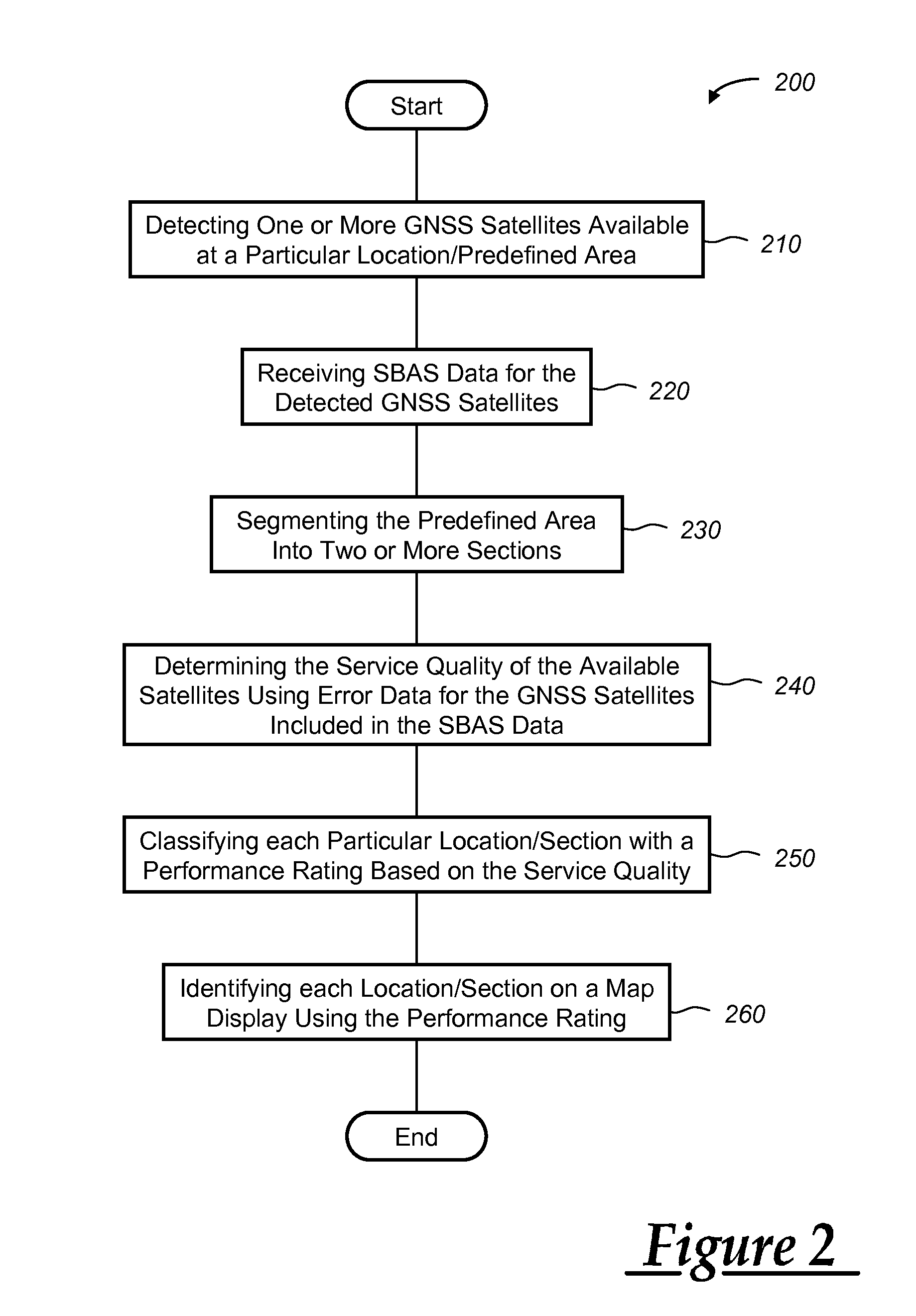
[0005]According to an aspect of the invention, there is provided a method of processing global navigation satellite system (GNSS) data. The method includes identifying one or more GNSS satellites servicing a predefined area, receiving at least one of GNSS almanac data or space-based augmentation system (SBAS) data for the satellites servicing the predefined area, determining the performance of the GNSS satellites servicing the predefined area using the almanac data or SBAS data, and applying a performance rating to the predefined area based on the performance of the GNSS satellites.
[0006]According to another aspect of the invention, there is provided a method of processing GNSS data. The method includes identifying one or more GNSS satellites servicing a predefined area, receiving space-based augmentation system (SBAS) data that indicates ...

Problems solved by technology

Sometimes, even though six or more satellites are within a line of sight, the performance of one or more of these satellites degrades to the point that the satellite(s) cannot provide positional information.
As a result, the location calculated by the GPS receiver or other equipment capable of receiving the precise radio wave signals suffers from error or may not be as accurate as desired.
While WAAS helps reduce GPS error, several limitations exist.
In addition, non-SBAS-equipped GPS receivers can provide inaccurate data to the call center reducing the value of call center services.

Method used


Image

  • Method of processing global navigation satellite system data
  • Method of processing global navigation satellite system data
  • Method of processing global navigation satellite system data

Examples


Embodiment Construction

)

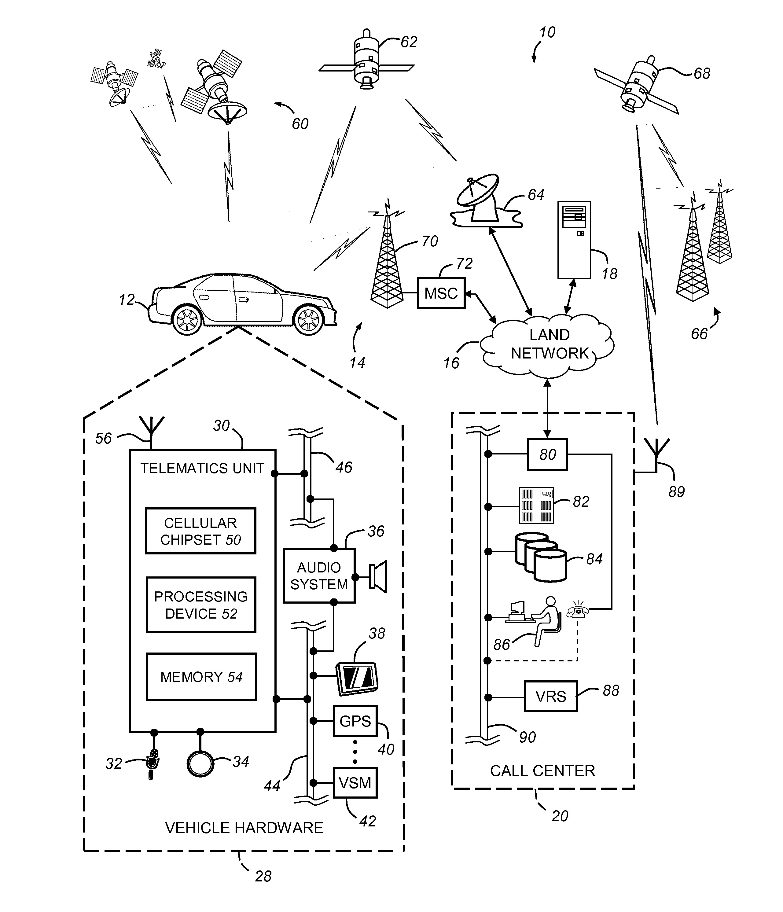
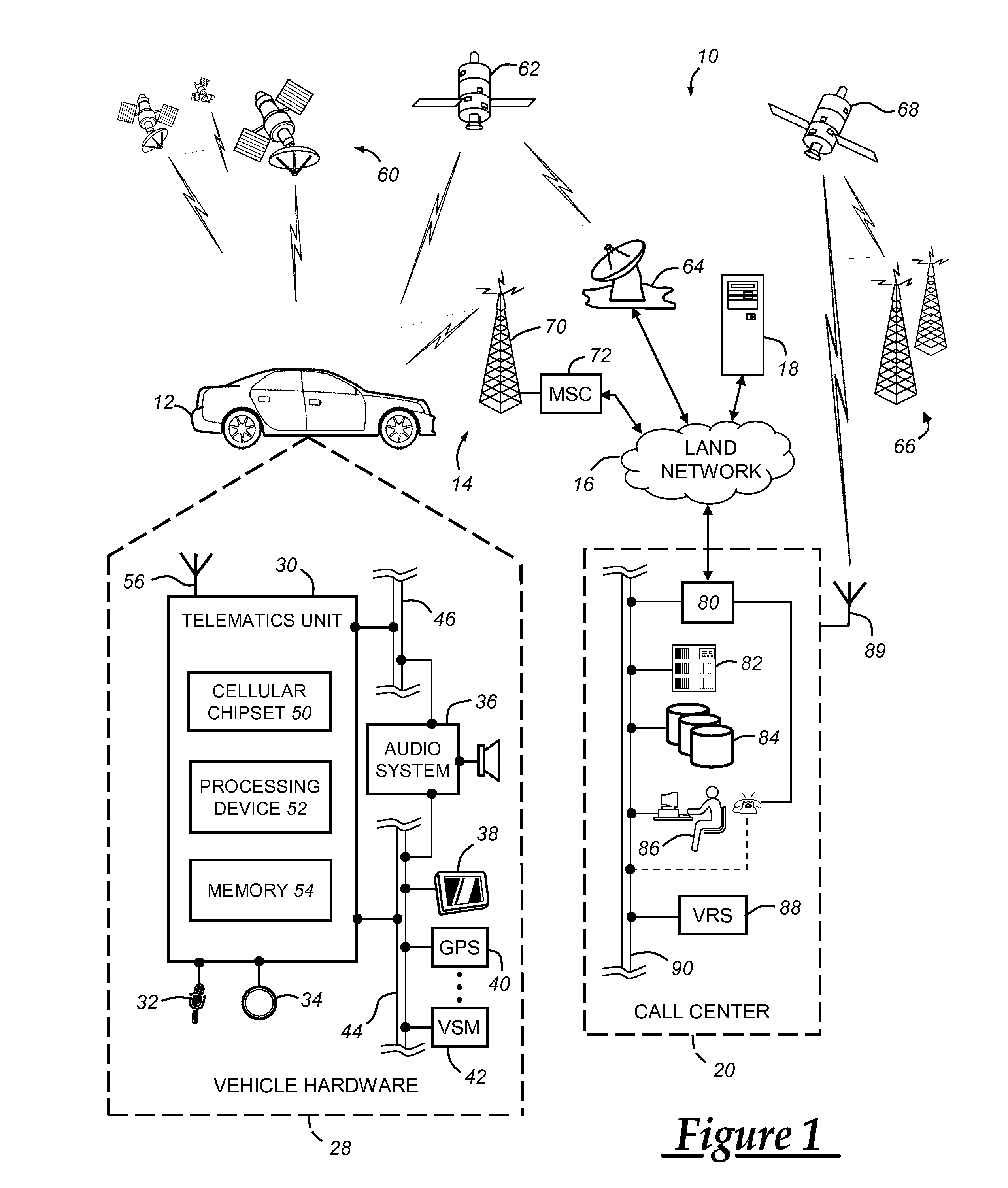
[0012]The method described below involves using global navigation satellite system (GNSS) data and / or space-based augmentation system (SBAS) data to determine the health of a constellation or constellation subset of GNSS satellites. Both the GNSS satellites and the SBAS satellites broadcast information that indicates the health of the GNSS satellites. This information can be used to identify the identity and location of GNSS satellites that are not performing optimally. Using the identity and location of these satellites, a facility, such as a call center, can determine areas or locations where GNSS satellite service is degraded or unavailable. The locations or areas can then be indicated using a map display.

[0013]With reference to FIG. 1, there is shown an exemplary operating environment that comprises a mobile vehicle communications system 10 and that can be used to implement the method disclosed herein. Communications system 10 generally includes a vehicle 12, one or more wirele...


PUM


Abstract

A method of processing global navigation satellite system (GNSS) data includes identifying one or more GNSS satellites servicing a predefined area, receiving at least one of GNSS almanac data or space-based augmentation system (SBAS) data for the satellites servicing the predefined area, determining the performance of the GNSS satellites servicing the predefined area using the almanac data or SBAS data, and applying a performance rating to the predefined area based on the performance of the GNSS satellites.

Description

TECHNICAL FIELD[0001]The present invention relates generally to global navigation satellite system (GNSS) data, and more particularly to a method of processing GNSS data.BACKGROUND OF THE INVENTION[0002]Vehicles and wireless devices include an increasing variety and amount of communication capabilities and available services. These capabilities and services include global positioning system (GPS) receivers for determining a vehicle or wireless device position. GPS is one example of a global navigation satellite system (GNSS) system. A GNSS system includes a network of satellites that orbits the earth and provides location services to individuals and devices using receivers capable of receiving data provided by the satellites. GPS uses a constellation of between 24 and 32 satellites transmitting precise radio wave signals that allow a GPS receiver to determine a current location, a precise time, and a velocity. Presently, a large number of vehicles and wireless devices leave a factor...

Claims


Application Information

Patent Timeline
IPC IPC(8): G01C21/00G01C21/32G01S19/20
CPCG01C21/00G01S19/42G01S19/20G01S19/08G01S19/396G01C21/3896B64C13/503B64C13/18
Inventor MADHAVAN, SETHU K.BASNAYAKE, CHAMINDAHUBER, CHESTER A.YASAN, ERAY
Owner GENERA MOTORS LLC
Learn More