

Geospatial modeling system for separating foliage data from building data based upon loose and strict tolerance noise filtering operations and related methods
a geospatial modeling and foliage data technology, applied in the field of topographical modeling, can solve the problems of difficult to distinguish the two using automated computer processing techniques, noisy data, and noise, and achieve the effect of reducing false building locations
- Summary
- Abstract
- Description
- Claims
- Application Information
AI Technical Summary
Benefits of technology
Problems solved by technology
Method used
Image

Examples
Embodiment Construction
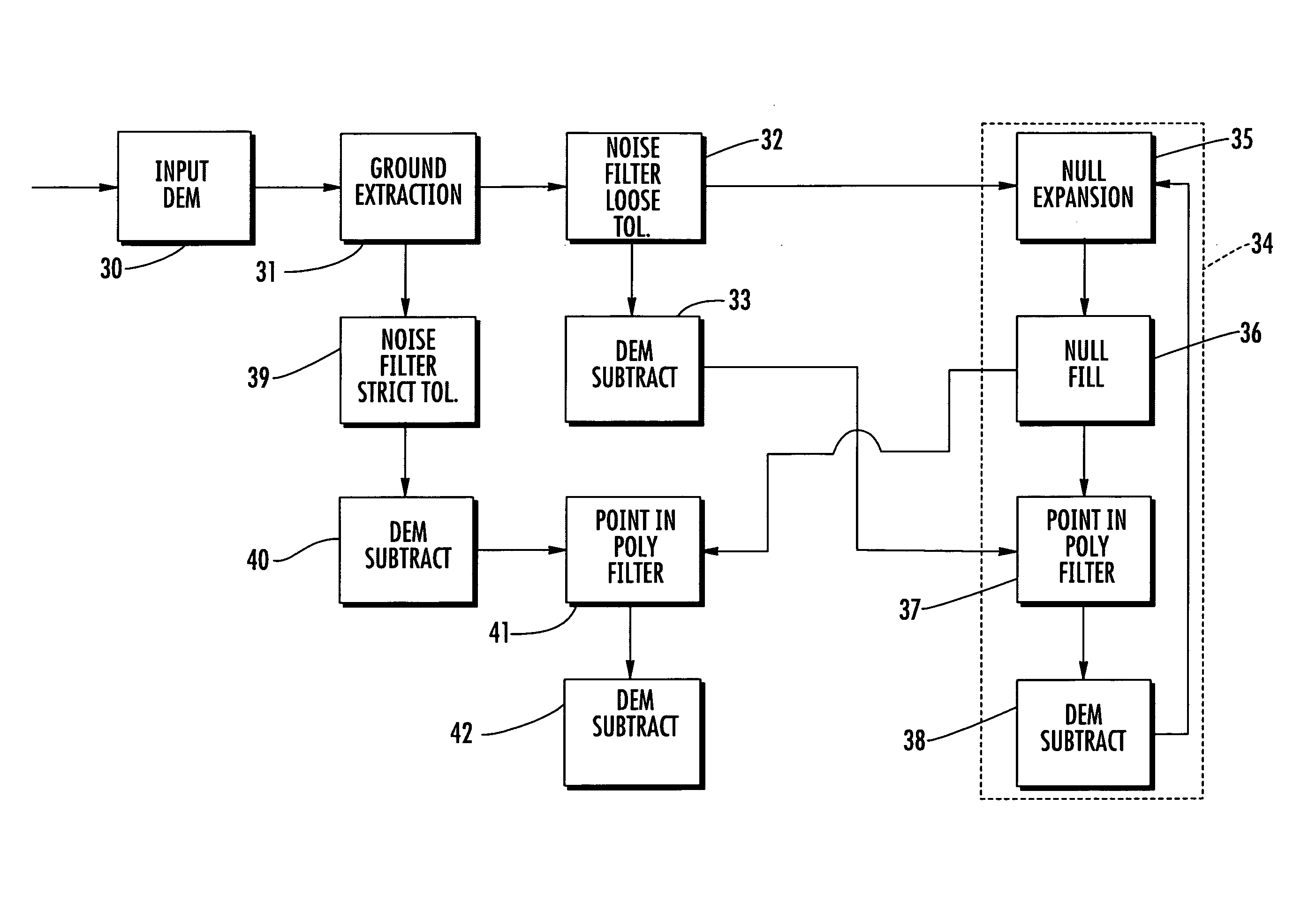
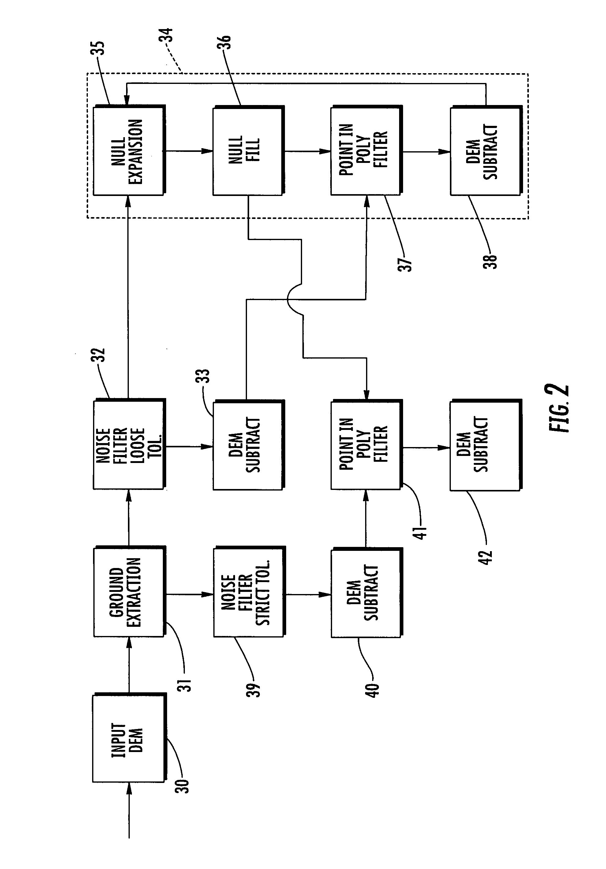
[0018]The present invention will now be described more fully hereinafter with reference to the accompanying drawings, in which preferred embodiments of the invention are shown. This invention may, however, be embodied in many different forms and should not be construed as limited to the embodiments set forth herein. Rather, these embodiments are provided so that this disclosure will be thorough and complete, and will fully convey the scope of the invention to those skilled in the art. Like numbers refer to like elements throughout.
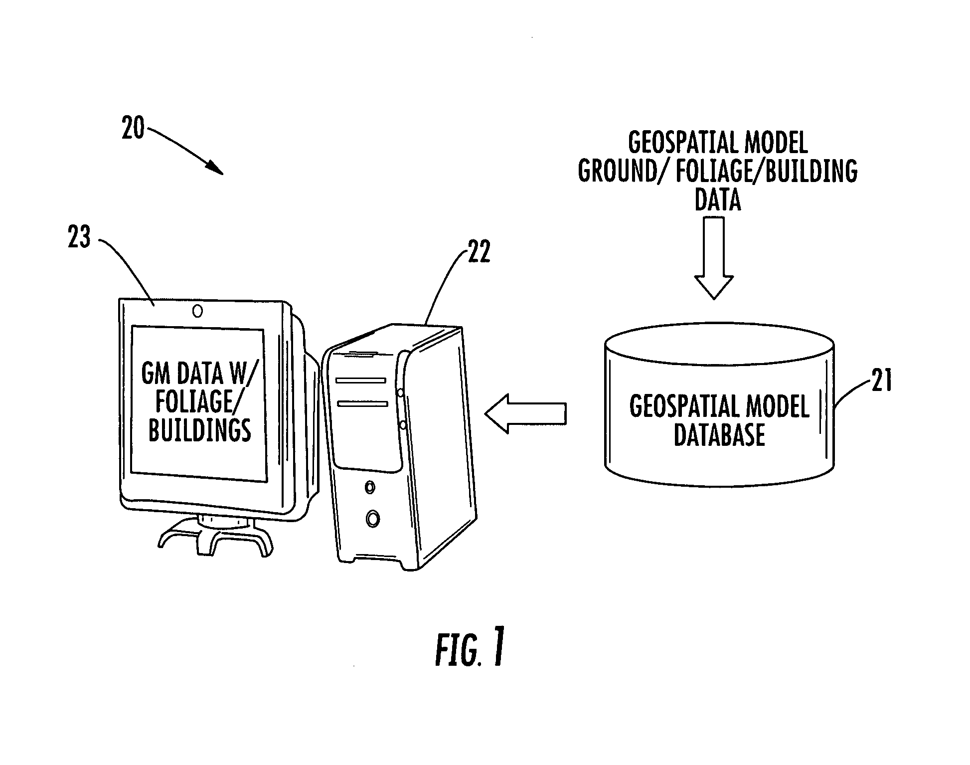
[0019]Referring initially to FIG. 1, a geospatial modeling system 20 illustratively includes a geospatial model database 21 and a processor 22 that may advantageously be used for separating different types of geospatial data, such as building and foliage data, for example. By way of example, the processor 22 may be a central processing unit (CPU) of a PC, Mac, or other computing workstation, for example. A display 23 may also be coupled to the processor 22...
PUM
 Abstract
Description
Claims
Application Information