Geographic management system

a geo-management system and geo-location technology, applied in the field of network configuration and management, can solve the problems of increasing difficulty in managing wireline and wireless networks

Inactive Publication Date: 2008-12-23
CELERITAS TECH L L C
View PDF51 Cites 109 Cited by
  • Summary
  • Abstract
  • Description
  • Claims
  • Application Information

AI Technical Summary

Problems solved by technology

Managing wireline and wireless networks has become increasingly difficult.

Method used


Image

  • Geographic management system
  • Geographic management system
  • Geographic management system

Examples


Embodiment Construction

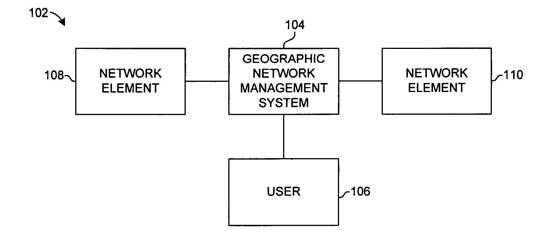
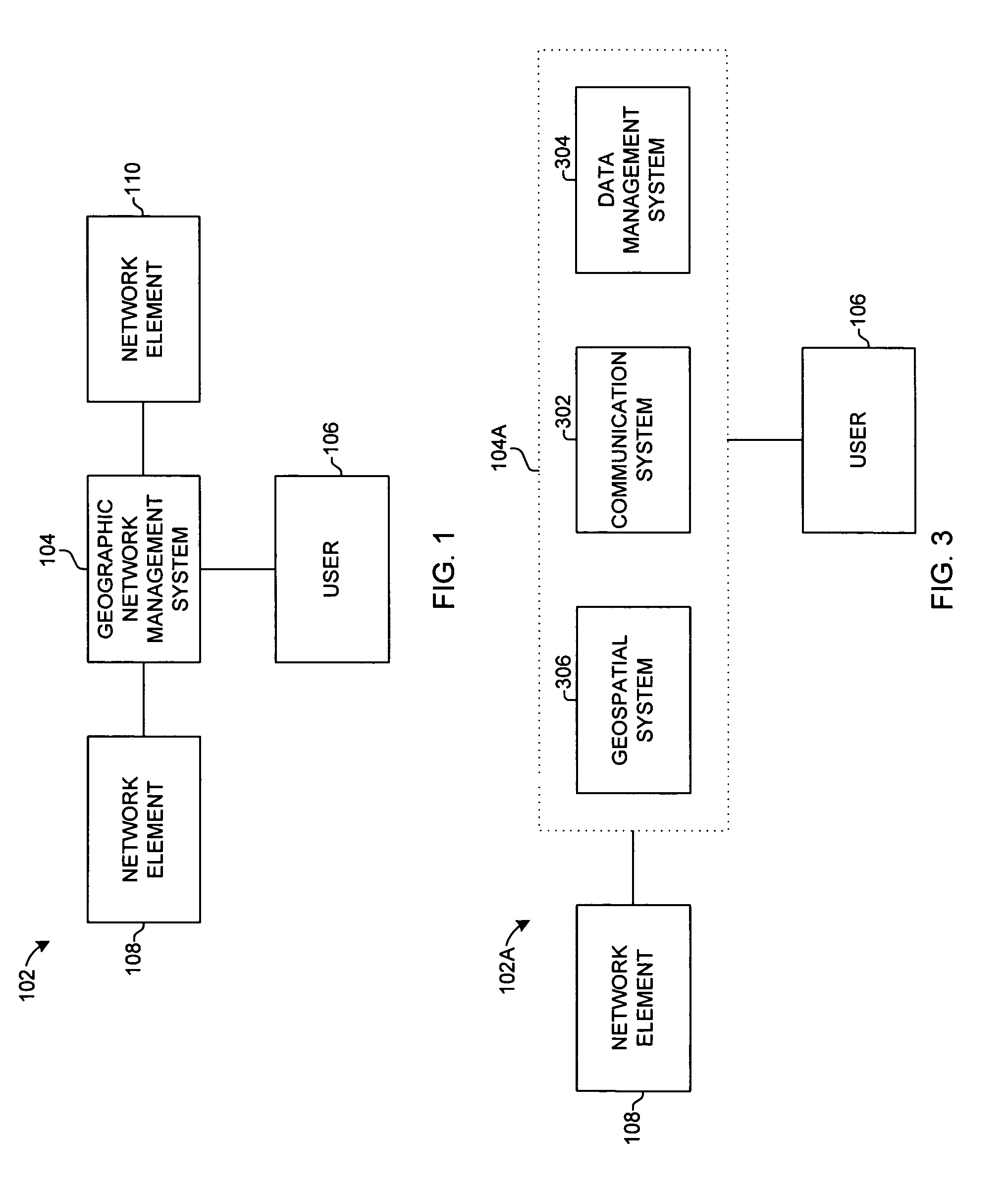
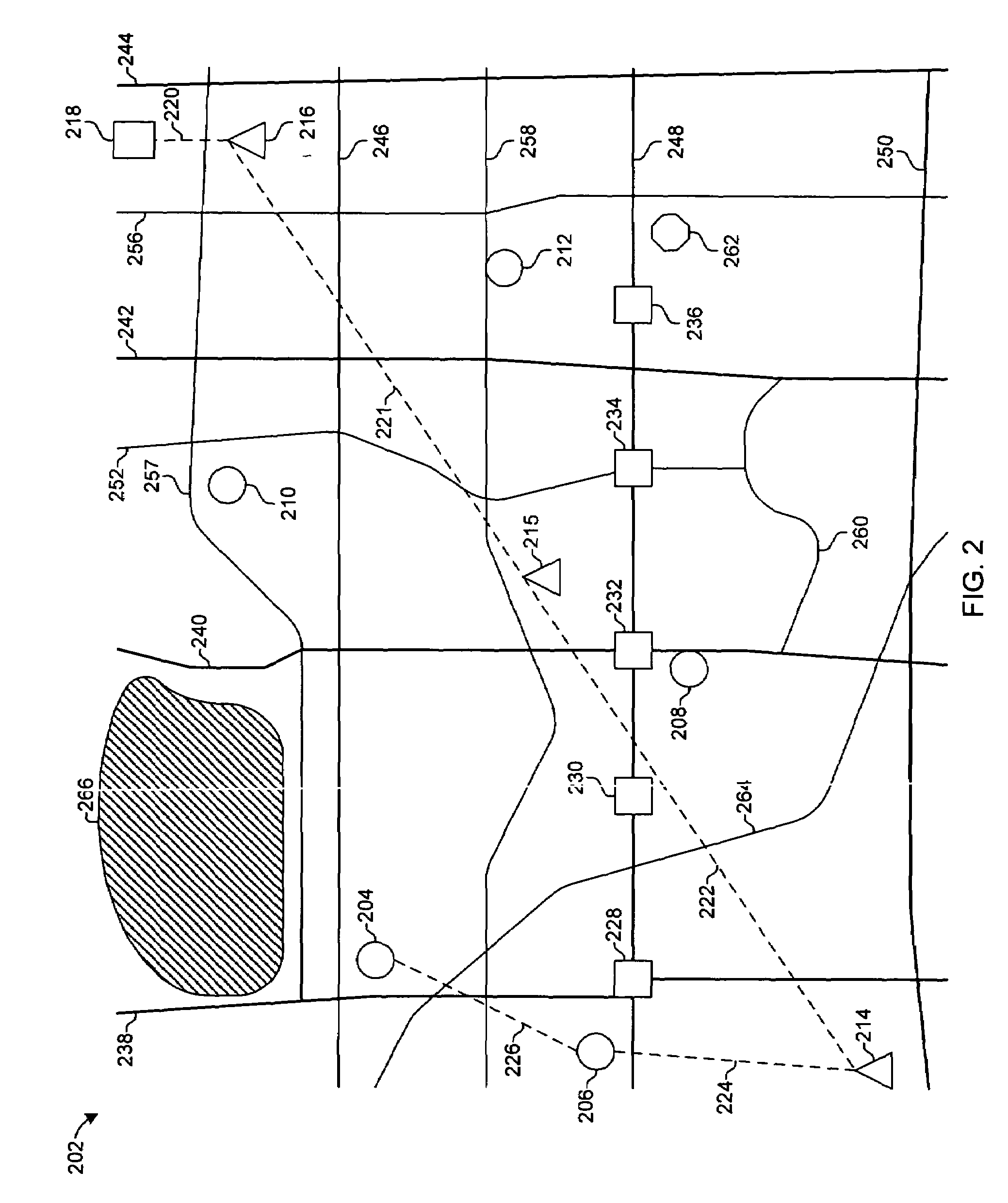
[0056]The present invention provides a system for managing one or more networks. As used herein, the term “network” may identify one or more different types of geographic areas in which one or more types of data are to be depicted. For example, a network may include an oil or gas industry network configured to identify one or more oil wells. Also, a network may include a communication network or a store network.

[0057]The present invention may be configured to manage networks using network data and geospatial data to provide a geographical representation of a network through a graphical interface for a user. The system is used to view, monitor, configure, and manage networks. As used herein, network data comprises performance data, equipment data, performance data, including trouble ticket data, event data, alarm data, customer service data, and / or configuration data for calls, for network elements, and / or for performance elements.

[0058]A trouble ticket is an entry of data for a repo...


PUM


Abstract

A geographic management system (GMS) comprises a web server, a database server, and a map server. A user browser connected to the GMS transmits a search criteria to the web server. The web server transmits the search criteria to the map server. The map server geocodes the search criteria, obtains network data and geospatial data from the database server corresponding to the geocode, and transmits the geocode, the network data, and the geospatial data to the web server. The web server transmits the geocode, the network data, and the geospatial data to the user browser. The network data and the geospatial data are displayed on the user browser as a map displaying network elements of a telecommunication network relative to other network elements, geographic elements, and customers. One or more of the network elements have associated performance elements or sectored performance elements that display performance characteristics or sectored performance characteristics that signify performance attributes associated with the network element. The user browser can navigate through other network data and geospatial data by selecting network elements on the map or by selecting navigation tools or navigation tabs displayed in conjunction with the map.

Description

RELATED APPLICATIONS[0001]This application is a continuation of U.S. patent application Ser. No. 10 / 004,346, filed on Nov. 1, 2001, entitled Geographic Management System which was a continuation-in-part of U.S. patent application Ser. No. 09 / 470,553, filed on Dec. 22, 1999, entitled Geographic Network Management System, now U.S. Pat. No. 6,343,290, all of which are incorporated fully herein.FEDERALLY SPONSORED RESEARCH OR DEVELOPMENT[0002]Not ApplicableCOMPACT DISK APPENDIX[0003]Not ApplicableBACKGROUND OF THE INVENTION[0004]The present invention relates to the field of network configuration and management using geographic data and network data.[0005]Managing wireline and wireless networks has become increasingly difficult. Service providers now connect calls for digital wireless communications and / or analog wireless communications (“wireless communications”) and / or wireline communications. The service providers must provide expansive coverage, adequate capacity, high reliability, a...

Claims


Application Information

Patent Timeline
Patent Type & Authority Patents(United States)
IPC IPC(8): G06F17/30H04L12/24H04L29/08H04W4/02H04W4/029
CPCH04L41/0253H04L41/12H04L41/22H04L69/329H04L67/16H04L67/36H04L67/18H04W4/02H04L67/52H04L67/51H04L67/75H04W4/029
Inventor COSSINS, ROBERT N.EVANS, SCOTT A.
Owner CELERITAS TECH L L C
Why Eureka
Try Eureka