Eureka AIR delivers breakthrough ideas for toughest innovation challenges, trusted by R&D personnel around the world.

Globally-convergent geo-location algorithm

a global convergence and algorithm technology, applied in direction finders, direction finders using radio waves, instruments, etc., can solve the problems of determining an initial location estimate that is difficult, zero, one, or multiple intersections, etc., and achieves the effect of reliable approximation of a geolocation

Inactive Publication Date: 2012-05-29
L 3 COMM INTEGRATED SYST
View PDF6 Cites 6 Cited by
  • Summary
  • Abstract
  • Description
  • Claims
  • Application Information

AI Technical Summary

Benefits of technology

[0008]Embodiments of the present invention solve the above-mentioned problems and provide a distinct advance in the art of geolocation. More particularly, embodiments of the invention provide a system and method for reliably approximating a geolocation of a non-cooperative target using any reasonable target location estimate.

Problems solved by technology

However, when a limited number of sensor measurements are available, such as when using only a time difference of arrival (TDOA) and frequency difference of arrival (FDOA) of a signal received by two sensors, determining an initial location estimate can be very difficult due to the geometry of the measurements.
This is a difficult problem to solve, and if solved, can produce zero, one, or multiple intersections because of sensor errors and platform-target geometry.
A lack of convexity at an initial location estimate can result in Newton's Method moving the location estimate away from the solution instead of towards it.
Although this guarantees that at each update the location estimate moves along a direction that initially does not increase the objective function, poor initialization can produce a huge change in the location estimate that overshoots the solution and results in convergence to a distant location.

Method used


Image

  • Globally-convergent geo-location algorithm
  • Globally-convergent geo-location algorithm
  • Globally-convergent geo-location algorithm

Examples


Embodiment Construction

[0024]The following detailed description of the invention references the accompanying drawings that illustrate specific embodiments in which the invention can be practiced. The embodiments are intended to describe aspects of the invention in sufficient detail to enable those skilled in the art to practice the invention. Other embodiments can be utilized and changes can be made without departing from the scope of the present invention. The following detailed description is, therefore, not to be taken in a limiting sense. The scope of the present invention is defined only by the appended claims, along with the full scope of equivalents to which such claims are entitled.

Target Locating System Components:

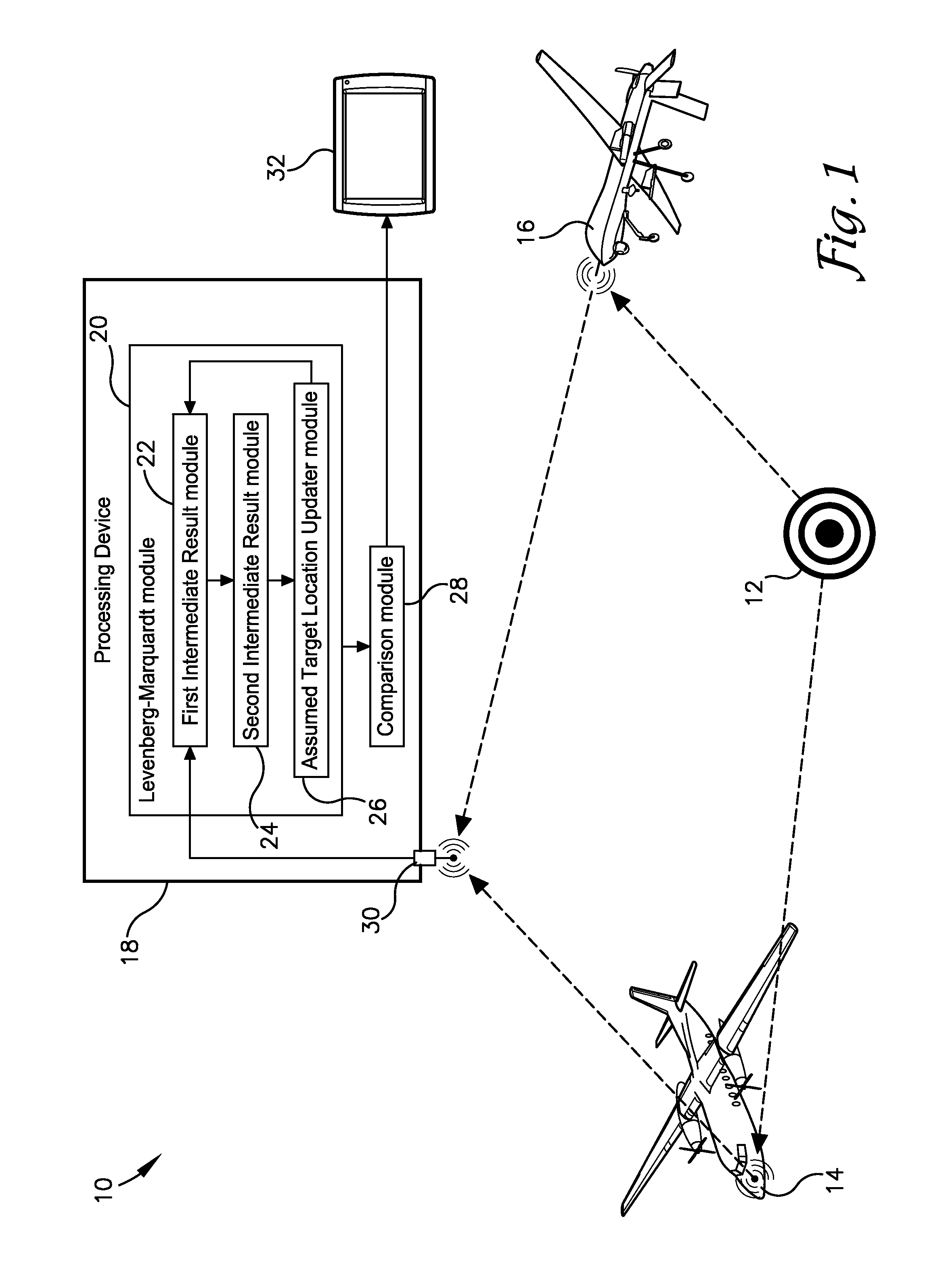
[0025]FIG. 1 illustrates a target locating system 10 configured to estimate or approximate a geographic location or geo-location of a non-cooperative target 12, such as enemy aircraft, tank, missile, silo, etc. The system 10 may comprise one or more collectors 14, 16 for collecting one ...


PUM


Abstract

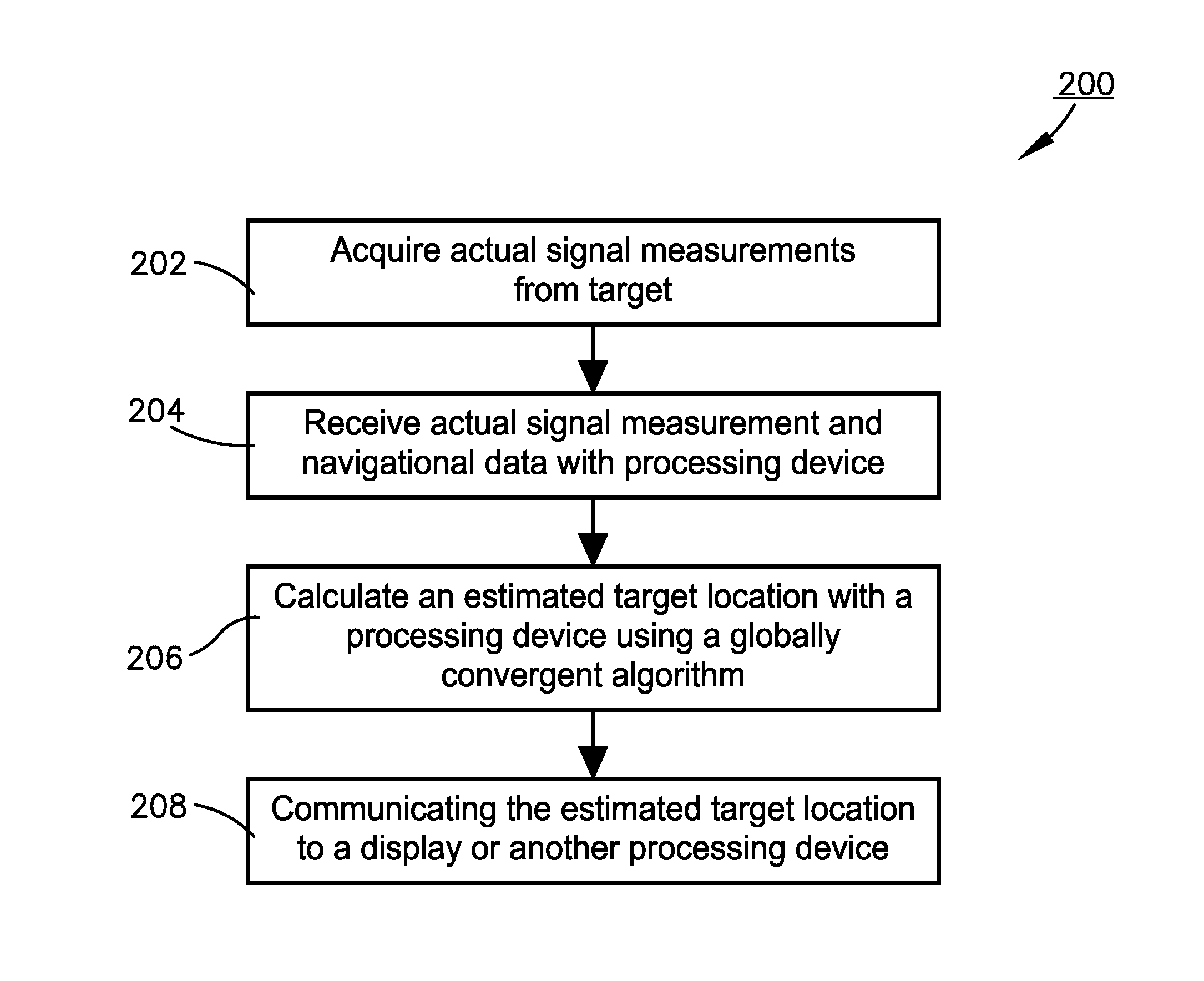
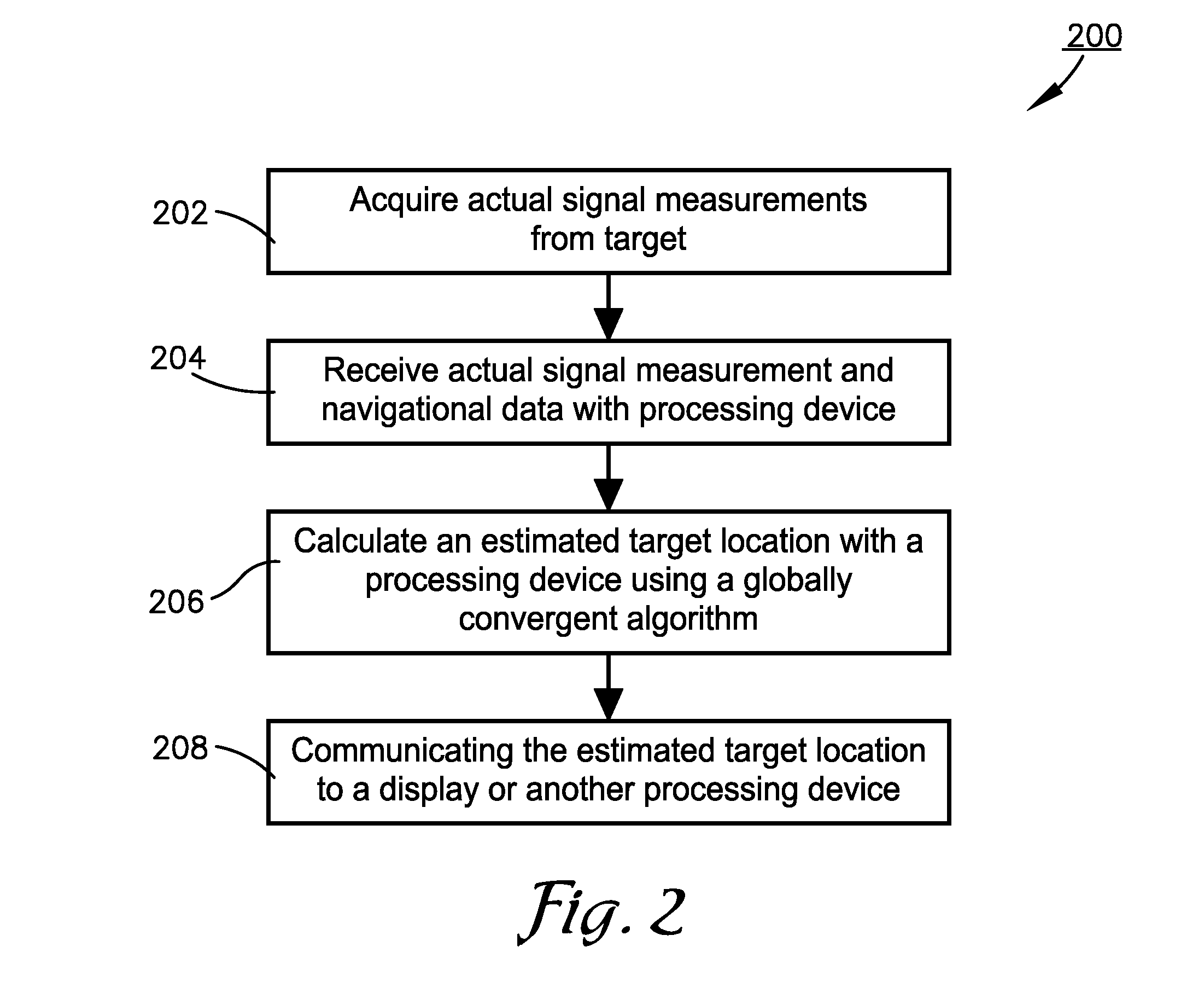
A system and method for estimating a geolocation of a non-cooperative target using any reasonable target location estimate. Collectors may acquire actual signal measurements including a direction of arrival (DOA), a target range, a time difference of arrival (TDOA), a range rate, a range sum, and / or a frequency difference of arrival (FDOA). A processing device may receive the actual signal measurements and navigational data regarding the collectors. Then, the processing device may calculate an estimated target location as a solution to a nonlinear optimization problem where an objective function to be minimized is a weighted sum-of-squares of differences between the actual signal measurements and calculated values corresponding to signal measurements that theoretically should be produced for a particular target location. The algorithm used to solve this problem may be a globally convergent algorithm, such as a Levenberg-Marquardt algorithm.

Description

BACKGROUND[0001]1. Field[0002]Embodiments of the present invention relate to geolocation of a non-cooperative target. More particularly, embodiments of the present invention relate to a system and method for using a globally convergent algorithm to determine the geolocation of a non-cooperative target.[0003]2. Related Art[0004]In order to locate a stationary ground target, sensor measurements and collection platform navigation data are processed either by a batch processing algorithm or a recursive estimator such as a Kalman filter. Such algorithms compute a target location estimate as the solution to a minimum variance optimization problem, with the answer being the point which best fits the sensor and navigation data in the weighted least-squares sense.[0005]Nearly all geo-location algorithms, such as that used by a recursive estimator called the Extended Kalman Filter, require an initial target location estimate. However, when a limited number of sensor measurements are available...

Claims


Application Information

Patent Timeline
Patent Type & Authority Patents(United States)
IPC IPC(8): G01S3/02G01S1/08G01S5/04
CPCG01S5/0205G01S5/12G01S5/011
Inventor GRABBE, MICHAEL T.WESTCOTT, BRYAN LLOYD
Owner L 3 COMM INTEGRATED SYST
Why Eureka
Eureka Blog
Learn More