Showing geo-located information in a 3D geographical space

a technology of geo-location and geographical space, applied in the field of geo-geographical information systems, can solve the problems of distorted rectangular billboards, strange unrealistic, intrusion into user experience, etc., and achieve the effect of not being clear-spaced, not being able to clearly display billboards, and being too intrusive to the user experien

Active Publication Date: 2015-01-27
GOOGLE LLC
View PDF22 Cites 26 Cited by
  • Summary
  • Abstract
  • Description
  • Claims
  • Application Information

AI Technical Summary

Problems solved by technology

These rectangular billboards have a number of problems.
Rectangular billboards are also distorted when viewed from certain viewpoints.
Floating billboards have been tried but these are too intrusive to the user experience and are strangely unrealistic when the user begins to navig...

Method used


Image

  • Showing geo-located information in a 3D geographical space
  • Showing geo-located information in a 3D geographical space
  • Showing geo-located information in a 3D geographical space

Examples


Embodiment Construction

[0023]The embodiments described herein refer to illustrations for particular applications. It should be understood that the invention is not limited to the embodiments. Those skilled in the art with access to the teachings provided herein will recognize additional modifications, applications, and embodiments within the scope thereof and additional fields in which the embodiments would be of significant utility.

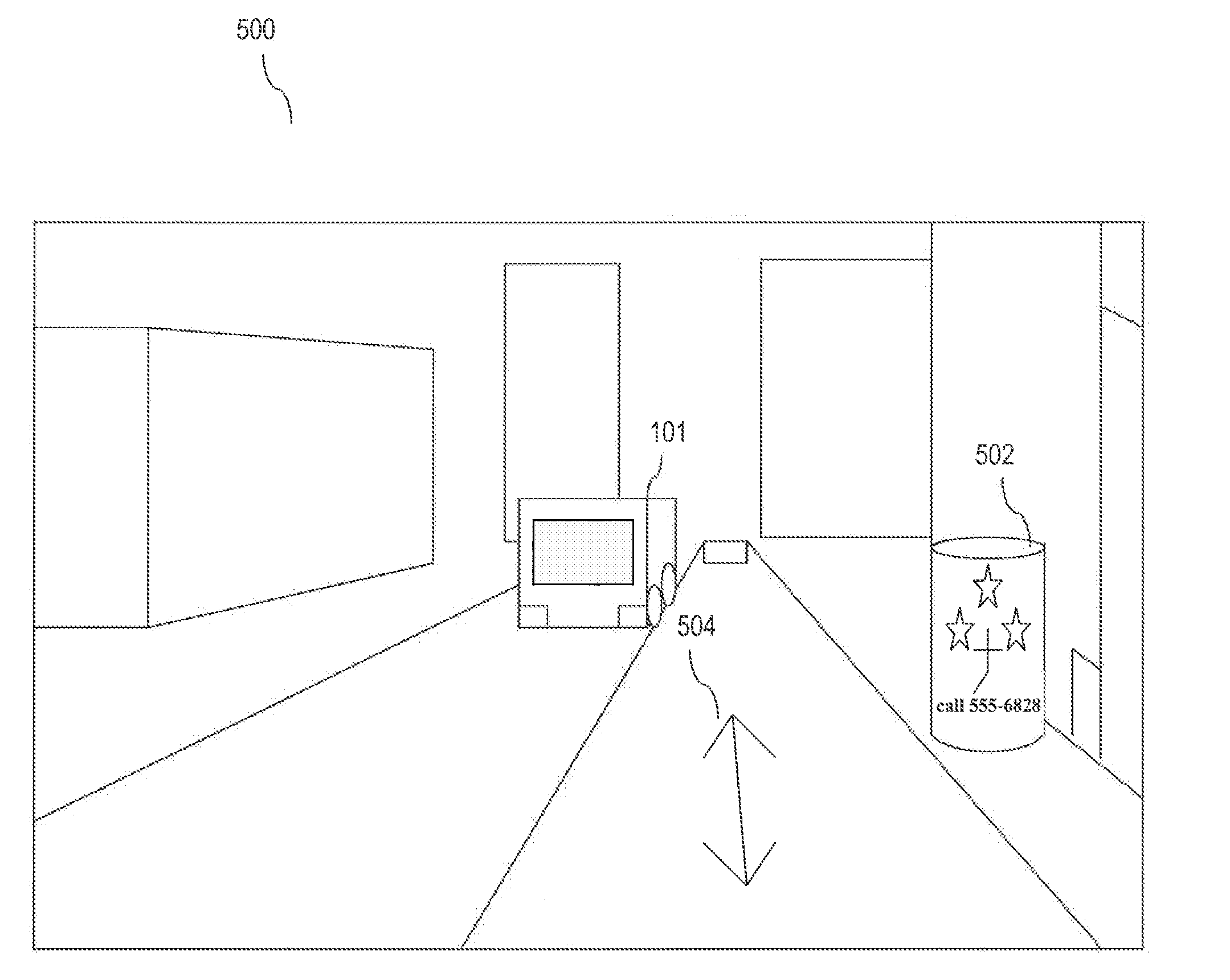
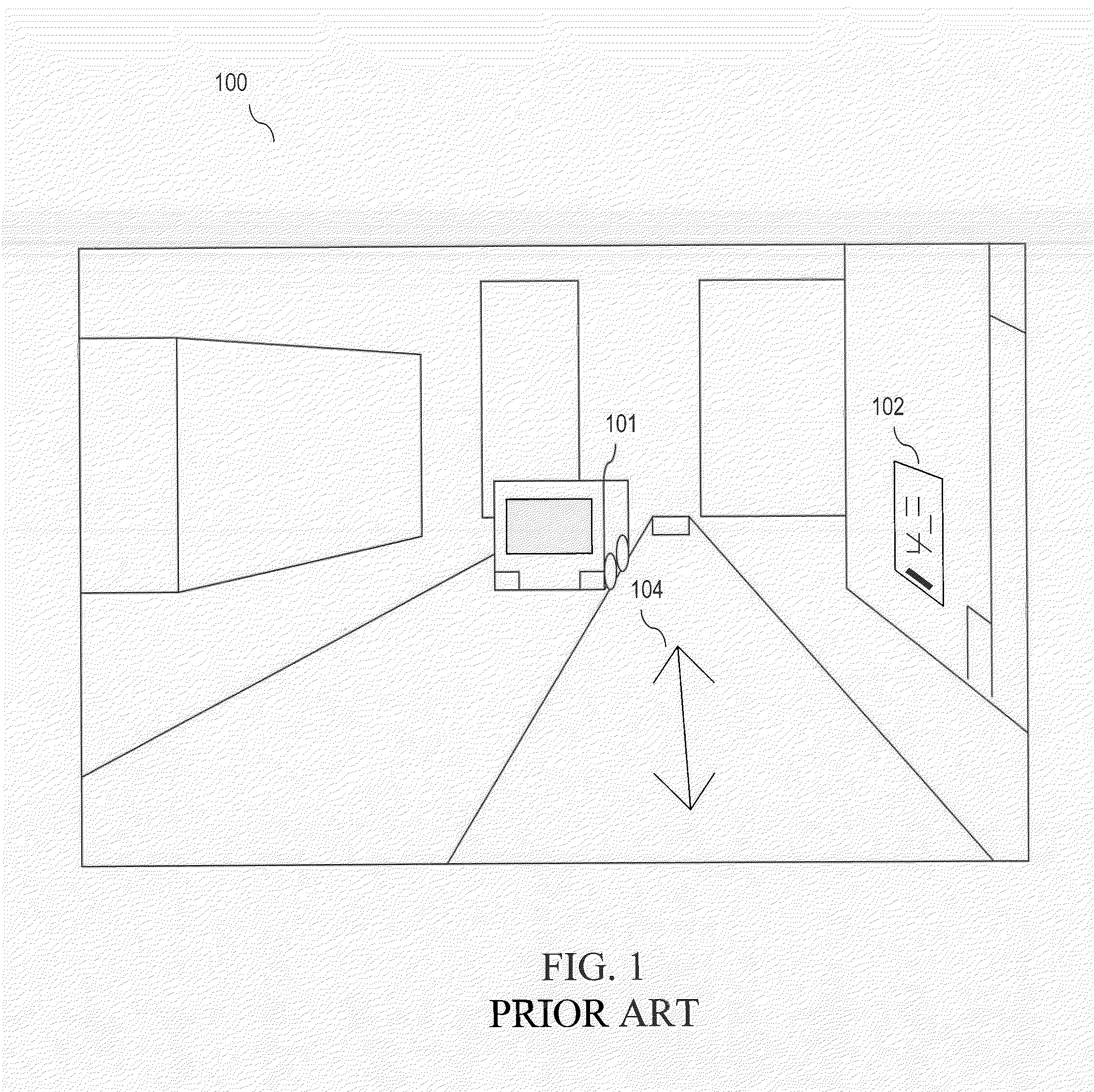
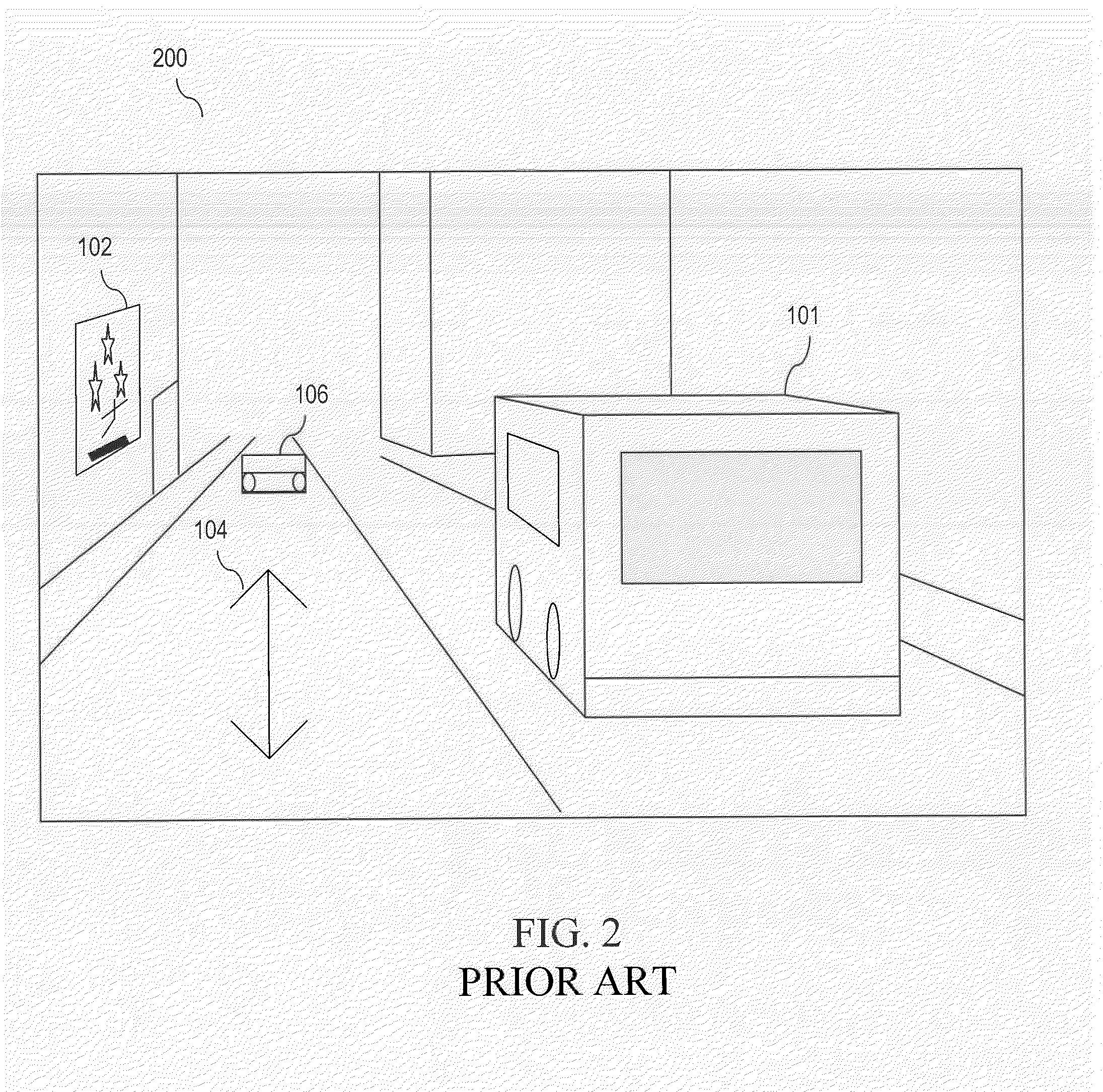
[0024]GIS applications, such as a Google Street View application, provide the experience of exploring a town or city with panoramic views while navigating along a street. Graphics, such as advertisements for local businesses, may be displayed within such 3D geographic environments. Existing techniques for displaying such graphics include flat markers that convey little information and virtual rectangular billboards applied to a flat surface. These rectangular billboards have a number of problems, as explained above with FIGS. 1-3.

[0025]Graphics, such as advertisements, may be ...


PUM


Abstract

Methods and systems for providing a graphic, such as an advertisement, in a 3D geographical information system (GIS) view are described. A method for providing a graphic in a 3D GIS view may include obtaining a graphic and determining a 3D geographical space in the GIS view based on a geographical reference in the GIS view. The method may also include rendering and displaying a curvilinear representation of the graphic in the geographical space. The method may further include adjusting the curvilinear representation of the graphic according to an updated viewpoint of the GIS view. The curvilinear representation may be oriented directly towards the updated viewpoint. A system for providing a graphic in a 3D GIS view may include a geographical space manager, a graphic representation generator and a display module.

Description

BACKGROUND[0001]1. Technical Field[0002]The field relates to geographical information systems.[0003]2. Background[0004]Geographic Information Systems (GIS) capture, store, manage and display data elements according to geospatial coordinates. For example, a Google Earth™ application renders satellite imagery, terrain, vectors and other data over a three-dimensional geometry representing the Earth's surface. Other GIS applications, such as a Google Street View application, provide the experience of exploring a city with panoramic views while navigating along a street.[0005]Advertisements for local businesses may be displayed within 3D geographic environments such as a Google Earth™ application and a Google Street View application. Existing techniques for displaying advertisements include flat markers or icons that convey little information and virtual rectangular billboards applied to a flat surface.[0006]These rectangular billboards have a number of problems. A billboard applied to a...

Claims


Application Information

Patent Timeline
IPC IPC(8): G09G5/00
CPCG06Q30/0241G06Q10/00
Inventor CHAPIN, CHARLESVARADHAN, GOKUL
Owner GOOGLE LLC
Why Eureka
Try Eureka