Method for determining and displaying geographical location

A technology of geographic location and geographic location information, applied in the field of location confirmation, which can solve the problems of easy loss, expensive kits, and expensive prices.

Inactive Publication Date: 2007-08-15
周毅 +1
View PDF0 Cites 3 Cited by
  • Summary
  • Abstract
  • Description
  • Claims
  • Application Information

AI Technical Summary

Problems solved by technology

[0003] In the GPS embodiment, a system combining the GPS global positioning system and the electronic map has appeared, and its purpose is to provide users with satellite navigation. At present, most of the GPS is realized by hardware, and its expensive price and Huge volume makes application promotion difficult
In addition, China, "Communication Technology" magazine, January 2002 edition published an article titled "PDA Magic", which announced a centralized kit for PDA, in which, by inserting the phone module kit into the navigation module kit, you can use Pock...

Method used


Image

  • Method for determining and displaying geographical location

Examples


Embodiment Construction

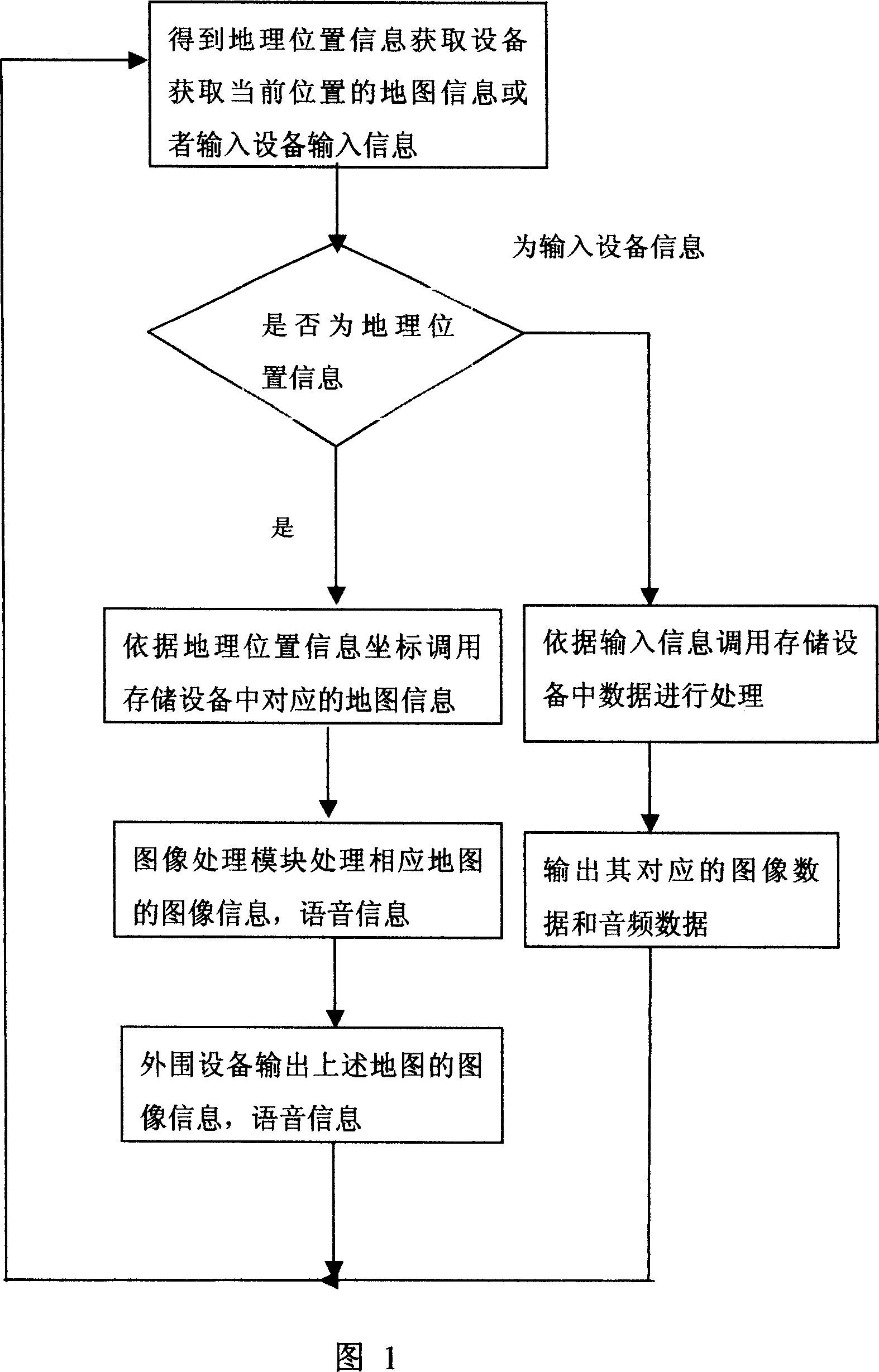
[0016] The principle and structure of the present invention will be further described below in conjunction with the accompanying drawings.

[0017] Figure 1 is a block diagram of a method for determining and displaying a geographical position of the present invention, as shown in Figure 1, after obtaining the geographical position information of the current position obtained by the geographical position information acquisition device, it is judged whether it is geographical information, if it is Geographical information; at this time, the system calls the map information in the storage device and compares it with the geographic information obtained by the current geographic location information acquisition device, so as to call the corresponding map information according to the geographic location information coordinates, and the corresponding map information system called above is sent to the image processing system The module processes image information or voice information, ...


PUM


Abstract

This invention relates to one geography position determination and display method, which provides one electronic map communication device and use based on global position system, Galileo device, north star system, difference device, wherein, the device can provide accurate geography position to get device data through software establishing satellite guide system to determine detail geography coordinates on device to display its geography position and image.

Description

【Technical field】 [0001] The invention relates to a location confirmation method, in particular to a method for determining and displaying a geographic location. 【Background technique】 [0002] The widespread availability of accurate electronic maps and the low cost of processing and display technology have been the driving force behind this trend in recent years. Maps are available on fixed media, in memory, and on networks such as the Internet. superior. Mapping software systems with GPS-based position determination are used on existing motor vehicles to make localized maps available to users. [0003] In the embodiment of GPS, a system combining GPS global positioning system and electronic map has appeared, and its purpose is to provide satellite navigation for users. At present, most of GPS is realized by hardware, and its expensive price and The huge size makes it difficult to promote the application. In addition, China, "Communication Technology" magazine, January 2...

Claims


Application Information

Patent Timeline
IPC IPC(8): G01C21/26G01C21/28G01C21/00
Inventor 周毅熊江辉陈若飞
Owner 周毅
Why Eureka
Try Eureka