Intelligent navigation monitoring system for vessel

An intelligent navigation and monitoring system technology, applied in the field of navigation systems, can solve problems such as low accuracy, rough digital charts, professional defects in digital chart production and processing, and achieve the effect of improving efficiency

Inactive Publication Date: 2008-12-10
ZHEJIANG SITUO INFORMATION ENG
View PDF4 Cites 28 Cited by
  • Summary
  • Abstract
  • Description
  • Claims
  • Application Information

AI Technical Summary

Problems solved by technology

Their technical implementation methods generally use self-made digital map engines or bitmap maps, and there are professional defects in the production and processing of digital charts
At the same time, the reference data used for navigation is only GPS positioning information, and the water depth information that affects navigation safety and the information of other ships around cannot be accessed
The digital nautical charts used on the existing marine GPS navigation equipment are very rough and have low precision, and cannot be updated automatically

Method used


Image

  • Intelligent navigation monitoring system for vessel
  • Intelligent navigation monitoring system for vessel
  • Intelligent navigation monitoring system for vessel

Examples


Embodiment Construction

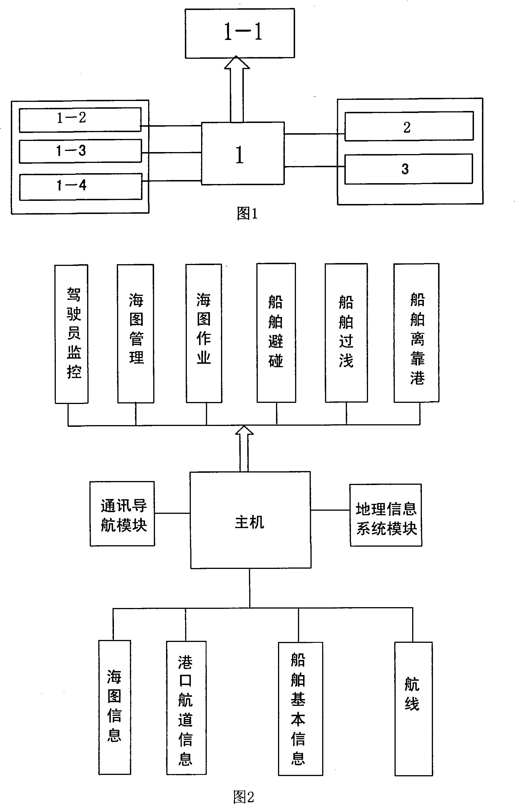
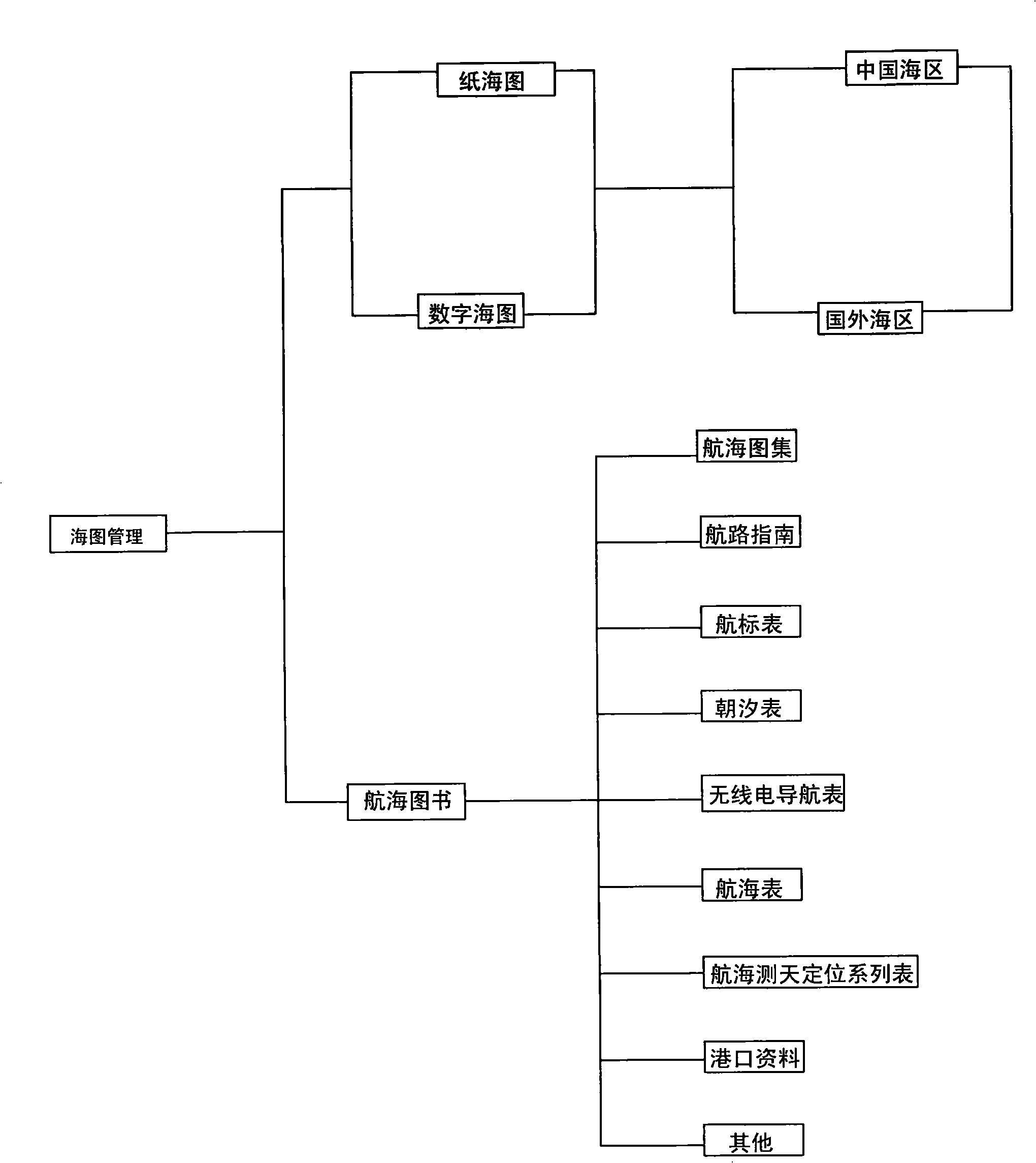
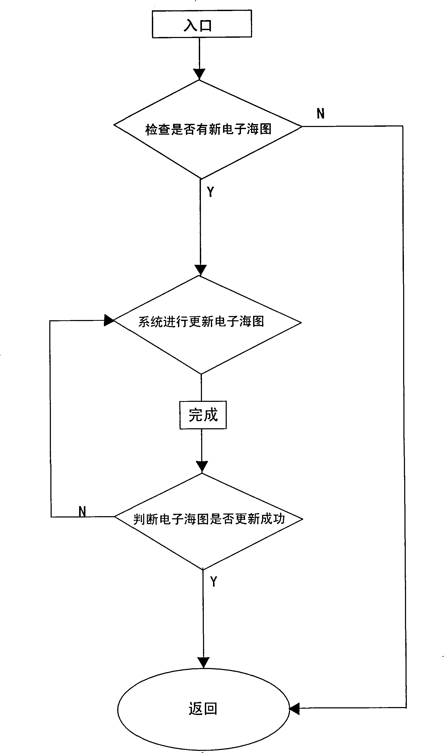
[0021] See Figure 1~ Image 6 , the hardware part of the embodiment of the present invention includes a host 1, the host 1 is an industrial control machine and is provided with a display 1-1, a GPS receiver 1-2, a wireless communication device 1-3 and a memory 1-4. A special control program is set in the host 1 to communicate with the built-in GPS receiver 1-2, so that the output data of the GPS receiver 1-2 can be input to the host 1 in time to participate in intelligent navigation. The built-in wireless communication equipment 1-3 in the host computer 1 is used for data receiving and sending, communication and navigation, the chart information is obtained through the geographic information system module, wireless data is sent and received through the communication and navigation module, and the auxiliary system module is based on the communication and navigation module, geographic information The relevant data obtained by the system module is combined with the relevant opera...


PUM


Abstract

The invention relates to a marine intelligent navigation monitoring system which is provided with a main frame with a display, a wireless communicating device, a GPS receiver, a communication navigation module, a geographic information system module and an auxiliary system module with intelligent decision function; the marine intelligent navigation monitoring system adopts MapX as the supporting platform of a digital nautical chart, obtains the digital nautical chart by the geographic information system module and carries out wireless data receiving and transmitting by the communication navigation module; the auxiliary system module realizes the effective references for the safe running of a ship, the real time monitoring on the ship-shore communication and the automatic updating of the digital nautical chart. The auxiliary system module includes six management modules of driving monitoring, nautical chart management, nautical chart operation, ship collision avoidance, shallowness passing of the ship, departure and in port of the ship as well as four basic databases of the nautical chart information, the port channel information, the basic information of the ship and a course. The invention can also be provided with a depth sounder used for detecting the depth of water. The invention adopts the MapX as the supporting platform of the digital nautical chart, to realize the networking dynamic management on the course, a flight point, a flight path, and the like, thus leading a manager to intuitively carry out immediate dispatching on the ship and improving the efficiency for shipping management.

Description

Technical field: [0001] The invention relates to a navigation system, in particular to a marine intelligent navigation monitoring system based on MapX digital charts, which is mainly suitable for GPS intelligent navigation monitoring of ships. Background technique: [0002] There are some domestic navigation systems for fishing or marine GPS navigators. Their technical implementation methods generally use self-made digital map engines or bitmap maps, and there are professional defects in the production and processing of digital charts. At the same time, the reference data used for navigation is only GPS positioning information, and cannot be accessed for water depth information that affects navigation safety and information about other ships around. The digital nautical charts used on existing marine GPS navigation devices are very rough and have low precision, and cannot be automatically updated. Invention content: [0003] The technical problem to be solved by the pres...

Claims


Application Information

Patent Timeline
Patent Type & Authority Applications(China)
IPC IPC(8): G01C21/00G09B29/00
Inventor 王若愚倪旭辉
Owner ZHEJIANG SITUO INFORMATION ENG
Why Eureka
Try Eureka