
Navigation display interface and navigation display method

A navigation display and interface technology, applied in the field of navigators, can solve the problems of weakened driving direction, the destination cannot be displayed, and the driver does not understand the direction of the destination, so as to achieve the effect of reducing hidden dangers.

Active Publication Date: 2010-02-17
广州风神汽车有限公司
View PDF4 Cites 40 Cited by
  • Summary
  • Abstract
  • Description
  • Claims
  • Application Information

AI Technical Summary

Problems solved by technology

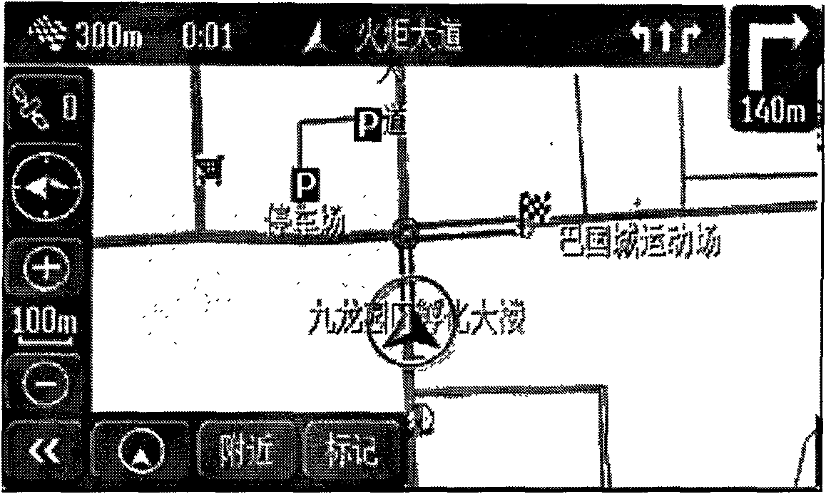
If the location of the vehicle is far away from the destination and the map is zoomed in, the destination cannot be displayed on the map, causing the driver to not understand the location of the destination, and the sense of driving direction is weakened; if the map is zoomed out, the destination can be displayed, but the driving The direction cannot be seen clearly due to the zooming out of the map, and the driver easily loses the sense of the road

Method used


Image

  • Navigation display interface and navigation display method
  • Navigation display interface and navigation display method
  • Navigation display interface and navigation display method

Examples


Embodiment Construction

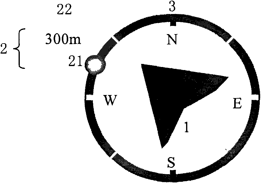
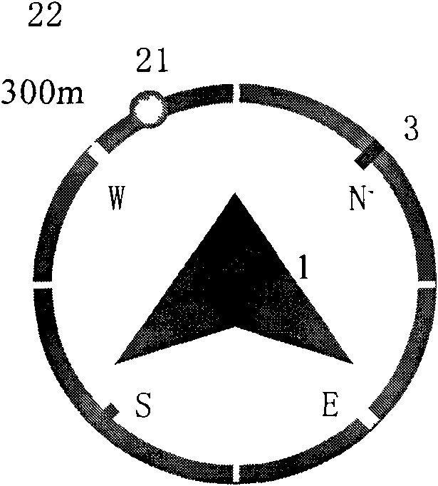
[0033] see Figure 4 The schematic diagram of the navigation display interface of the present invention is different from the scattered display in the prior art, and all the information required by the driver is displayed in one icon on the display interface of the present invention. Please also refer to figure 2 and image 3 The navigation display interface of the present invention includes a vehicle icon 1 representing the position and orientation of the vehicle, a destination icon 2 representing the location and distance of the destination, and a compass icon 3 representing the north-south position. The vehicle icon 1, the destination icon 2 and the compass Icons 3 are combined into one navigation icon and displayed on the display interface. The vehicle icon 1 is a directional triangular icon that can indicate the orientation of the vehicle, and the orientation of the vehicle is indicated by pointing at the apex of the triangle. The compass icon 3 is represented by a ci...


PUM


Abstract

The invention provides a navigation display interface which comprises a vehicle icon, a destination icon and a compass icon, wherein the vehicle icon expresses the position and the direction of a vehicle; the destination icon expresses the direction and the distance of a destination; the compass icon expresses the south and the north; and the vehicle icon, the destination icon and the compass icon are combined into the same navigation icon to be displayed on a display interface. The display method of the display interface comprises the following steps: acquiring relevant data by a GPS signal;then calculating a running course angle of the vehicle and a destination direction angle; and displaying vehicle running information, destination information and the north and south direction on the same icon. The navigation display interface displays the vehicle position, the running direction and the destination direction and distance on the same navigation icon simultaneously, and a driver cansimultaneously learn running information in the same icon, such as destination position, direction, distance, south and north direction, and the like and acquire the clear vehicle running direction without sight transfer.

Description

【Technical field】 [0001] The invention relates to a navigator, in particular to a display interface and a display method of a car navigation system. 【Background technique】 [0002] If you are not familiar with the road when driving out, sometimes you will turn to the map, but it is inconvenient to look at the map while driving, and it may cause driving safety hazards due to distraction. When driving, it is convenient to check the road conditions and the direction and distance of the destination, and find the most convenient route to the destination, and the electronic navigator was born. The navigator simply and intuitively displays the route, distance, distance, direction and other information between the current vehicle location and the destination. The implementation of existing navigators is generally to display the location of the vehicle, the orientation of the vehicle head, and the location of the destination separately, such as figure 1 As shown, a triangle or an a...

Claims


Application Information

Patent Timeline
Patent Type & Authority Applications(China)
IPC IPC(8): G01C21/36
Inventor 马骏卜健
Owner 广州风神汽车有限公司
Learn More