Terrain correction method for remote sensing image based on micro terrain
A remote sensing image and terrain correction technology, applied in the field of remote sensing image processing, can solve problems such as no physical meaning
- Summary
- Abstract
- Description
- Claims
- Application Information
AI Technical Summary
Problems solved by technology
Method used
Image
Examples
Embodiment Construction
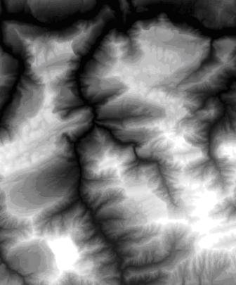
[0064] A preferred embodiment of the present invention is described in detail as follows in conjunction with accompanying drawing: Embodiment of the present invention selects the fourth wave band of LandSat image to have collected the desired research area of this embodiment, as figure 2 , 3 The digital elevation (DEM data) image and remote sensing image of the Three Gorges area in Hubei Province are shown.
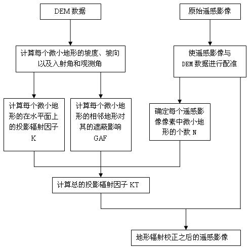
[0065] see figure 1 , the method for terrain correction of remote sensing images based on tiny terrain of the present invention, its specific steps are as follows:
[0066] (1), first use the original remote sensing image and DEM data for registration, so that the spatial resolution of the DEM is an integer multiple of the resolution of the remote sensing image, such as figure 2 , 3 shown;
[0067] (2), determine the number N of the tiny topography contained in each remote sensing image pixel;
[0068] (3) According to the DEM data and the orientation of the sun ...
PUM
 Abstract
Description
Claims
Application Information
 - R&D
- Intellectual Property
- Life Sciences
- Materials
- Tech Scout
- Unparalleled Data Quality
- Higher Quality Content
- 60% Fewer Hallucinations
Browse by: Latest US Patents, China's latest patents, Technical Efficacy Thesaurus, Application Domain, Technology Topic, Popular Technical Reports.
© 2025 PatSnap. All rights reserved.Legal|Privacy policy|Modern Slavery Act Transparency Statement|Sitemap|About US| Contact US: help@patsnap.com


