GIS (geographic information system)-GPS (global position system) navigation method of inspection robot

A technology of line patrol robot and navigation method, applied in the field of navigation, can solve the problems of low degree of autonomy and low efficiency, and achieve the effect of high degree of autonomy and high efficiency

Inactive Publication Date: 2013-01-23
WUHAN UNIV +1
View PDF6 Cites 2 Cited by
  • Summary
  • Abstract
  • Description
  • Claims
  • Application Information

AI Technical Summary

Problems solved by technology

[0004] The present invention mainly solves the technical problems existing in the prior art based on the local characteristics of the line, which can only complete the crossing of local obstacles, low degree of autonomy and low efficiency in the overall environment of the line; A GIS-GPS navigation method for line patrol robots with high degree of autonomy and high efficiency in the overall environment of the line to cross the obstacles of the entire line

Method used


Image

  • GIS (geographic information system)-GPS (global position system) navigation method of inspection robot
  • GIS (geographic information system)-GPS (global position system) navigation method of inspection robot
  • GIS (geographic information system)-GPS (global position system) navigation method of inspection robot

Examples


Embodiment

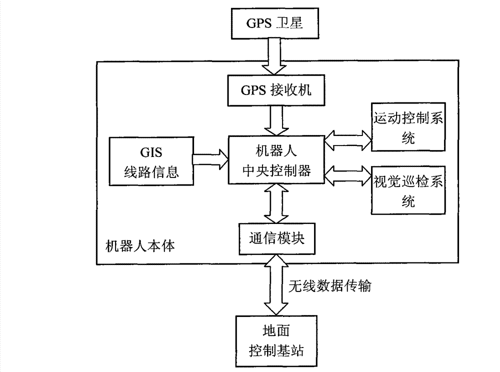
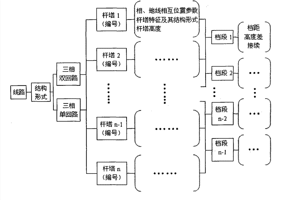
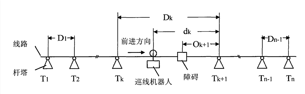
[0032] In order to realize autonomous navigation on the global route, the present invention introduces advanced GPS-GIS technology. Based on GIS technology, a high-voltage transmission line information system is established, relying on the GPS positioning system to monitor the specific position of the robot in real time, the distance relative to the front and rear towers and obstacles, and determine the line inspection plan of the robot. Autonomous inspection of the line The global structural and environmental information guides the visible light camera and infrared imaging system to conduct inspections.

[0033]The principle of GPS positioning calculation is: each space satellite has a coordinate value to represent its position at any time when it is running, and the position coordinate of the receiver is an unknown value, and the information of the space satellite is transmitted. The time spent can be calculated by comparing the satellite clock with the clock in the receiver...


PUM


Abstract

The invention relates to a navigation method, in particular to a GIS (geographic information system)-GPS (global position system) navigation method of an inspection robot. In order to realize autonomous navigation on an overall line, the invention introduces an advanced GIS-GPS technology. A high-voltage power transmission line information system is built based on GIS technology, the specific position of a robot and the distances from the robot to a front tower, a rear tower and a barrier can be monitored in real time by virtue of a GPS positioning system, so as to determine the inspection plan of the robot; furthermore, a visible light picking-up and infrared imaging system can be guided to carry out inspection according to autonomous inspection overall structure environmental information of the towers and lines, stored in a GIS line information system.

Description

technical field [0001] The invention relates to a navigation method, in particular to a GIS-GPS navigation method for a line patrol robot. Background technique [0002] In the field of overhead power line inspection robots, Sawada et al. from Tokyo Electric Power Company of Japan, Kansai Electric Power Company of Japan, TRC Corporation of the United States, and Moutambault of Quebec Hydropower Research Institute (LineScout) in Canada have successively carried out research work on line inspection robots. , but the line inspection robots they developed generally require human assistance when working, with a small scope of work and low intelligence. In China, Wuhan University has carried out the research on the overhead power line inspection robot with the function of crossing the linear tower and the tension tower and walking along the line under the support of the 863 plan project, and applied for patents CN200410061316.8, CN200410061314.9, CN200320116267.4, CN200510019930.2...

Claims


Application Information

Patent Timeline
Patent Type & Authority Patents(China)
IPC IPC(8): G01C21/00G01S19/14H02G1/02
Inventor 吴功平黄正烈郑拓刘欢
Owner WUHAN UNIV
Why Eureka
Try Eureka