

Chinese geographic coding and decoding method and device adopting same
A geocoding and Chinese technology, applied in the field of geographic information systems, can solve the problems of poor standardization of Chinese addresses, complex naming rules of Chinese addresses, and inability to find them, and achieve the effect of improving efficiency and accuracy
- Summary
- Abstract
- Description
- Claims
- Application Information
AI Technical Summary
Problems solved by technology
Method used
Image

Examples
Embodiment Construction
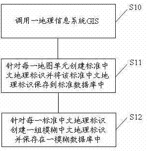
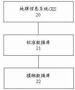
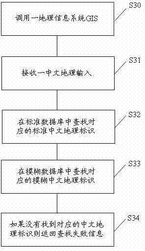
[0036] refer to figure 1 with image 3 Shown, according to the present invention, the process of Chinese geocoding and decoding is as follows:
[0037] first reference figure 1 As shown, the process of Chinese geocoding includes:
[0038] S10. Invoke a geographic information system GIS. The GIS includes an electronic map, coordinate data, and geographic information data, wherein each map unit on the electronic map corresponds to a coordinate data and a set of geographic information data. Electronic maps and GIS are existing technologies in this field, so the specific content will not be repeated here.
[0039] S11. For each map unit, create a standard Chinese geographic identifier and save the standard Chinese geographic identifier in the standard database. The storage position of the standard Chinese geographic identifier in the standard database is mapped to geographic information data, wherein the standard Chinese geographic identifier Geo-identification includes delim...
PUM
 Abstract
Description
Claims
Application Information