

Symbol configuration system of zonal statistical map and method thereof
A technology of map symbols and zoning statistics, which is applied in the directions of maps/plans/charts, instruments, educational appliances, etc., and can solve problems such as the configuration of map symbols without zoning statistics
- Summary
- Abstract
- Description
- Claims
- Application Information
AI Technical Summary
Problems solved by technology
Method used
Image

Examples
Embodiment Construction
[0059] The present invention will be described in detail below in conjunction with the accompanying drawings and specific embodiments, but not as a limitation of the present invention.
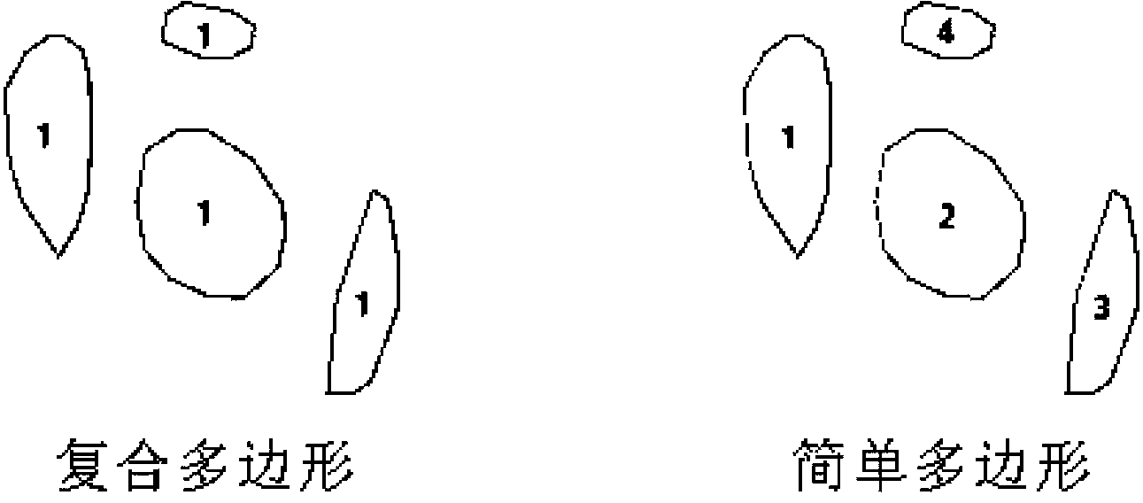
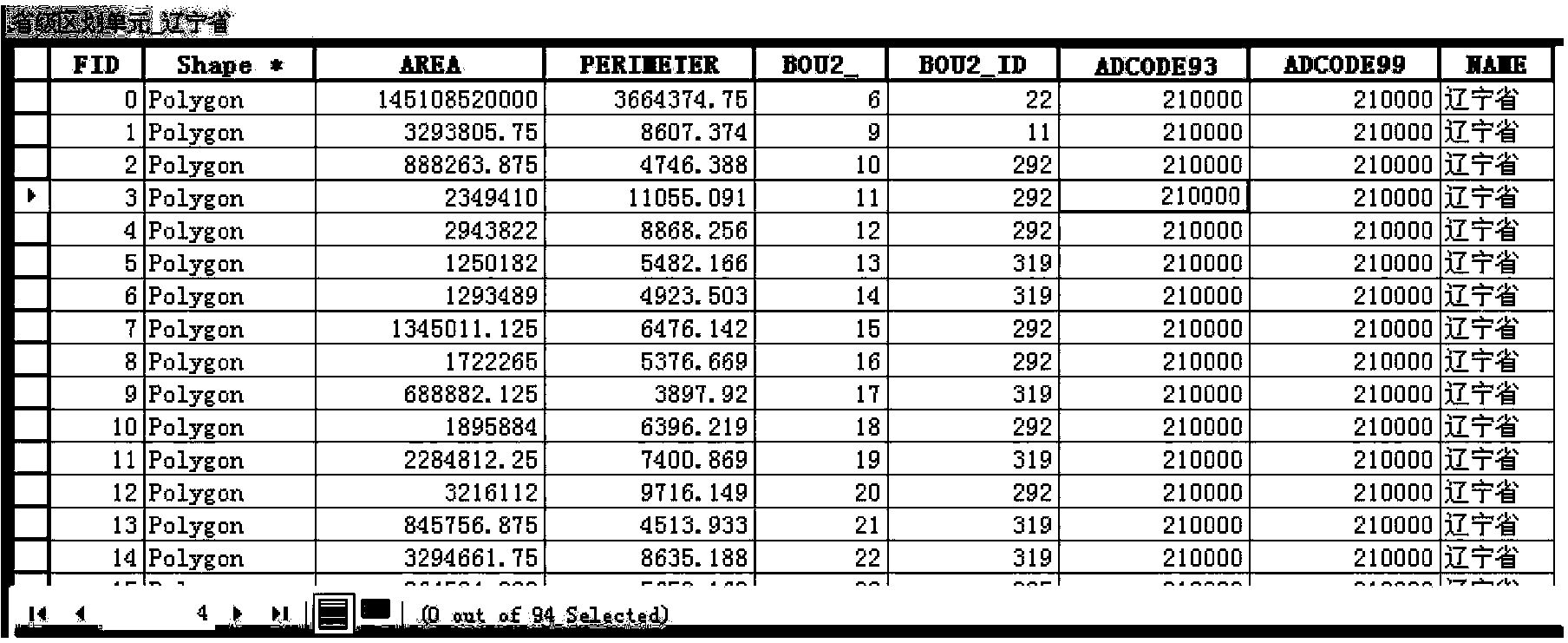
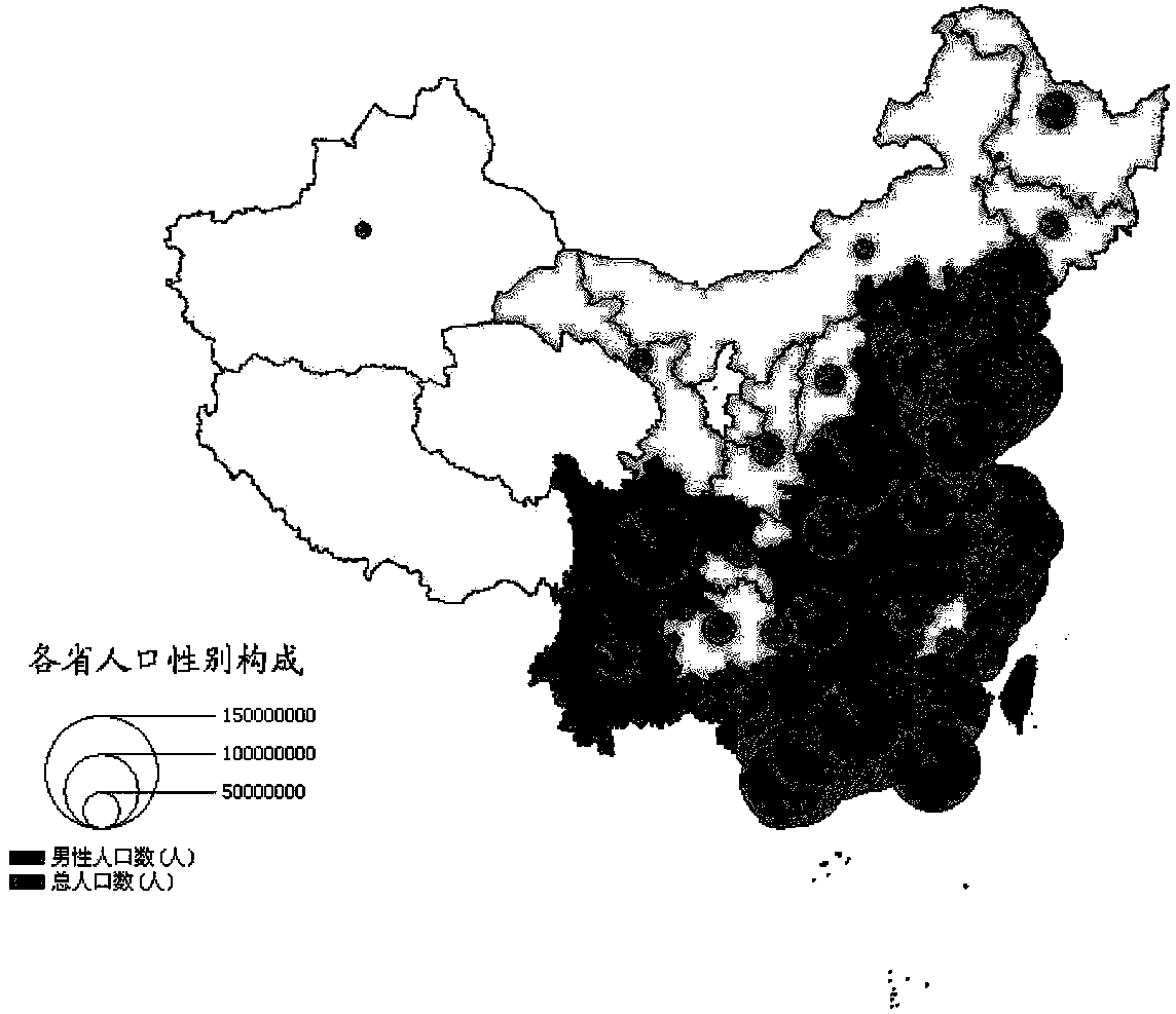
[0060] Such as figure 1 As shown, it is an example of a composite polygon of the present invention (1:1, one division unit corresponds to one record); figure 2 It is an example of a polygon with the same name in the present invention (1:n, one division unit corresponds to multiple records); image 3 It is a schematic diagram of ineffective positioning of statistical map symbols under multiple polygons with the same name in the present invention.
[0061] For the case where the zoning unit is a simple polygon, the symbols of the zonal statistical thematic map are mostly positioned by the center of gravity or interior point of the polygon. Considering that the center of gravity of the polygon sometimes falls outside the polygon, the present invention adopts the inner point of the polygon for ...
PUM
 Abstract
Description
Claims
Application Information