A Method for Measuring Radius of Curvature of Horizontal Surface of Inertial Navigation System

A technology of inertial navigation system and radius of curvature, applied in the direction of measuring devices, navigation through speed/acceleration measurement, instruments, etc., can solve problems such as lack, reduce measurement errors, improve navigation accuracy, and solve polar region navigation problems Effect

Inactive Publication Date: 2015-09-30
HARBIN ENG UNIV
View PDF4 Cites 0 Cited by
  • Summary
  • Abstract
  • Description
  • Claims
  • Application Information

AI Technical Summary

Problems solved by technology

However, there is currently a lack of research on navigation machinery arrangement and related parameter measurement methods under the abscissa reference frame

Method used


Image

  • A Method for Measuring Radius of Curvature of Horizontal Surface of Inertial Navigation System
  • A Method for Measuring Radius of Curvature of Horizontal Surface of Inertial Navigation System
  • A Method for Measuring Radius of Curvature of Horizontal Surface of Inertial Navigation System

Examples


Embodiment Construction

[0020] The present invention will be further described below in conjunction with accompanying drawing:

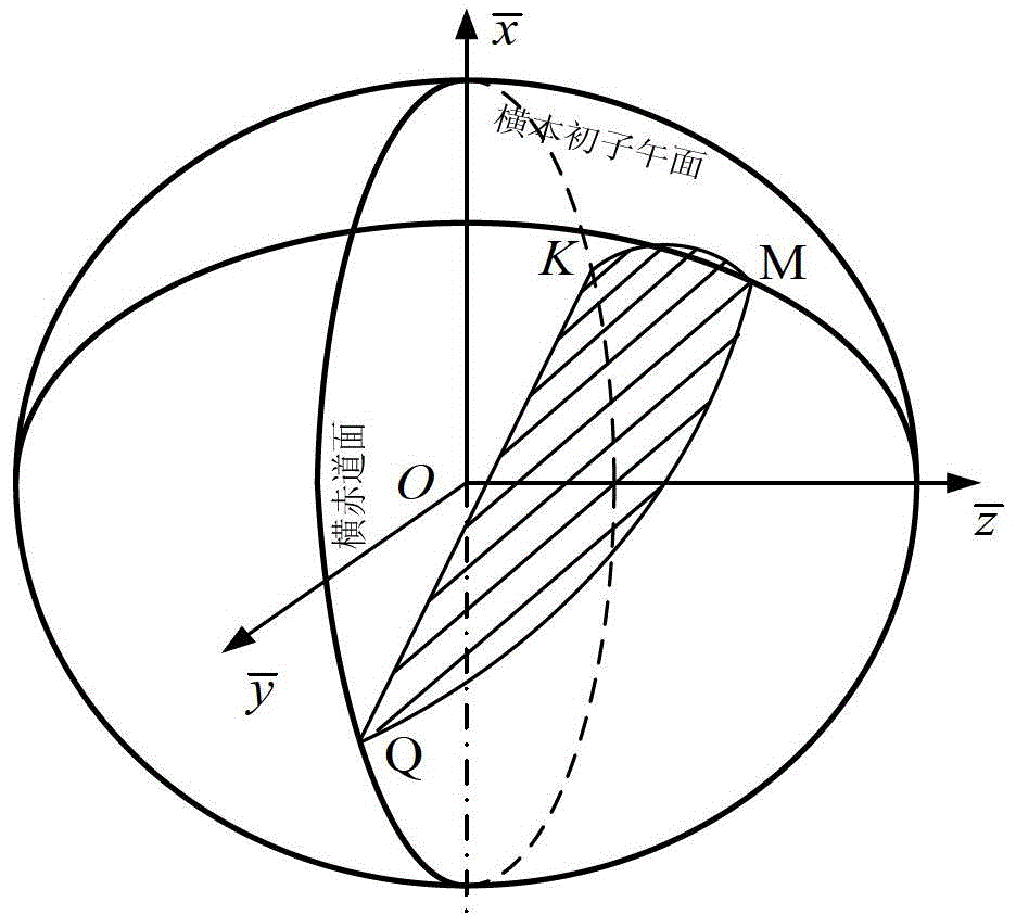
[0021] In order to solve the problem that the inertial navigation system needs to use the real-time measurement value of the radius of curvature of the horizontal surface when the ship enters the polar region, the present invention proposes a measurement of the radius of curvature of the horizontal surface of the inertial navigation system. method. This method is to describe the earth with an ellipsoid model, and use the latitude and longitude information currently output by the inertial navigation system to measure the radius of curvature of the transverse surface. The measurement method can meet the needs of high-precision inertial navigation systems for polar navigation.

[0022] The concrete steps that this method realizes are as follows:

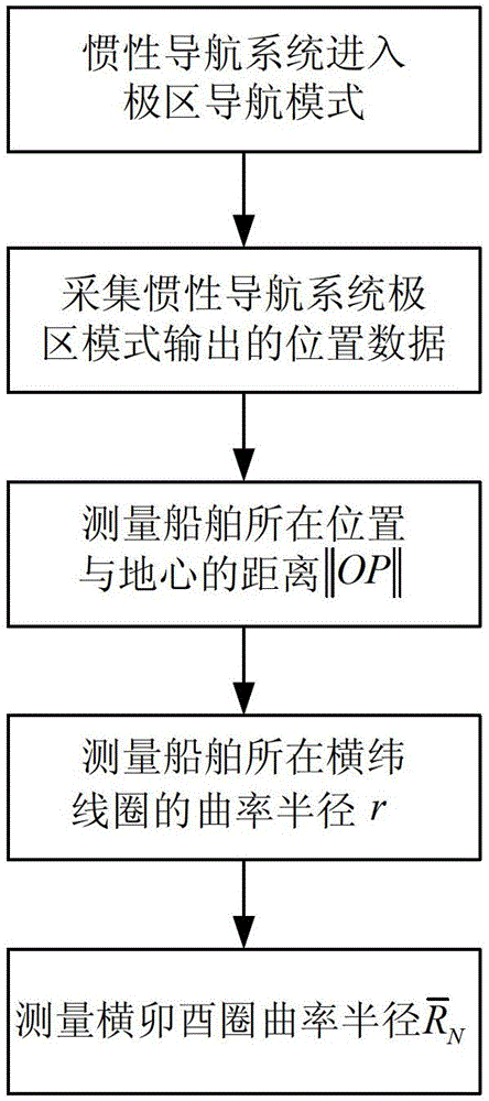
[0023] 1. The ship sails to the polar region, and the inertial navigation system enters the polar region mode;
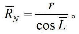
[0024] 2. Collec...


PUM


Abstract

The invention belongs to the technical field of inertial navigation system polar region navigation and particularly relates to a method for measuring the horizontal prime plane curvature radius by an inertial navigation system under a polar region mode with output horizontal longitude and latitude information by describing the earth with an ellipsoidal model. The method comprises the steps that when a ship carries out polar navigation, the inertial navigation system works to output horizontal geographic latitude and horizontal longitude to measure horizontal geocentric latitude; a measuring value of the distance between the position of the ship and the geocenter is obtained through the horizontal geocentric latitude and the horizontal longitude; the curvature radius of a horizontal latitude line circle where the ship is placed is measured through the horizontal longitude, the horizontal geocentric latitude and the distance between the position of the ship and the geocenter; the horizontal prime plane curvature radius is measured through the horizontal geographic latitude and the curvature radius of the horizontal latitude line circle where the ship is placed. The method fills the blank of measuring methods of the horizontal prime plane curvature radius of the earth under the abscissa system. Measuring errors caused by an inaccurate earth model are lowered from the principle, navigation accuracy is improved, the measuring method is simple and convenient to use, and practical using is convenient.

Description

technical field [0001] The invention belongs to the technical field of polar area navigation of an inertial navigation system, and specifically relates to a method for an inertial navigation system to describe the earth with an ellipsoid model in polar area mode, and to measure the radius of curvature of a transverse surface by using output latitude and longitude information. Background technique [0002] The polar region has increasingly become an area where major powers compete for interests: First, the polar region is rich in oil and gas resources. According to data from the US Geological Survey, 25% of the world’s undiscovered oil and gas resources are distributed in the polar region, and the cruising of ships in the polar region will increase my country has the right to speak in the development of resources in the polar region; secondly, in terms of strategic geographical distribution, the Arctic is close to countries such as the United States, the United Kingdom, and Rus...

Claims


Application Information

Patent Timeline
Patent Type & Authority Patents(China)
IPC IPC(8): G01B21/20G01C21/16
Inventor 于飞鲍桂清奔粤阳高伟李倩徐文佳邹梅魁王兴彬付艳伟陈斐楠
Owner HARBIN ENG UNIV
Why Eureka
Try Eureka