Regional scale forest canopy height remote sensing retrieval method

A canopy height and remote sensing inversion technology, applied in the direction of radio wave reflection/re-radiation, electromagnetic wave re-radiation, utilization of re-radiation, etc., can solve the problem of inability to accurately obtain regional-scale forest canopy height information.

Inactive Publication Date: 2014-04-30
NANJING INST OF GEOGRAPHY & LIMNOLOGY
View PDF4 Cites 38 Cited by
  • Summary
  • Abstract
  • Description
  • Claims
  • Application Information

AI Technical Summary

Problems solved by technology

[0003] The purpose of the present invention is to consider the integration of laser radar and multispectral data to realize large-scale forest canopy height inversion in view of the fact that the current single remote sensing data source cannot accurately obtain information on forest canopy height information on a regional scale

Method used


Image

  • Regional scale forest canopy height remote sensing retrieval method
  • Regional scale forest canopy height remote sensing retrieval method
  • Regional scale forest canopy height remote sensing retrieval method

Examples


Embodiment Construction

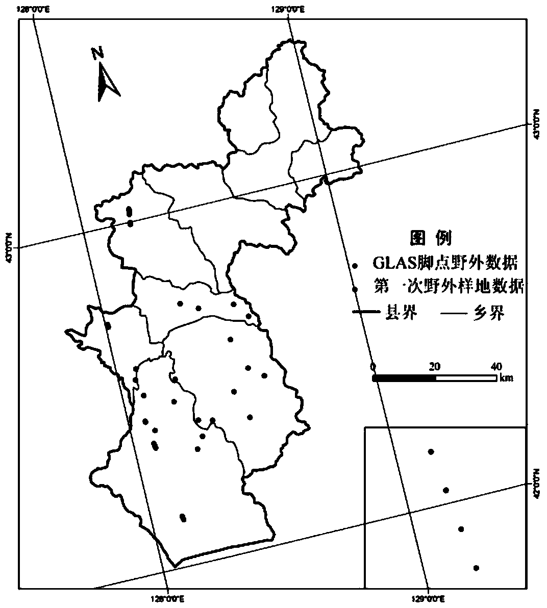
[0036] The Changbai Mountain forest area is an important forest reserve in my country, and it is one of the most complete and best-growing primitive temperate forest ecosystems in the world. Take Antu County, Jilin Province, which is located on the northern slope of Changbai Mountain, as an example for analysis:

[0037] Step 1 Field sample plot setting and survey method

[0038] 1) The distribution of sample plots in the two field surveys is as follows: figure 1 shown.

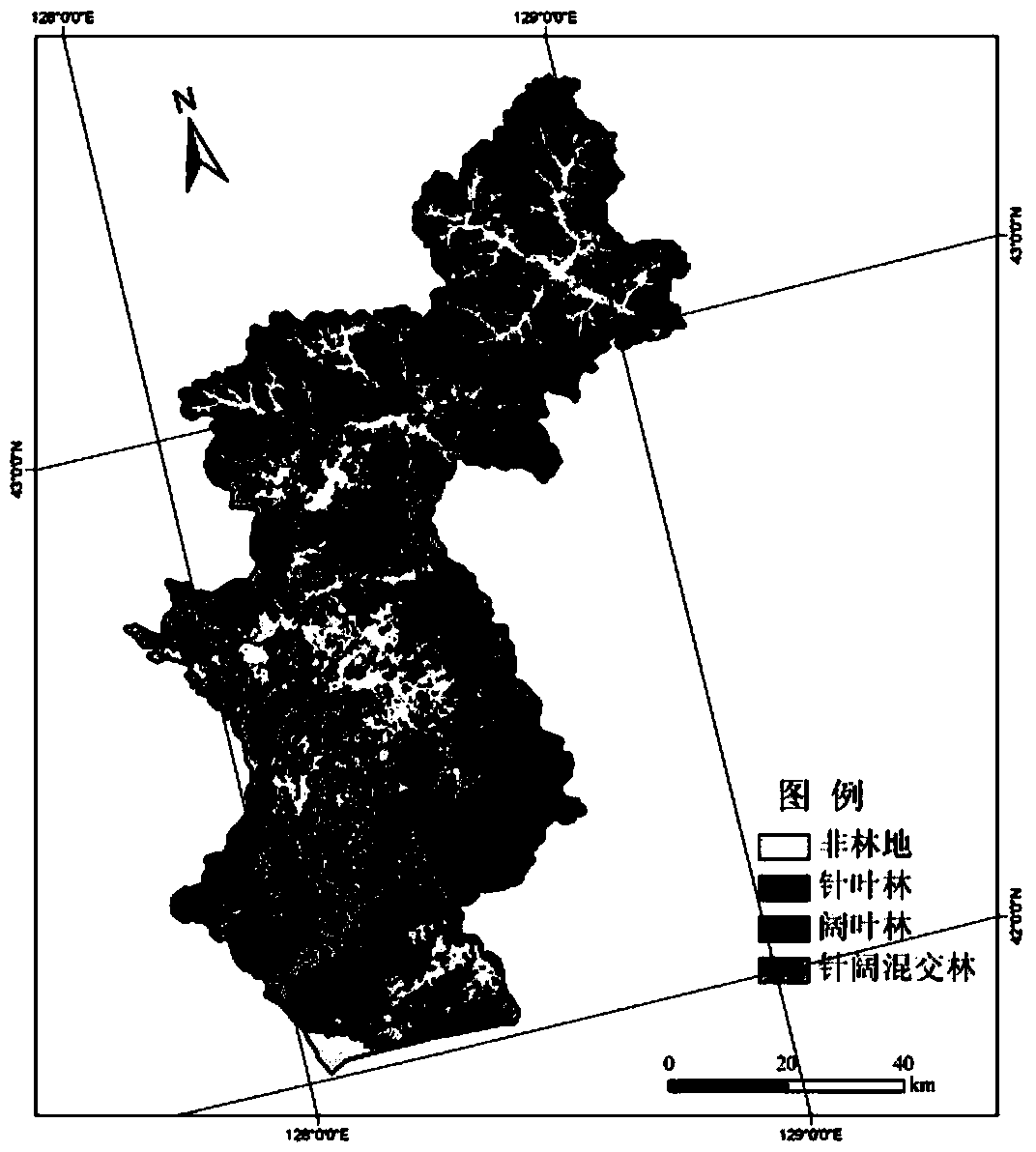
[0039] Step 2 Acquisition of multispectral TM data and extraction of thematic information

[0040] 2) Forest type information extraction based on object-oriented classification methods, such as figure 2 shown.

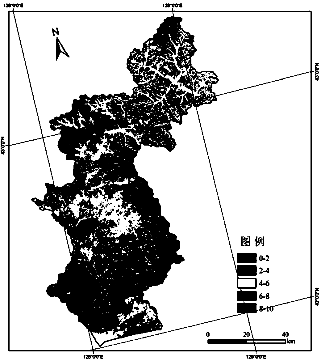
[0041] 3) Leaf area index remote sensing estimation. Based on the reflectance of 6 bands of TM remote sensing images and 10 vegetation indices such as RVI, NDVI, SLAVI, EVI, VII, MSR, NDVIc, BI, GVI, WI, etc., and supplemented by topographic information such as DEM, ASPECT, and SLOPE, the correl...


PUM


Abstract

The invention discloses a regional scale forest canopy height remote sensing retrieval method. The regional scale forest canopy height remote sensing retrieval method includes the following steps: (1) setting a field sampling plot, and surveying parameters, (2) extracting forest type information based on an object-oriented classification method, (3) carrying out remote sensing estimation on the leaf area index, (4) carrying out remote sensing retrieval on the canopy density, (5) extracting and standardizing laser radar complete-waveform data and corresponding geographic position and elevation information, (6) carrying out Fourier transformation and low-pass filtering on the waveform data, (7) estimating noise of the waveform data, (8) judging the beginning position and the end position of waveform data signals, (9) determining waveform data peak value positions which include the ground echo position, the canopy top position and the centroid position, (10) computing the forest canopy height in a flat area with the gradient smaller than 5 degrees, (11) building a GLAS forest canopy height extracting model under the slopping-field terrain condition, and (12) fusing the laser radar canopy height data with multi-spectral information to carry out regional retrieval.

Description

technical field [0001] The invention relates to a method for inversion of forest canopy height at a regional scale by fusing multi-source remote sensing data such as optics and laser radar, and belongs to the technical field of quantitative remote sensing inversion. Background technique [0002] Quantitative acquisition of forest vertical structure parameters, such as tree height, plays a vital role in forest ecosystem function, material and energy exchange, especially forest carbon storage and global carbon cycle research. At present, optical remote sensing technology has been widely used in the monitoring of forest type, distribution and structural characteristics, but it mainly obtains the horizontal information of the canopy, and has great limitations in the acquisition of vertical information. The new technology represented by lidar has unparalleled advantages in obtaining forest vertical structure parameters due to its strong penetrating ability. However, its spatial ...

Claims


Application Information

Patent Timeline
Patent Type & Authority Applications(China)
IPC IPC(8): G01S17/00G01B11/02
CPCG01S17/88G01S13/882G01S17/08
Inventor 汤旭光李恒鹏
Owner NANJING INST OF GEOGRAPHY & LIMNOLOGY
Why Eureka
Try Eureka