Prominence-based generation and rendering of map features

A map and remarkable technology, applied in the field of map drawing system, can solve problems such as difficulties in map features

Active Publication Date: 2014-06-04
GOOGLE LLC
View PDF6 Cites 12 Cited by
  • Summary
  • Abstract
  • Description
  • Claims
  • Application Information

AI Technical Summary

Problems solved by technology

Therefore, users may have difficulty in distinguishing map features that may be more relevant to their needs and search criteria when using such conventional systems

Method used


Image

  • Prominence-based generation and rendering of map features
  • Prominence-based generation and rendering of map features
  • Prominence-based generation and rendering of map features

Examples


Embodiment Construction

[0014] introduction

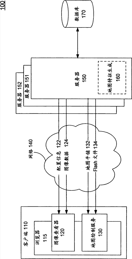
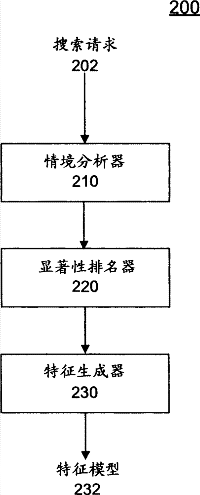
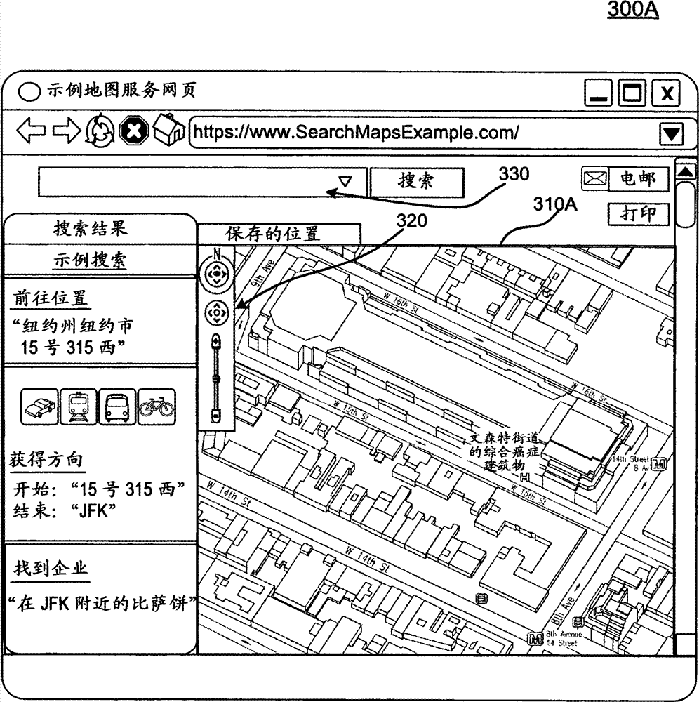
[0015] Provides a capability for generating and rendering features for digital maps based on saliency. More specifically, embodiments relate to rendering map features, such as buildings or landmarks, in different rendering styles based on a signal for how important a particular feature is to a search context. A search context may be, for example, without limitation, an overall view of a map or a user-initiated search request for a specific point of interest on the map or for driving directions between different points of interest. For example, different rendering styles may include, but are not limited to, two-dimensional (2D) footprints, two-and-a-half-dimensional (2.5D) extruded polygons, and full three-dimensional (3D) models as will be described further below. Additionally, styles may include rendering scales, colors, and / or visual textures. Thus, styling elements such as contrast and transparency can be adjusted based on the importance of particula...


PUM


Abstract

A capability for prominence-based feature generation and rendering for digital maps is provided. More specifically, embodiments relate to rendering map features such as buildings or landmarks in different rendering styles based on signals for how important a particular feature is to a search context. A search context may be, for example and without limitation, a general view of the map or a user-initiated search request for a particular point of interest or driving directions between different points of interest on the map. For example, the different rendering styles may include, but are not limited to, two-dimensional (2D) footprints, two-and-a-half-dimensional (2.5D) extruded polygons, as will be described further below, and full three-dimensional (3D) models. Furthermore, the style could include color and / or visual texture.

Description

technical field [0001] Embodiments relate generally to the field of mapping systems, and in particular to displaying imagery in mapping systems. Background technique [0002] Computerized mapping systems enable users to view and navigate geospatial data in an interactive digital environment. Such an interactive digital environment may, for example, be provided by a web-based mapping service accessible to users via a web browser. Mapping systems can also enable users to search and view various points of interest on digital maps. Each point of interest can be geocoded to a specific location on the map. Thus, information stored by the mapping system for a point of interest may include data associated with a location. Examples of such data include, but are not limited to, the name or type of business at the location (e.g., a gas station, hotel, restaurant, retail store, or other business), the name or type of place of public interest at the location (e.g., public school, post...

Claims


Application Information

Patent Timeline
Patent Type & Authority Applications(China)
IPC IPC(8): G01C21/36G06T17/05G06T19/20G06F17/30
CPCG06T19/20G01C21/3638G06T2210/36G06T2219/2012G06T17/05G06F16/29G06F16/583
Inventor B·斯托特B·布鲁因顿J·琼斯C·萨沃普洛斯
Owner GOOGLE LLC
Why Eureka
Try Eureka