Method and system for determining an estimated geographic location of a base station
A geographic location and base station technology, applied in positioning, radio wave measurement systems, measurement devices, etc., can solve the problem of unavailable mobile devices and achieve the effect of improving GNSS signal acquisition time
- Summary
- Abstract
- Description
- Claims
- Application Information
AI Technical Summary
Problems solved by technology
Method used
Image
Examples
Embodiment Construction
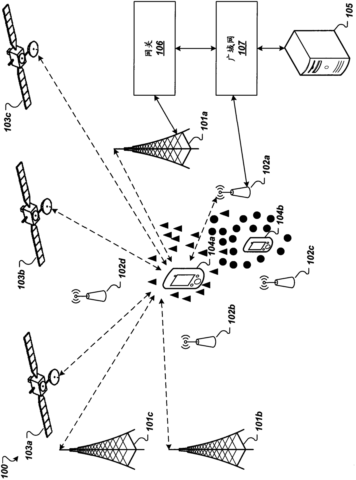
[0014] figure 1 is a diagram illustrating an example of a system 100 for determining an estimated location of a base station. The base station may be, for example, a cell tower 101a of a cellular communication network, or an access point 102a of a Wireless Local Area Network (WLAN) or a Wireless Personal Area Network (WPAN). A base station can typically broadcast a beacon signal that provides mobile device 104a with critical information necessary to detect (or connect to) it. Multiple base stations 101a and 102a may be distributed over a geographical area.
[0015] Cell tower 101a may communicate with mobile device 104a over a greater distance than access point 102a using various cellular technologies. In some embodiments, the cell tower 101a may be a cell tower for a Mobile Communications (GSM) network with General Packet Radio Service (GPRS), or Enhanced Data Rates for GSM Evolution (EDGE). In some embodiments, the cell tower 101a may be a cell tower of a Universal Mobil...
PUM
 Abstract
Description
Claims
Application Information
 - R&D
- Intellectual Property
- Life Sciences
- Materials
- Tech Scout
- Unparalleled Data Quality
- Higher Quality Content
- 60% Fewer Hallucinations
Browse by: Latest US Patents, China's latest patents, Technical Efficacy Thesaurus, Application Domain, Technology Topic, Popular Technical Reports.
© 2025 PatSnap. All rights reserved.Legal|Privacy policy|Modern Slavery Act Transparency Statement|Sitemap|About US| Contact US: help@patsnap.com


