Junction identification based intelligent road extraction method

An extraction method and fork technology, applied in the field of remote sensing applications, can solve the problems of interrupted tracking continuity, increased labor cost, topology inconsistency, etc., to achieve the effect of ensuring topology consistency, reducing manual operations, and high accuracy

Active Publication Date: 2014-12-24
WUHAN UNIV
View PDF2 Cites 19 Cited by
  • Summary
  • Abstract
  • Description
  • Claims
  • Application Information

AI Technical Summary

Problems solved by technology

Doing so increases the artificial cost of road extraction, interrupts the continuity of tracking, and easily causes topological inconsistencies

Method used


Image

  • Junction identification based intelligent road extraction method
  • Junction identification based intelligent road extraction method
  • Junction identification based intelligent road extraction method

Examples


Embodiment Construction

[0037] In order to facilitate those of ordinary skill in the art to understand and implement the present invention, the present invention will be described in further detail below in conjunction with the accompanying drawings and embodiments. It should be understood that the implementation examples described here are only for illustration and explanation of the present invention, and are not intended to limit this invention.

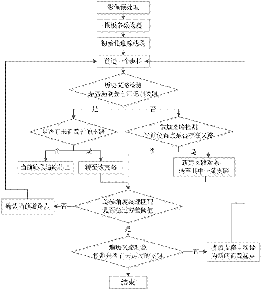
[0038] please see figure 1 , the technical solution adopted in the present invention is: a road intelligent extraction method based on fork road identification, comprising the following steps:

[0039] Step 1: Select a high-resolution panchromatic remote sensing image with a spatial resolution of less than 6m, without cloud cover, stretch the histogram of the image segmentally, and increase the contrast between the road area and the surrounding features;

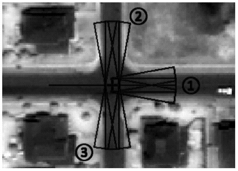
[0040] Step 2: Set the parameters of the tracking template according to the characteristics of the...


PUM


Abstract

The invention discloses a junction identification based intelligent road extraction method. According to the method, junctions can be identified in the road tracking process according to high-resolution images (with spatial resolution above six meters), follow-up tracking of each branch is guided and assisted according to acquired junction information, and interconnected roads can be all tracked and extracted by only initial point setting at one time. Extraction of the roads is assisted and guided by identifying the junctions and by means of fully utilizing geometrical and textural features of the urban roads in the high-resolution images and mode characteristics of the road junctions. By the method, shortcomings of the currently existing methods are made up, manual operation is reduced remarkably, one-time automatic extraction of a connected road network is realized effectively, topological consistency of the junction road sections can be effectively guaranteed, and extraction results are high in accuracy.

Description

technical field [0001] The invention belongs to the field of remote sensing applications, and relates to an image road intelligent extraction method, in particular to an urban road extraction method applied to high-resolution panchromatic remote sensing images. Background technique [0002] Extracting roads from high-resolution remote sensing images is one of the research focuses of computer vision, artificial intelligence, photogrammetry and remote sensing. Significance. [0003] Judging from the current research status, it is still relatively difficult to automatically extract roads. The existing technology has not yet achieved satisfactory results in terms of completeness and correctness, and a large number of manual editing and post-processing are still required. Therefore, researching semi-automatic methods with human intervention in order to extract roads quickly and accurately is a more practical option at present. Among various semi-automatic road extraction method...

Claims


Application Information

Patent Timeline
Patent Type & Authority Applications(China)
IPC IPC(8): G06T7/00G06K9/46
Inventor 刘耀林陈昌黎何青松危小建谭荣辉焦利民王慧敏
Owner WUHAN UNIV
Why Eureka
Try Eureka