Multi-translation-information based VPS/IMU (Virtual Private Server/Inertial Measurement Unit) integrated navigation data spatial synchronization method
A technology of integrated navigation and data, applied in the direction of navigation calculation tools, etc., can solve the problems of inaccurate results, inability to meet the requirements of integrated navigation data conversion accuracy and conversion speed, and complexity
- Summary
- Abstract
- Description
- Claims
- Application Information
AI Technical Summary
Problems solved by technology
Method used
Image

Examples
Embodiment Construction
[0023] The present invention will be further described in detail below in conjunction with specific embodiments, which are explanations of the present invention rather than limitations.
[0024] The space synchronization method of the VPS / IMU combined navigation data based on multi-translation information in the present invention is specifically as follows.
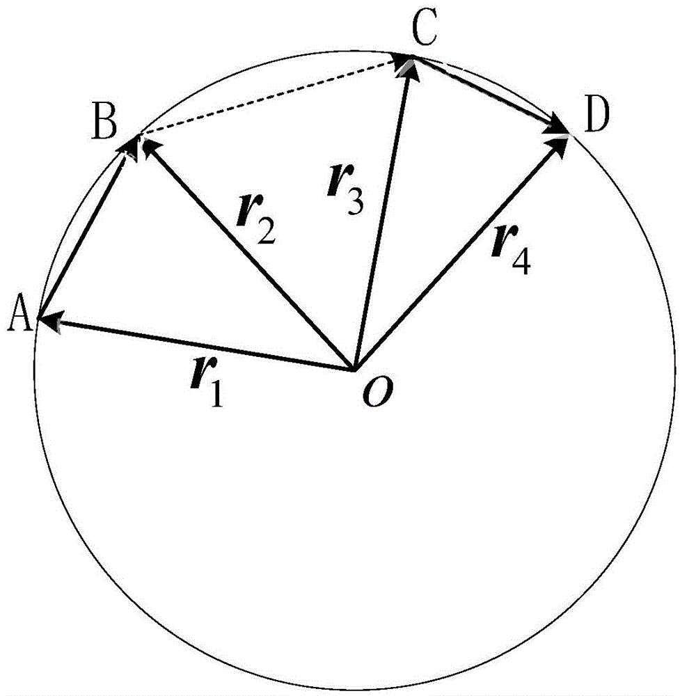
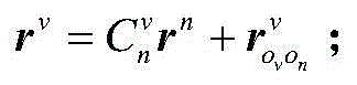
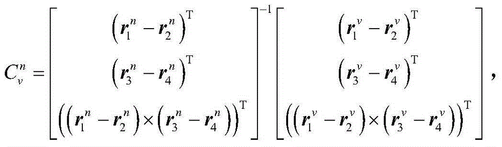
[0025] VPS can accurately measure the position of the subject within a certain range, and the output position information is the projection under the defined VPS world coordinate system, which is recorded as v system, while the information output by IMU is in the local geographic system , that is, the northeast sky coordinate system n, and this coordinate system is recorded as n system. There is a translation vector between the origin of the v system and the n system, and there is also a certain angle relationship between the orientation of the coordinate axes.
[0026] There is a projection equation between the projecti...
PUM
 Abstract
Description
Claims
Application Information
 - R&D Engineer
- R&D Manager
- IP Professional
- Industry Leading Data Capabilities
- Powerful AI technology
- Patent DNA Extraction
Browse by: Latest US Patents, China's latest patents, Technical Efficacy Thesaurus, Application Domain, Technology Topic.
© 2024 PatSnap. All rights reserved.Legal|Privacy policy|Modern Slavery Act Transparency Statement|Sitemap