City block function zoning method based on multi-factor spatial clustering
A technology of urban blocks and spatial clustering, which is applied in special data processing applications, instruments, electrical digital data processing, etc., and can solve problems such as dependence
- Summary
- Abstract
- Description
- Claims
- Application Information
AI Technical Summary
Problems solved by technology
Method used
Image
Examples
Embodiment
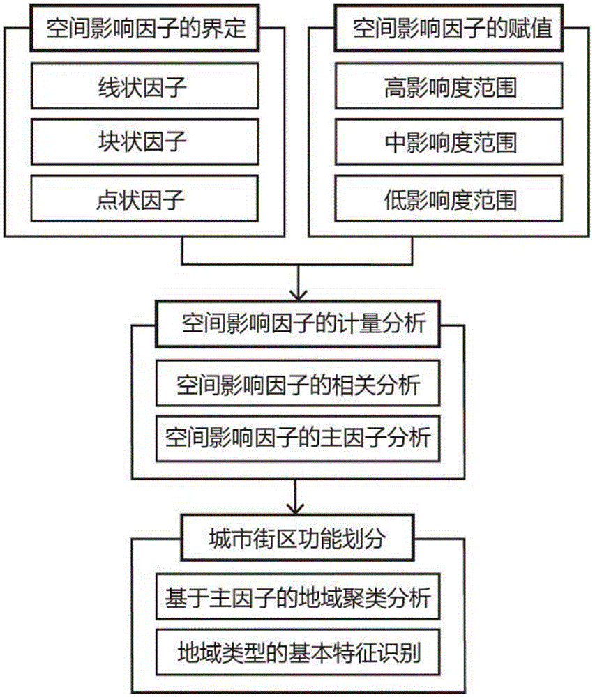
[0078] In this embodiment, taking the North Bund area of Shanghai as an example, a method for functional zoning of urban blocks based on spatial clustering of principal factors is provided. The North Bund area starts from Dalian Road / Qinhuangdao Road in the east, Henan North Road in the west, Huangpu River / Suzhou Creek in the south, and Zhoujiazui Road in the north, with a total land area of 3.66 square kilometers. like figure 1 As shown, it specifically includes the following steps:
[0079] (1) Definition of spatial impact factors
[0080] Guided by the development orientation of the region, drawing on international experience and combining the specific conditions of the region, the main influencing factors of the spatial development framework of the North Bund area include waterfront shorelines, industrial clusters, rail transit stations, historical and cultural heritage, and large open spaces.
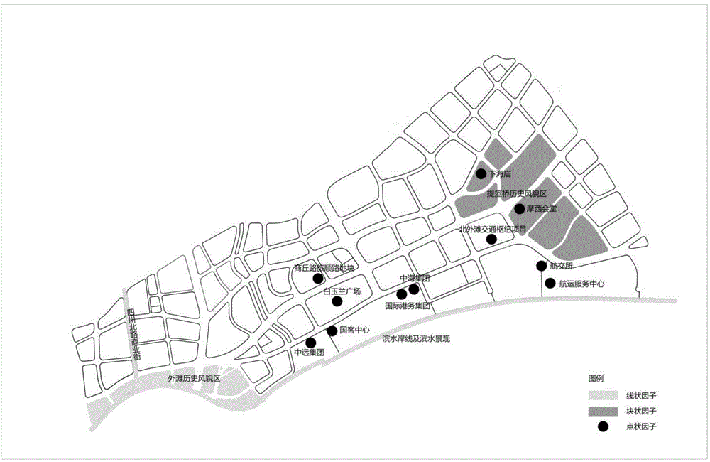
[0081] like figure 2 As shown, according to the morphological characte...
PUM
 Abstract
Description
Claims
Application Information
 - R&D
- Intellectual Property
- Life Sciences
- Materials
- Tech Scout
- Unparalleled Data Quality
- Higher Quality Content
- 60% Fewer Hallucinations
Browse by: Latest US Patents, China's latest patents, Technical Efficacy Thesaurus, Application Domain, Technology Topic, Popular Technical Reports.
© 2025 PatSnap. All rights reserved.Legal|Privacy policy|Modern Slavery Act Transparency Statement|Sitemap|About US| Contact US: help@patsnap.com


