
Method for displaying a travel route

A technology of traveling route and display screen, applied in the direction of road network navigator, navigation, instrument, etc., which can solve problems such as unfavorable, hindering the driver's ability to drive tasks, and reducing driving performance

Inactive Publication Date: 2016-01-20
VOLKSWAGEN AG +1
View PDF8 Cites 7 Cited by
  • Summary
  • Abstract
  • Description
  • Claims
  • Application Information

AI Technical Summary

Problems solved by technology

In particular, requiring a driver's visual distraction to take his or her eyes off the road reduces drivability and may increase the risk of accidents
Also, simultaneous tasks, such as operating a navigation system on a vehicle's dashboard while performing the primary task of driving, may have an adverse effect on the ability to perform both tasks in a satisfactory manner
[0005] Conventional navigation systems as described above are visually and cognitively demanding and can adversely hinder a driver's ability to perform primary vehicle driving tasks

Method used


Image

  • Method for displaying a travel route
  • Method for displaying a travel route
  • Method for displaying a travel route

Examples


Embodiment Construction

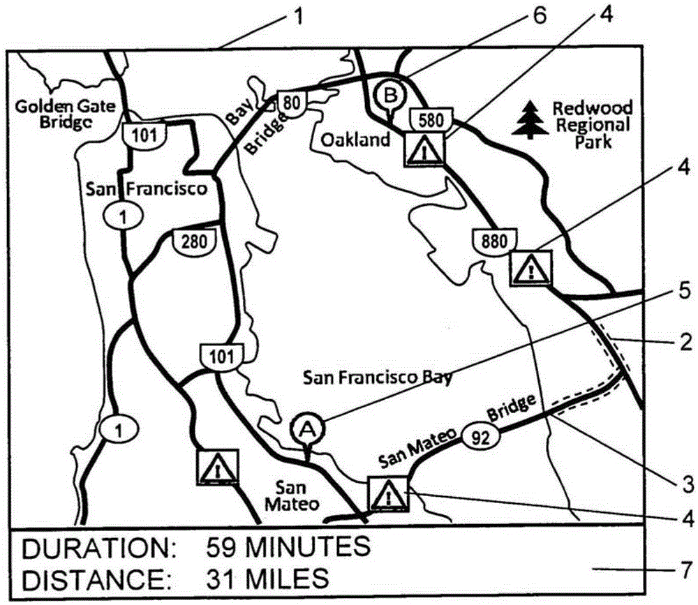
[0034]With reference now in detail to the drawings, and first, in particular figure 1 , which shows a plan view of a typical prior art navigation map illustrating a method for displaying traffic information on a map. As explained above, the navigation system provides the driver with information about route maneuvers, arrival information, landmarks, points of interest, traffic conditions, and events along the calculated route of travel or about a number of other highway arterials displayed on a map view. figure 1 A disadvantage of the navigation map shown in is that when presented graphically as an overlay plan view navigation map, it can be difficult for the driver to understand certain types of information while having to concentrate on the driving task.

[0035] figure 1 shows the navigator figure 1 A typical prior art plan view of , showing a method for displaying traffic information on a map. There are generally two types of traffic information. The first type, the tra...


PUM


Abstract

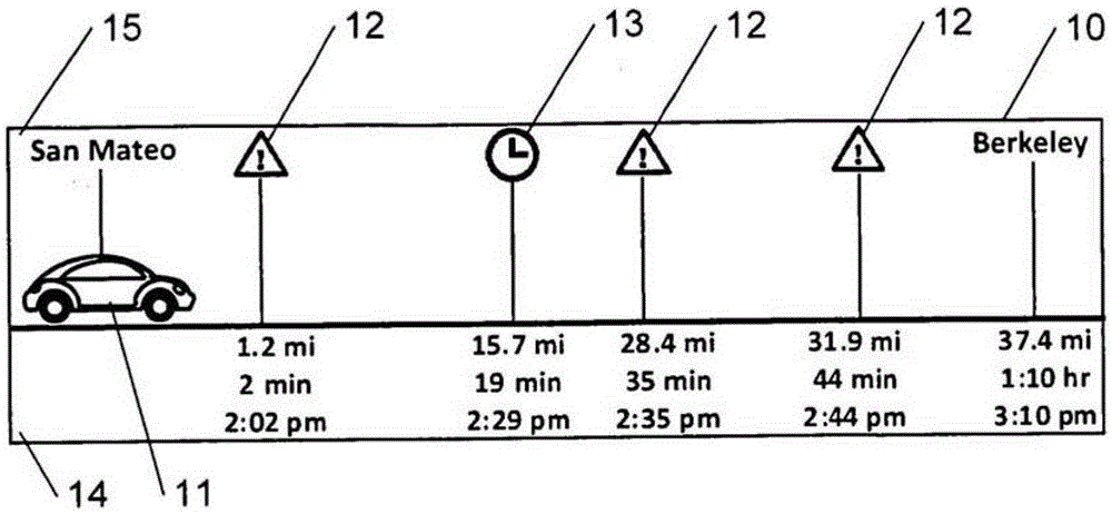
A method for displaying a travel route on a display screen in a vehicle includes plotting location names in a linear manner horizontally across the display screen. A travel route is displayed by plotting items of travel route information in a linear manner horizontally across the display screen, wherein the travel route information is a time information or a distance information. Each location name and a respective one of the items of travel route information are aligned in a vertical direction. A graphical symbol for the vehicle is displayed on the display screen such that a position of the graphical symbol for the vehicle indicates a current Position of the vehicle along the travel route. The location names and the travel route information are updated as the vehicle travels along the travel route.

Description

technical field [0001] The invention relates to a method for displaying a route on a display screen in a vehicle. Background technique [0002] Conventional navigation systems provide the driver with information about route maneuvers, arrival information, landmarks, points of interest, traffic and events along the driver's calculated route of travel, as well as information about other highway arterials displayed on a map view. Some traditional navigation systems even display weather data plotted as a terrain overlay on the map. A disadvantage of such traditional navigation systems that provide information about route maneuvers, arrival information, waypoints, points of interest, traffic conditions, current events, and weather is that it is sometimes difficult to Difficulty understanding some types of information. Yet another disadvantage of such a navigation system is that it may be visually and cognitively laborious to determine which of the information items shown on the...

Claims


Application Information

Patent Timeline
IPC IPC(8): G01C21/36
CPCG01C21/3676G01C21/3694
Inventor G.罗萨诺A.K.洛米迪
Owner VOLKSWAGEN AG
Learn More