Method for geographic selection of global navigation satellite system elements

A satellite, select type of technology, applied in the field of systems, can solve problems such as the need for time navigators

Inactive Publication Date: 2021-06-04
HONEYWELL INT INC
View PDF6 Cites 0 Cited by
  • Summary
  • Abstract
  • Description
  • Claims
  • Application Information

AI Technical Summary

Problems solved by technology

This takes time and is additional stress on the navigator when flying between geopolitical areas

Method used


Image

  • Method for geographic selection of global navigation satellite system elements
  • Method for geographic selection of global navigation satellite system elements
  • Method for geographic selection of global navigation satellite system elements

Examples


example 1

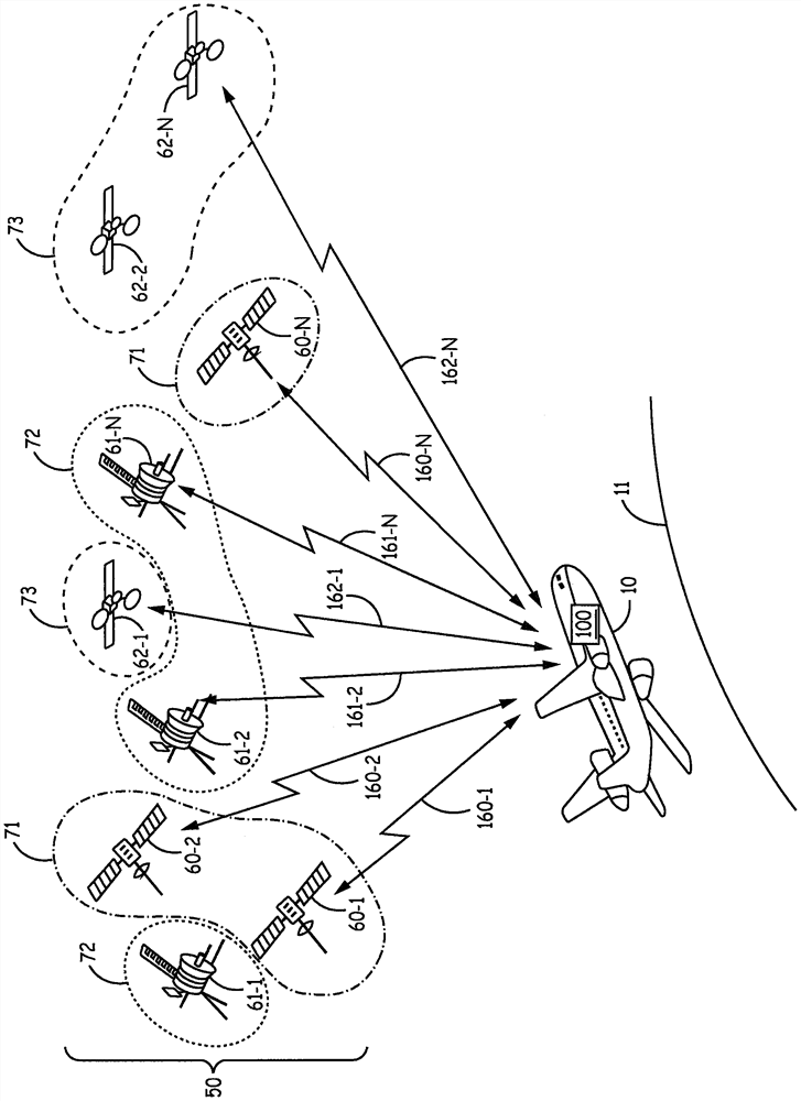
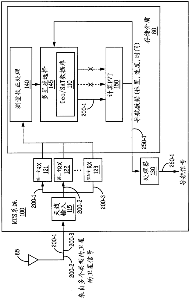
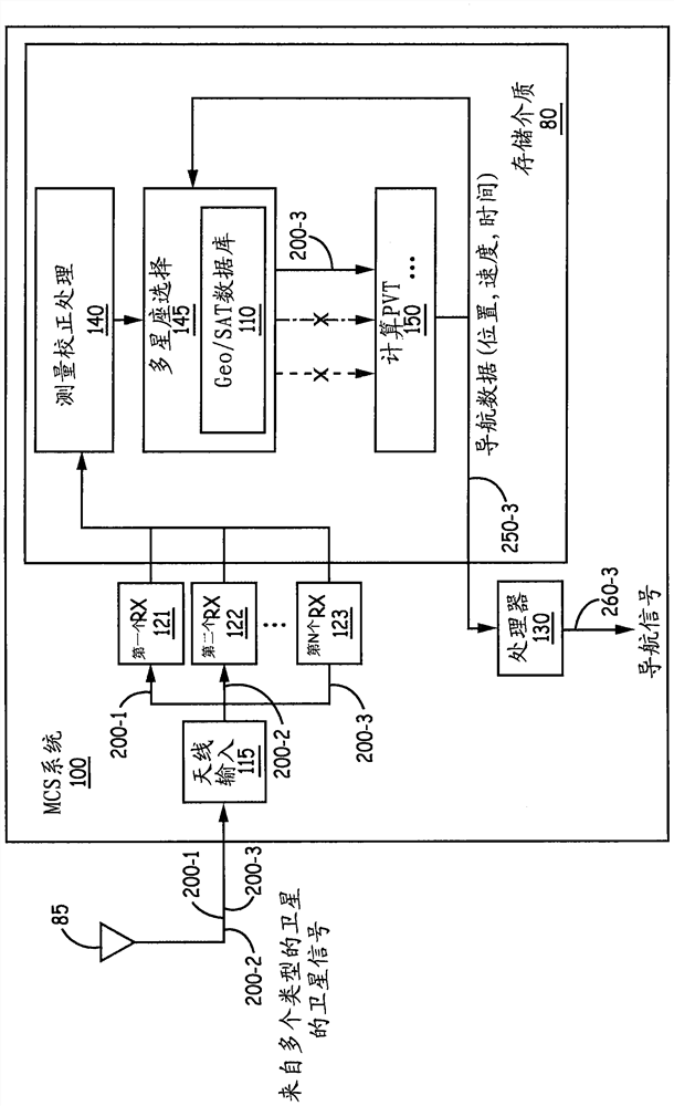
[0099] Example 1 includes a system for selecting one or more types of satellites from a plurality of types of satellites in a multi-constellation of satellites, the system comprising: a plurality of receivers including at least: configured to input and a second receiver configured to input signals from satellites of a second type; a processor configured to: execute a multi-constellation selection software module to: compare the current position with the map feature correlating; selecting at least one satellite of a selected type from a plurality of types of satellites based on the associated mapping feature; calculating a current position / velocity / time from at least one selected input signal input at an associated receiver; and feeding the calculated current position / velocity / time to a multi-constellation selection software module based on execution of the calculate PVT software module, to implement the rules for at least one satellite of the selected type.

example 2

[0100] Example 2 includes the system of Example 1, wherein the first type of satellite is selected from one of the currently available global navigation system satellites (GNSS) Satellites of the second type are selected from among the satellites of the , wherein the satellites of the first type are different from the satellites of the second type.

example 3

[0101] Example 3 includes the system of any of Examples 1-2, wherein the first type of satellite is different from the second type of satellite.


PUM


Abstract

Method for geographic selection of GNSS elements. A system for selecting a type of satellite from a plurality of types of satellites in a multi-constellation of satellites is provided. The system includes at least a first receiver configured to input signals from a first type of satellite; and a second receiver configured to input signals from a second type of satellite; and a processor. Processor: execute the multi-constellation selection software module to associate the current position with the map feature and select at least one satellite of the selected type from a plurality of types of satellites based on the associated map feature; perform a calculation of position / velocity / time (PVT ) software module to calculate a current position / velocity / time based on at least one selected input signal input at a receiver associated with at least one selected type of satellite; Position / velocity / time feed to multi-constellation selection software module.

Description

Background technique [0001] A Global Navigation System (GNS) receiver has the capability to acquire and track satellite signals from multiple satellite constellations such as Global Positioning System (GPS), Russian GNSS, Global Navigation Satellite System (GLONASS), etc. In addition, GNSS receivers may also have the ability to track and use satellite-based augmentation systems (MSAS) from systems such as Wide Area Application Service (WAAS), European Geosynchronous Navigation Overlay Service (EGNOS), Multifunctional Transport Satellite (MTSAT), and GPS A satellite for the space-based augmentation system of the Geosynchronous Earth Orbit (GEO) Augmented Navigation (GAGAN) system. A Global Navigation System Satellite (GNSS) receiver has the ability to track and use satellites from multiple GNSS elements such as the Satellite Based Augmentation System (SBAS), the European Global Navigation Satellite System known as Galileo, and GLONASS. [0002] There are customer and regulator...

Claims


Application Information

Patent Timeline
Patent Type & Authority Patents(China)
IPC IPC(8): G01S19/28
CPCG01S19/28G01S19/48G01S19/33G01S19/423G01S19/03G01S19/45
Inventor J·D·小萨沃伊V·克里什南K·伍德沃思
Owner HONEYWELL INT INC
Why Eureka
Try Eureka