Spatial index and cache construction method for vector data of mobile terminal
A technology of vector data and spatial indexing, applied in structured data retrieval, electronic digital data processing, geographic information database, etc., can solve problems such as failing to achieve good results
- Summary
- Abstract
- Description
- Claims
- Application Information
AI Technical Summary
Problems solved by technology
Method used
Image
Examples
Embodiment Construction
[0015] The present invention will be further described below in conjunction with the accompanying drawings and specific embodiments.
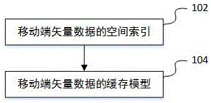
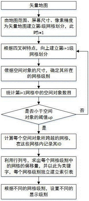
[0016] The relevant parameter items of the spatial index construction method of a kind of mobile terminal vector data that the present invention proposes are as shown in table 1:
[0017] Table 1
[0018]
[0019] The relevant parameter items of a kind of cache model of vector data oriented to mobile terminal segmentation and hierarchical display proposed by the present invention are shown in Table 2:
[0020] Table 2
[0021] name
parameter meaning
Remark
grid
grid management object
Record all information of this grid
spatial object container
Duplicate judgment for display objects
level
grid level
The grid level where the grid is located
times
grid visits
Default is a positive integer
t 0
Grid read time
The moment when the grid is first read i...
PUM
 Abstract
Description
Claims
Application Information
 - R&D
- Intellectual Property
- Life Sciences
- Materials
- Tech Scout
- Unparalleled Data Quality
- Higher Quality Content
- 60% Fewer Hallucinations
Browse by: Latest US Patents, China's latest patents, Technical Efficacy Thesaurus, Application Domain, Technology Topic, Popular Technical Reports.
© 2025 PatSnap. All rights reserved.Legal|Privacy policy|Modern Slavery Act Transparency Statement|Sitemap|About US| Contact US: help@patsnap.com


