Independent monitoring method for construction verticality of super-high building
A technology for buildings and super high-rise buildings. It is used in measuring devices, measuring fixed angles, instruments, etc. It can solve problems such as not considering matching problems, and achieve the effects of good harmony, high precision, and no accumulation of errors.
- Summary
- Abstract
- Description
- Claims
- Application Information
AI Technical Summary
Problems solved by technology
Method used
Image
Examples
Embodiment 1
[0037] like Figure 4 , a kind of independent monitoring method of verticality of super high-rise building construction, comprises the steps of following sequence:
[0038] Step 1. Select a laser plumb instrument projection point on the monitoring layer of the super high-rise building as the monitoring point, and select N control points as reference points in the first-level control network of the super high-rise building, where N≥3;
[0039] Step 2, set up a GNSS receiver on the monitoring point and reference point selected in step 1 for static synchronous observation, and the synchronous observation time T≥24 hours;
[0040] Step 3, using the classic static baseline calculation mode to process the field observation data, taking the construction coordinates of the reference point as constraints, and obtaining the construction coordinates of the monitoring points through adjustment;
[0041] Step 4, calculate the vertical line deviation meridian component ξ and the unitary co...
Embodiment 2
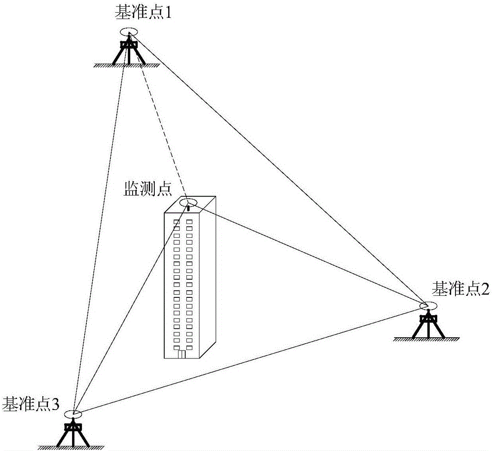
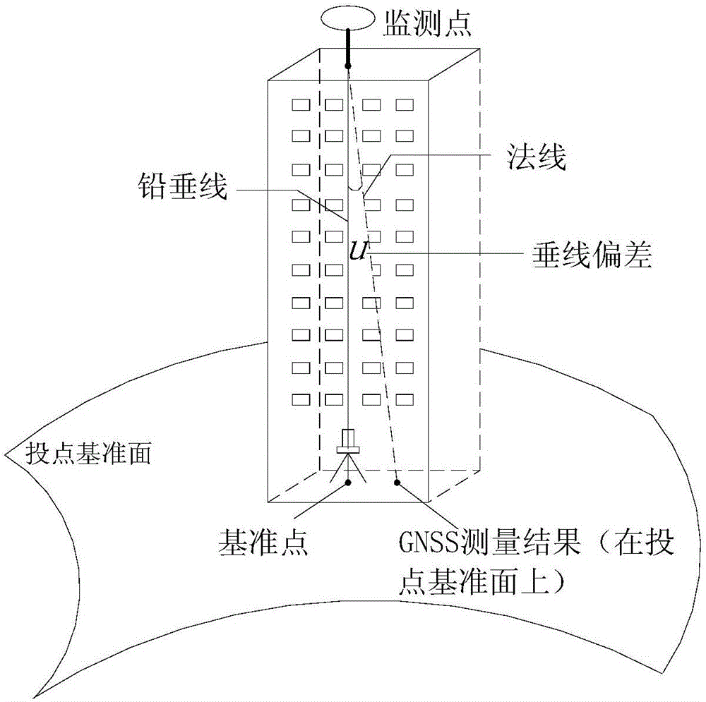
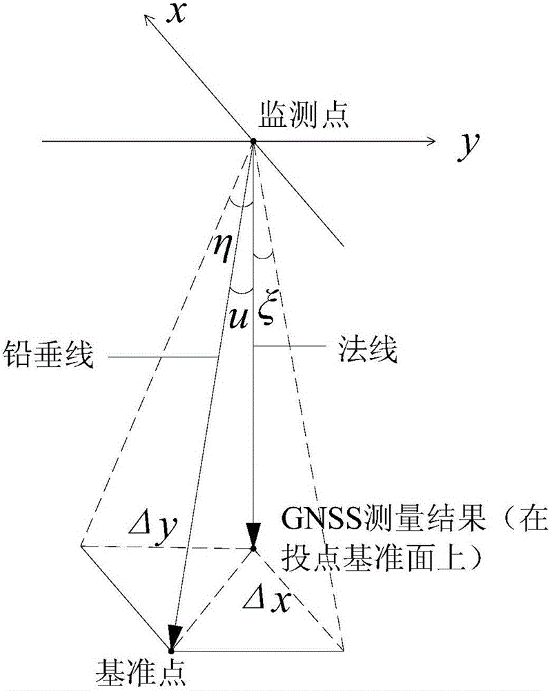
[0056] like figure 1 , 2 , Shown in 3 and 4, the present embodiment provides a kind of independent monitoring method utilizing GNSS technology to realize the verticality of super high-rise building construction, and the steps are as follows:
[0057] (a) On the super high-rise building monitoring layer, select a laser plumb meter projection point as the monitoring point, and select three control points with better air observation conditions in the super high-rise building's first-level control network as the benchmark point;
[0058] (b) Set up a GNSS receiver on the monitoring point and reference point selected in step (a) to carry out long-term static synchronous observation, requiring synchronous observation time ≥ 24 hours;
[0059] (c) Use the classic static baseline calculation mode to process the field observation data, and use the construction coordinates of the datum points as constraints to obtain the construction coordinates of the monitoring points through adjust...
PUM
 Abstract
Description
Claims
Application Information
 - R&D
- Intellectual Property
- Life Sciences
- Materials
- Tech Scout
- Unparalleled Data Quality
- Higher Quality Content
- 60% Fewer Hallucinations
Browse by: Latest US Patents, China's latest patents, Technical Efficacy Thesaurus, Application Domain, Technology Topic, Popular Technical Reports.
© 2025 PatSnap. All rights reserved.Legal|Privacy policy|Modern Slavery Act Transparency Statement|Sitemap|About US| Contact US: help@patsnap.com


