Road mapping method and device

A technology for roads and lanes, which is applied in the field of road surveying and mapping methods and devices, and can solve problems such as low surveying and mapping efficiency and potential safety hazards

Active Publication Date: 2016-12-07
SHANGHAI HAIJI INFORMATION TECH
View PDF6 Cites 5 Cited by
  • Summary
  • Abstract
  • Description
  • Claims
  • Application Information

AI Technical Summary

Problems solved by technology

[0006] Embodiments of the present invention provide a road surveying and mapping method and device to solve the problems of potential safety hazards and low surveying and mapping efficiency existing in existing surveying and mapping methods

Method used


Image

  • Road mapping method and device
  • Road mapping method and device
  • Road mapping method and device

Examples


Embodiment Construction

[0029] In order to make the object, technical solution and advantages of the present invention clearer, the present invention will be further described in detail below in conjunction with the accompanying drawings. Obviously, the described embodiments are only some embodiments of the present invention, rather than all embodiments . Based on the embodiments of the present invention, all other embodiments obtained by persons of ordinary skill in the art without making creative efforts belong to the protection scope of the present invention.

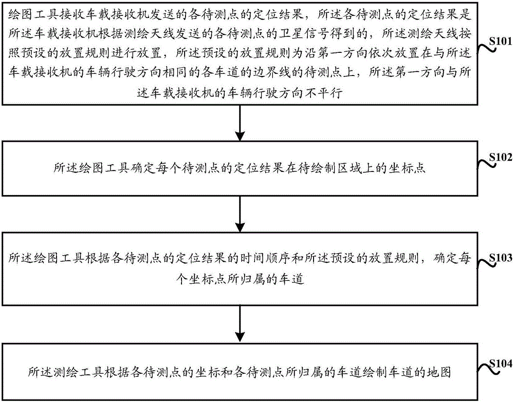
[0030] see figure 2 As shown, the embodiment of the present invention provides a schematic flow chart of a road surveying and mapping method, and the specific implementation method includes:

[0031] Step S101, the drawing tool receives the positioning results of the points to be measured sent by the vehicle-mounted receiver, and the positioning results of the points to be measured are obtained by the vehicle-mounted receiver according to...


PUM


Abstract

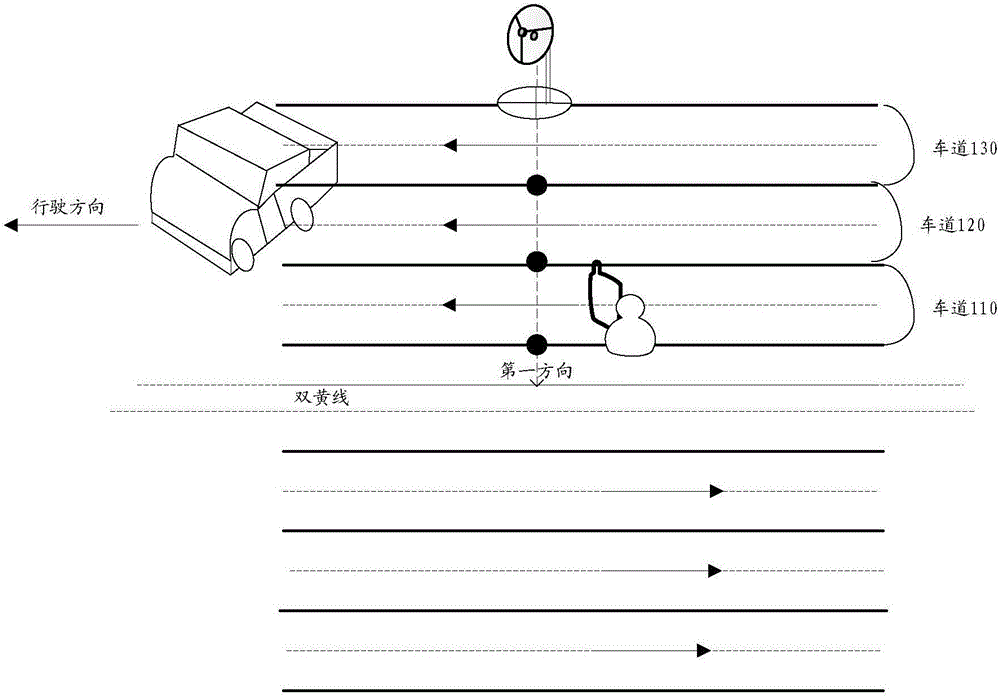
The method provides a road mapping method and device. The method comprises the steps that a drawing tool receives the positioning result, which is sent by an on-board receiver, of each to-be-measured point; the positioning result of each to-be-measured point is acquired by the on-board receiver according to the satellite signal, which is sent by a mapping antenna, of each to-be-measured point; mapping antennas are placed according to a preset placement rule, wherein the preset placement rule is that the mapping antennas are successively on the to-be-measured points of lane border lines same as the vehicle traveling direction of the on-board receiver along a first direction, and the first direction is not parallel to the vehicle traveling direction of the on-board receiver; a drawing tool determines the coordinate point of the positioning result of each to-be-measured point in an area to be drawn; and the drawing tool determines the lane of each coordinate point and draws a lane map according to the time order of the positioning result of each to-be-measured point and the preset placement rule. The problems of hidden dangers and low mapping efficiency of the existing surveying method are solved.

Description

technical field [0001] The invention relates to the field of surveying and mapping, in particular to a road surveying and mapping method and device. Background technique [0002] According to Order No. 123 of the Ministry of Public Security, the evaluation of motor vehicle driver tests must be automated. As the GPS / Beidou high-precision positioning technology becomes more and more mature, this technology has become the mainstream method for road test evaluation of motor vehicle drivers. The use of satellite positioning system as the source of evaluation data requires that each test site must map the corresponding test site, and the map must also have the characteristics of high-precision surveying and mapping, that is, all lanes in the test site need to be calibrated and mapped. In this way, when the test vehicle changes lanes or presses the line during the test, the motor vehicle driver test system can make accurate judgments. [0003] The current road surveying and mappi...

Claims


Application Information

Patent Timeline
Patent Type & Authority Applications(China)
IPC IPC(8): G01S19/14
CPCG01S19/14
Inventor 李月光江宇轩曹潇王亚汀储召锐张嘉文吉青
Owner SHANGHAI HAIJI INFORMATION TECH
Why Eureka
Try Eureka