

Method and device for road surveying and mapping
A road and lane technology, applied in the field of road surveying and mapping methods and devices, can solve problems such as hidden safety hazards and low surveying and mapping efficiency.
- Summary
- Abstract
- Description
- Claims
- Application Information
AI Technical Summary
Problems solved by technology
Method used
Image

Examples
Embodiment Construction
[0029] In order to make the object, technical solution and advantages of the present invention clearer, the present invention will be further described in detail below in conjunction with the accompanying drawings. Obviously, the described embodiments are only some embodiments of the present invention, rather than all embodiments . Based on the embodiments of the present invention, all other embodiments obtained by persons of ordinary skill in the art without making creative efforts belong to the protection scope of the present invention.
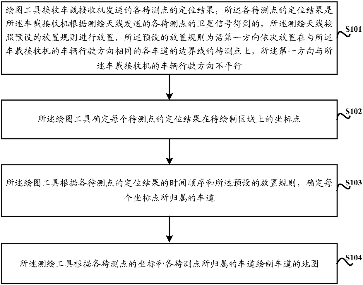
[0030] see figure 2 As shown, the embodiment of the present invention provides a schematic flow chart of a road surveying and mapping method, and the specific implementation method includes:
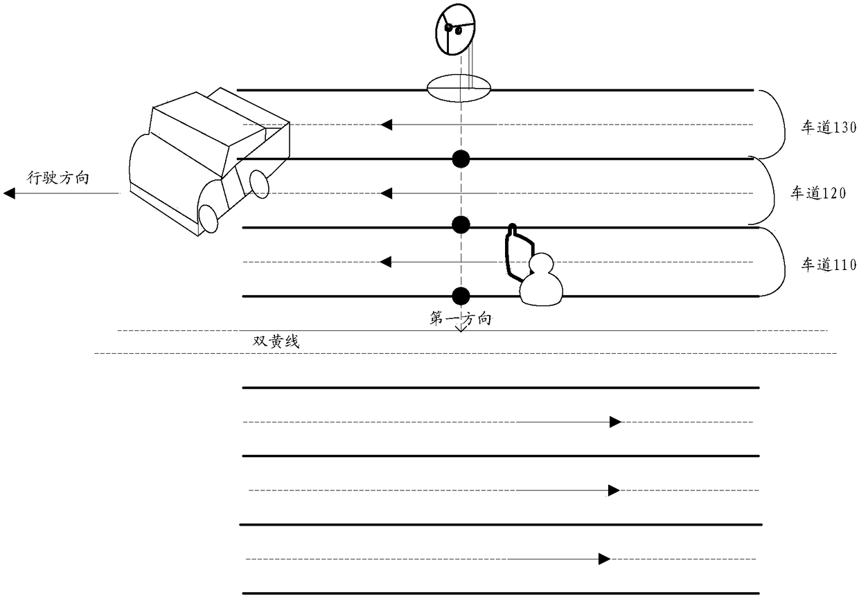
[0031] Step S101, the surveying and mapping tool receives the positioning results of the points to be measured sent by the vehicle-mounted receiver, and the positioning results of the points to be measured are obtained by the vehicle-mounted receive...
PUM
 Abstract
Description
Claims
Application Information