Earth geographic information data sharing method
A geographic information data, earth technology, applied in geographic information database, electronic digital data processing, structured data retrieval, etc., can solve the problem of poor timeliness and security of earth geographic information data sharing, and cannot realize shared information storage safely and quickly and issues such as the release of shared information
- Summary
- Abstract
- Description
- Claims
- Application Information
AI Technical Summary
Problems solved by technology
Method used
Image
Examples
Embodiment 1
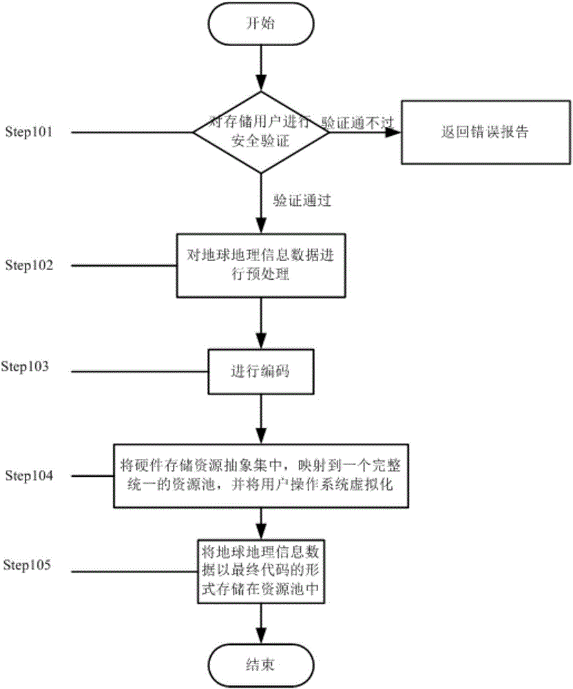
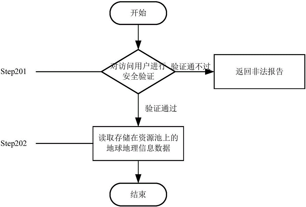
[0063] see figure 1 , figure 2 In this embodiment, a method for sharing geographic information data is characterized in that it includes preliminary processing, secure storage of geographic information data, and secure access to geographic information data;
[0064] The preliminary processing includes the following steps:
[0065] Classify the input geographic information data according to the preset geographic information data classification table, and store the classified geographic information data in the geographic information database corresponding to the geographic information data classification table;
[0066] According to the pre-set update cycle, read the geo-geographic information data stored in the geo-geographic information databases in the geo-geographic information data interface, convert the read geo-geographic information data in different formats into the geo-geographic information data of the pre-set format, and Output the earth geographic information dat...
Embodiment 2
[0089] see figure 1 , figure 2 In this embodiment, a method for sharing geographic information data is characterized in that it includes preliminary processing, secure storage of geographic information data, and secure access to geographic information data;
[0090] The preliminary processing includes the following steps:
[0091] Classify the input geographic information data according to the preset geographic information data classification table, and store the classified geographic information data in the geographic information database corresponding to the geographic information data classification table;
[0092] According to the pre-set update cycle, read the geo-geographic information data stored in the geo-geographic information databases in the geo-geographic information data interface, convert the read geo-geographic information data in different formats into the geo-geographic information data of the pre-set format, and Output the earth geographic information dat...
Embodiment 3
[0131] see figure 1 , figure 2 In this embodiment, a method for sharing geographic information data is characterized in that it includes preliminary processing, secure storage of geographic information data, and secure access to geographic information data;
[0132] The preliminary processing includes the following steps:
[0133] Classify the input geographic information data according to the preset geographic information data classification table, and store the classified geographic information data in the geographic information database corresponding to the geographic information data classification table;
[0134] According to the pre-set update cycle, read the geo-geographic information data stored in the geo-geographic information databases in the geo-geographic information data interface, convert the read geo-geographic information data in different formats into the geo-geographic information data of the pre-set format, and Output the earth geographic information dat...
PUM
 Abstract
Description
Claims
Application Information
 - R&D
- Intellectual Property
- Life Sciences
- Materials
- Tech Scout
- Unparalleled Data Quality
- Higher Quality Content
- 60% Fewer Hallucinations
Browse by: Latest US Patents, China's latest patents, Technical Efficacy Thesaurus, Application Domain, Technology Topic, Popular Technical Reports.
© 2025 PatSnap. All rights reserved.Legal|Privacy policy|Modern Slavery Act Transparency Statement|Sitemap|About US| Contact US: help@patsnap.com


