Method for calculating ground surface root-mean-square height through fully-polarized SAR data
A technology of root mean square height and data calculation, which is applied in the field of microwave remote sensing, and can solve the problems of not calculating the surface roughness of vegetation coverage, and cannot be directly used to calculate the root mean square height of the surface.
- Summary
- Abstract
- Description
- Claims
- Application Information
AI Technical Summary
Problems solved by technology
Method used
Image

Examples
Embodiment Construction
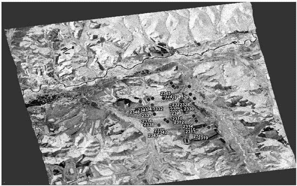
[0031] Study area and data
[0032] The present invention's research area is located at Egan Farm and its surroundings in Erguna City, Inner Mongolia Autonomous Region ( figure 1 ), located on the west slope of the northern section of the Great Khingan Mountains, covering a range from 120°12 to 122°55' east longitude and 50°20' to 52°30' north latitude. Its physical and geographical characteristics are high latitude and high cold, and the crops are mainly upland crops such as wheat and rapeseed; at the same time, the range of plots in the research area is much higher than the image resolution, which is conducive to reducing the number of mixed pixels and types of mixed It provides favorable conditions for the development of experiments. In the experiment, the RADARSAT-2 full polarization data acquired on June 24, 2016 and the actual sampling data collected during the transit were carried out to carry out research on extracting surface soil moisture based on RADARSAT-2 data. ...
PUM
 Abstract
Description
Claims
Application Information
 - R&D Engineer
- R&D Manager
- IP Professional
- Industry Leading Data Capabilities
- Powerful AI technology
- Patent DNA Extraction
Browse by: Latest US Patents, China's latest patents, Technical Efficacy Thesaurus, Application Domain, Technology Topic.
© 2024 PatSnap. All rights reserved.Legal|Privacy policy|Modern Slavery Act Transparency Statement|Sitemap