
Methods and systems for creating and using a location identification grid

A technology of identification and identifier, applied in the field of geographic location identification, can solve the problems of non-existent addressing system and cumbersome international use

Pending Publication Date: 2017-08-01
US POSTAL SERVICE
View PDF7 Cites 21 Cited by
  • Summary
  • Abstract
  • Description
  • Claims
  • Application Information

AI Technical Summary

Problems solved by technology

[0008] Also, in some parts of the world, an addressing system may not exist, or may be too cumbersome for domestic and / or international use

Method used


Image

  • Methods and systems for creating and using a location identification grid
  • Methods and systems for creating and using a location identification grid
  • Methods and systems for creating and using a location identification grid

Examples


Embodiment Construction

[0062] Some embodiments described herein relate to systems and methods for generating location identification grids. Some embodiments relate specifically to methods of generating location identification grids. Some embodiments relate to methods for identifying grids using locations. Some embodiments relate to new techniques and methods of identifying locations within a location identification grid. Some embodiments relate to hardware and software components that may be used in conjunction with a location identification grid.

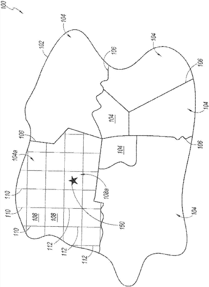
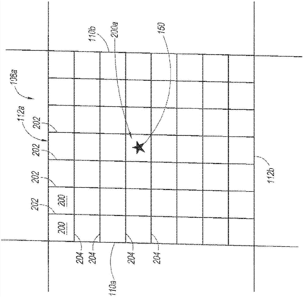
[0063] In some embodiments, a geographic area may be divided into several smaller geographic regions. In some embodiments, each of these geographic regions may be further divided until a desired level of resolution is achieved within the grid. In some embodiments, a location may be identified by identifying one or more areas that contain the location. In some embodiments, these geographic regions can be divided by applying existing grid systems such ...


PUM


Abstract

A method and system for generating a location identifier using a location code and a grid coordinate. The location code corresponds to a defined geographical area, such as a postal code or an area code, A grid coordinate can be determined based on destination location information, such as an address, a GPS-determined position, or other reference to a specific physical location. The location identifier is combined with the location code to generate a location identifier, which can be encoded in a computer readable format and placed on items for use in a distribution network. The location identifier can be used to facilitate domestic or international distribution of items using a common format or addressing scheme. The domestic and foreign distribution networks read and interpret location identifiers in order to deliver items.

Description

[0001] Cross References to Related Applications [0002] This application claims priority to US Provisional Application 62 / 055,442, filed September 25, 2015, the entire contents of which are hereby incorporated by reference. technical field [0003] This application relates to the field of geographic location identification. Background technique [0004] Location identification is done in a number of ways including, for example, relative location, addressing and through the use of a grid system. [0005] Determining relative positions is a long-established method of developing location markers. The relative position is referenced to a landmark or other identifying feature. Although relative location is simple, it is difficult to use reliably because landmarks can be difficult to identify consistently. Relative locations are also difficult to use because landmarks and other identifying features can change over time. Thus, while relative positions are useful in facilitatin...

Claims


Application Information

Patent Timeline
Patent Type & Authority Applications(China)
IPC IPC(8): G06Q10/08G09B29/00G09B29/10
CPCG06Q10/083G06Q10/08355G09B29/007G09B29/10G06F16/9537G06F16/24578
Inventor C·C·博内尔G·C·勒柏林
Owner US POSTAL SERVICE
Learn More