A method for automatic placement of annotations on 3D map line elements
A technology of three-dimensional maps and line elements, applied in maps/plans/charts, geographic information databases, instruments, etc., to achieve the effects of reducing real-time calculations, improving readability, and solving differentiated needs
- Summary
- Abstract
- Description
- Claims
- Application Information
AI Technical Summary
Problems solved by technology
Method used
Image
Examples
Embodiment Construction
[0036] The present invention will be further explained below in conjunction with the drawings and specific embodiments.
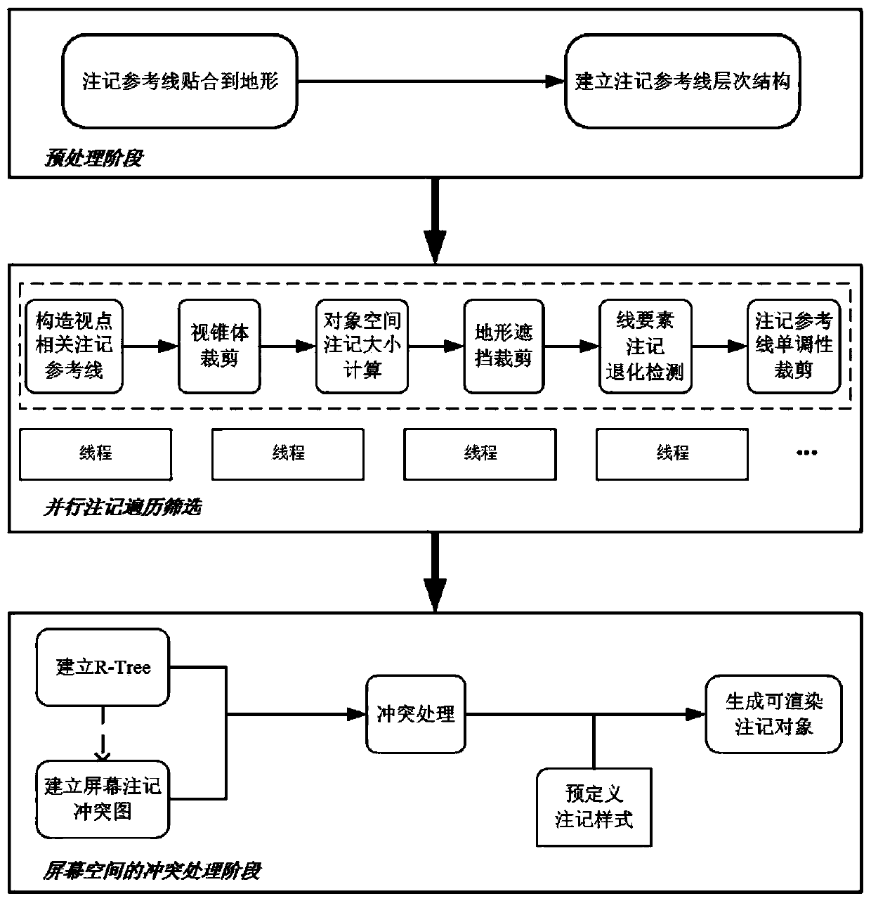
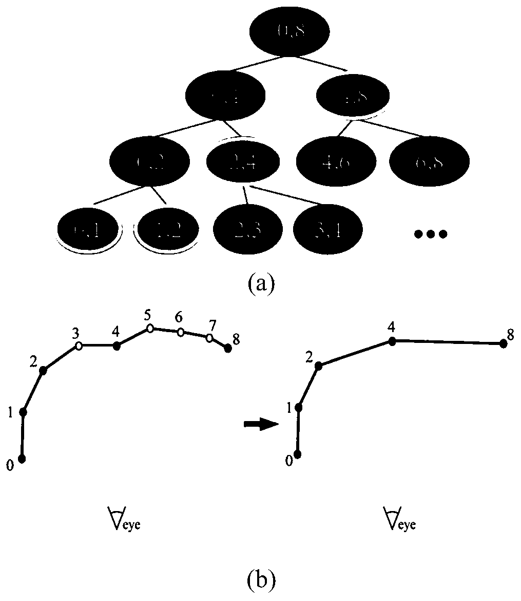
[0037] The processing flow of a method for automatically placing annotations of three-dimensional map line elements disclosed in the embodiment of the present invention is divided into three stages: figure 1 ), generate a hierarchical tree structure of annotation reference lines in the preprocessing stage to speed up the real-time generation of viewpoint-related annotation reference lines in the next stage; An annotation, and finally project annotation guides to screen space as input to the next stage; the last stage, conflicts between annotations are handled on screen space.
[0038] Step (1) In the preprocessing stage, the annotation reference line is attached to the ground surface, and the hierarchical tree structure of the annotation reference line is established. include:
[0039] (1.1) Fit the line elements to the terrain surface to generate the ori...
PUM
 Abstract
Description
Claims
Application Information
 - R&D
- Intellectual Property
- Life Sciences
- Materials
- Tech Scout
- Unparalleled Data Quality
- Higher Quality Content
- 60% Fewer Hallucinations
Browse by: Latest US Patents, China's latest patents, Technical Efficacy Thesaurus, Application Domain, Technology Topic, Popular Technical Reports.
© 2025 PatSnap. All rights reserved.Legal|Privacy policy|Modern Slavery Act Transparency Statement|Sitemap|About US| Contact US: help@patsnap.com


