
Geography location standardization extraction method

A technology of geographic location and geographic location information, applied in the field of standardized extraction of geographic location, can solve problems such as shortened analysis time, high algorithm complexity, and slow running time, and achieve the effects of shortened analysis time, improved analysis efficiency, and improved operating efficiency

Inactive Publication Date: 2018-01-09
SICHUAN CHANGHONG ELECTRIC CO LTD
View PDF4 Cites 2 Cited by
  • Summary
  • Abstract
  • Description
  • Claims
  • Application Information

AI Technical Summary

Problems solved by technology

[0003] The present invention overcomes the problems of high algorithm complexity and slow running time caused by multi-dimensional fuzzy matching of address information in the prior art, and provides a method for standardized extraction of geographic location with significantly shortened analysis time in the case of a large amount of data

Method used


Image

  • Geography location standardization extraction method

Examples


Embodiment Construction

[0014] The present invention will be further elaborated below in conjunction with the accompanying drawings.

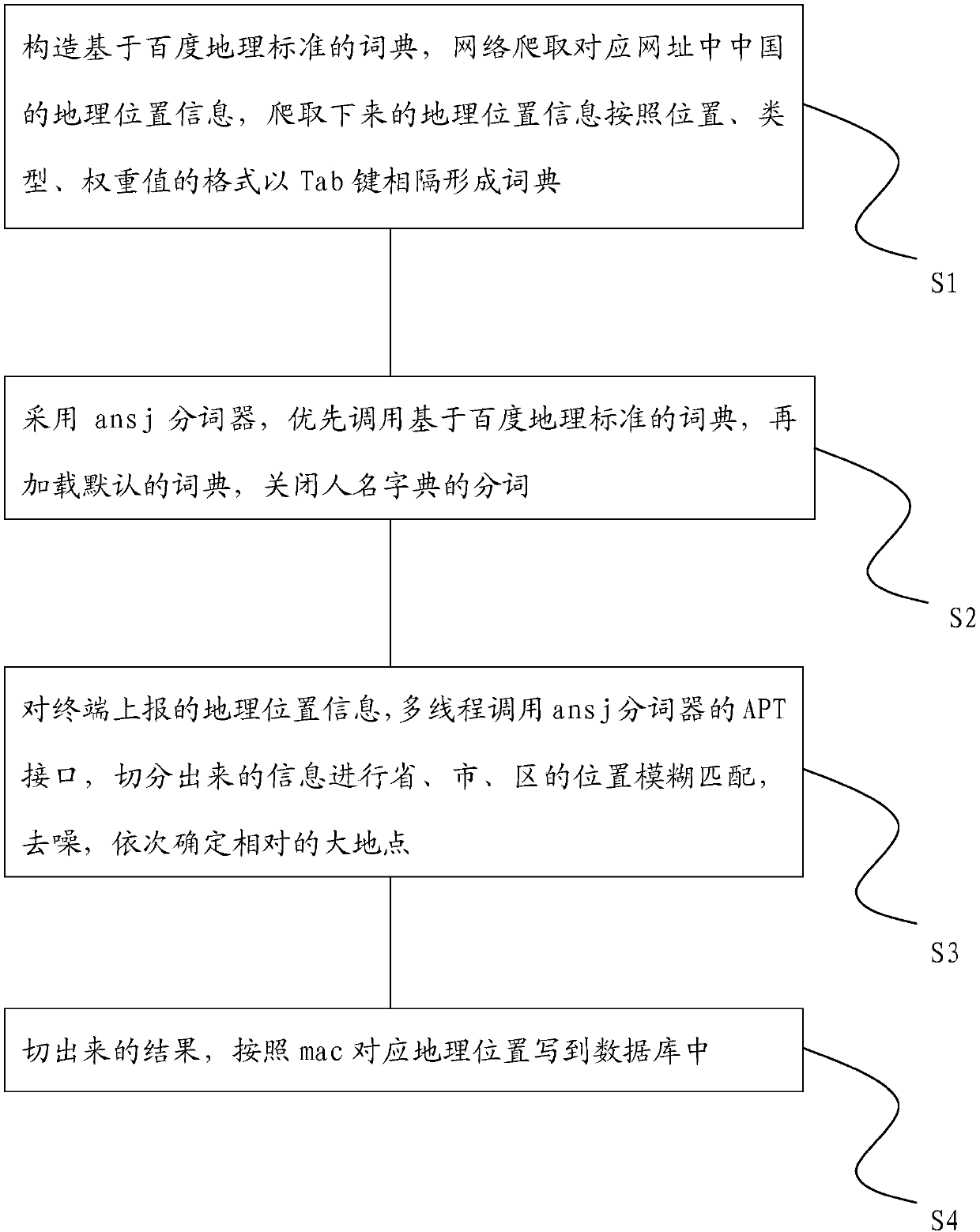
[0015] Such as figure 1 As shown, a method for geographical location standardization extraction, it includes the following steps:

[0016] S1. Construct a dictionary based on Baidu’s geographical standards, and crawl the corresponding website (www.meet99.com) for China’s geographical location information. The crawled geographical location information is separated by the Tab key in the format of location, type, and weight value. dictionary;

[0017] S2, using the ans j word segmenter, first calling the dictionary based on Baidu's geographical standards, then loading the default dictionary, and turning off the word segmentation of the name dictionary;

[0018] S3, for the geographical location information reported by the terminal, call the APT interface of the ans j tokenizer in multiple threads, perform fuzzy matching on the location of the province, city, and distri...


PUM


Abstract

The invention discloses a geography location standardization extraction method. The method comprises the following steps: constructing a dictionary based on Baidu geography standards, crawling for China geography location information in a corresponding website on a network, and taking a Tab key as intervals to use the geography location information, which is obtained by crawling, to form a dictionary according to a format of locations, types and weight values; adopting an ansj word-segmentation device, preferentially invoking the dictionary based on the Baidu geography standards, then loadinga default dictionary, and closing word segmentation of a person name dictionary; invoking an APT interface of the ansj word-segmentation device in a multi-threading manner to segment geography location information reported by a terminal, carrying out fuzzy location matching of a province, a city and a district and denoising on information obtained by segmentation, and determining relatively big places in turn; and writing a result, which is obtained by segmentation, into a database according to a corresponding geography location of mac. Resolution time of the method is significantly shortenedin a case of massive data.

Description

technical field [0001] The invention relates to the field of network technology, in particular to a method for standardized extraction of geographic location. Background technique [0002] In the case of a large increase in the amount of data, the granularity and speed of address information extraction are particularly important, so a fast and accurate algorithm for extracting provinces, cities, districts, and streets in address information is needed. Existing technical means are to use multi-dimensional geographic location matching to fuzzy match known geographic locations with unspecified geographic locations. This method relies heavily on existing geographic locations, and its completeness determines the matching probability. For example, multi-dimensional matching in Chengdu, Sichuan Province The geographical location of the city group needs to be matched with the 34 provinces and their corresponding cities. The number of calculations is the product of the two dimensions...

Claims


Application Information

Patent Timeline
Patent Type & Authority Applications(China)
IPC IPC(8): G06F17/30G06F17/27
Inventor 闫立鑫吴上波
Owner SICHUAN CHANGHONG ELECTRIC CO LTD
Learn More