
A display system of ground stress based on gis

A technology for displaying systems and ground stresses, applied in the information field, can solve problems such as inability to visually view ground stress data, achieve better display effects, ensure clarity, and overcome the effects of low resolution of saved pictures

Active Publication Date: 2020-09-01
CCTEG COAL MINING RES INST
View PDF5 Cites 0 Cited by
  • Summary
  • Abstract
  • Description
  • Claims
  • Application Information

AI Technical Summary

Problems solved by technology

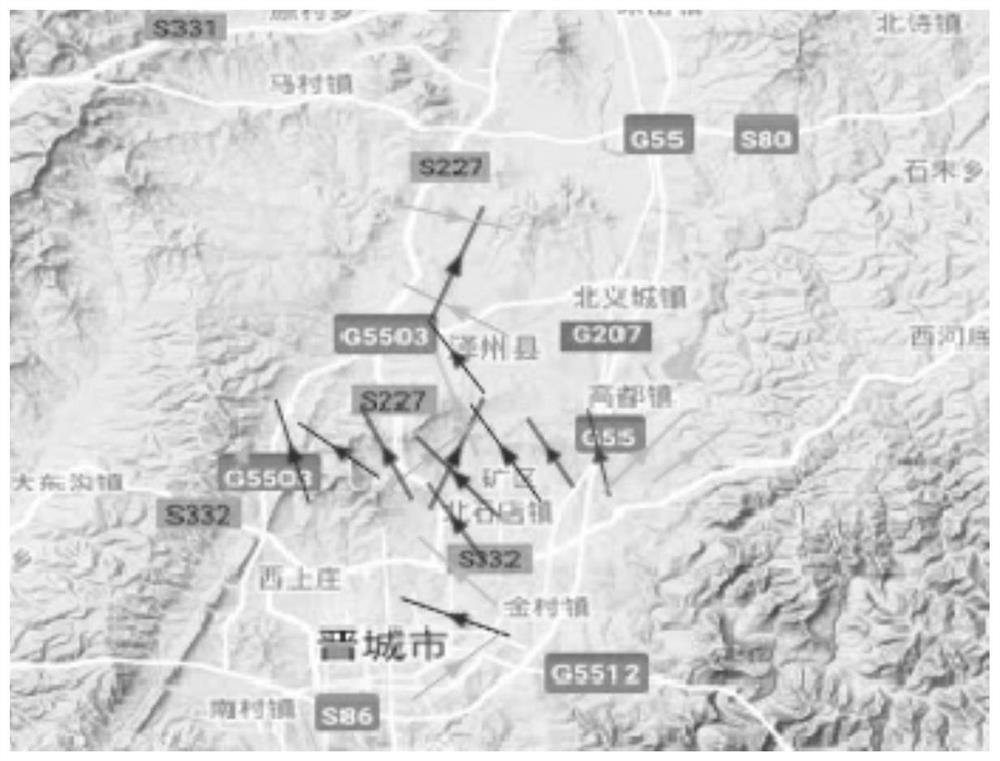
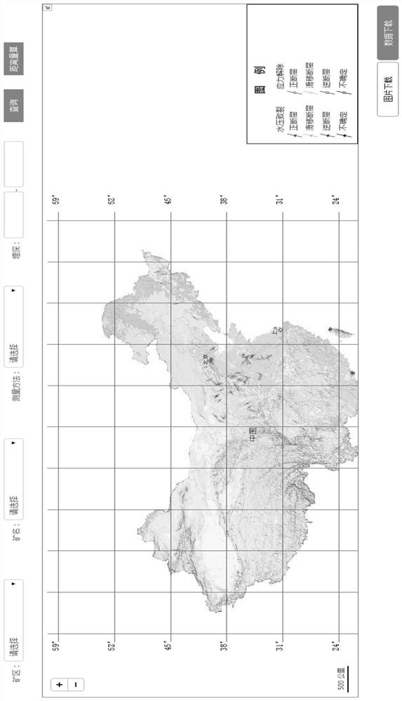
[0005] The technical problem to be solved by the present invention is to provide a GIS-based geostress display system for the defect that the geostress data cannot be viewed intuitively in the prior art, which can be visually displayed by marking the stress data icon on the map of the geographic information system

Method used


Image

  • A display system of ground stress based on gis
  • A display system of ground stress based on gis
  • A display system of ground stress based on gis

Examples


Embodiment Construction

[0042]In order to make the purpose, technical solutions and advantages of the embodiments of the present invention clearer, the technical solutions in the embodiments of the present invention will be clearly and completely described below in conjunction with the drawings in the embodiments of the present invention. Obviously, the described embodiments It is a part of embodiments of the present invention, but not all embodiments. Based on the embodiments of the present invention, all other embodiments obtained by persons of ordinary skill in the art without making creative efforts belong to the protection scope of the present invention.

[0043] see figure 1 , is a block diagram of a GIS-based geostress display system according to the first embodiment of the present invention. Such as figure 1 As shown, the GIS-based geostress display system provided by the first embodiment at least includes: a data management module 100 , a data query module 200 and a geographic information ...


PUM


Abstract

The invention relates a GIS-based (geographic information system) geostress depicting system and method, wherein the method comprises: a data management module for managing geostress data, wherein thegeostress data at least include geographic coordinates of monitoring spots and magnitude and direction of maximum horizontal stress; a data query module for receiving geostress query conditions, sending the geostress query conditions to the data management module for the purpose of querying, and supplying queried geostress data to a geographic information system module; the geographic informationsystem module for displaying the queried geostress data of the data query module correspondingly on a geographic information system map, wherein stress data icons are marked correspondingly on the geographic information system map according to the geographic coordinates of the monitoring spots. The stress data icons are marked on the GIS map to display geostress distribution conditions of mine areas, so that users may visually understand the geostress of the mine areas.

Description

technical field [0001] The invention relates to the field of information technology, in particular to a GIS-based geostress display system. Background technique [0002] In-situ stress is the natural stress in the crust that has not been disturbed by engineering. It is also called the initial stress of rock mass, absolute stress or original rock stress. In a broad sense, it also refers to the stress in the earth. It includes stresses caused by geothermal, gravity, changes in the Earth's rotation rate, and other factors. [0003] In-situ stress is the fundamental force that causes deformation and destruction of mining, water conservancy and hydropower, civil construction, railway, highway, military and other various underground or open-pit rock and soil excavation projects. Analysis is the necessary prerequisite to realize the scientific design and decision-making of geotechnical engineering excavation. The state of ground stress is also of great significance to earthquake ...

Claims


Application Information

Patent Timeline
Patent Type & Authority Patents(China)
IPC IPC(8): G06F16/29G06T11/60
CPCG06F16/29G06T11/60
Inventor 高富强康红普娄金福李建忠杨景贺王晓卿
Owner CCTEG COAL MINING RES INST
Learn More