Method for generating grid map used for unmanned vehicle navigation control

A grid map, unmanned vehicle technology, applied in geographic information databases, special data processing applications, structured data retrieval, etc., can solve problems such as inability to use unmanned vehicles to control decision-making, complex environments, and inability to obtain information.

Inactive Publication Date: 2018-07-10
FAFA AUTOMOBILE (CHINA) CO LTD
View PDF4 Cites 20 Cited by
  • Summary
  • Abstract
  • Description
  • Claims
  • Application Information

AI Technical Summary

Problems solved by technology

[0004] In the process of implementing the present invention, the inventor of the present application found that the above-mentioned solution in the prior art can only obtain whether the location around the unmanned vehicle is occupied and whether the vehicle can move to this location, but cannot obtain more information
Such a grid map is not suitable for unmanned vehicles operating outdoors. Because the diversity of traffic conditions makes the environment around unmanned vehicles more complex, it cannot be used for control decisions of unmanned vehicles
In addition, the above-mentioned solutions in the prior art also have the following defects: high production and maintenance costs, relatively long update cycle, and inability to obtain real-time information around unmanned vehicles, etc.

Method used


Image

  • Method for generating grid map used for unmanned vehicle navigation control
  • Method for generating grid map used for unmanned vehicle navigation control
  • Method for generating grid map used for unmanned vehicle navigation control

Examples


Embodiment Construction

[0030] The specific implementation manners of the embodiments of the present invention will be described in detail below with reference to the accompanying drawings. It should be understood that the specific implementations described here are only used to illustrate and explain the embodiments of the present invention, and are not used to limit the embodiments of the present invention.

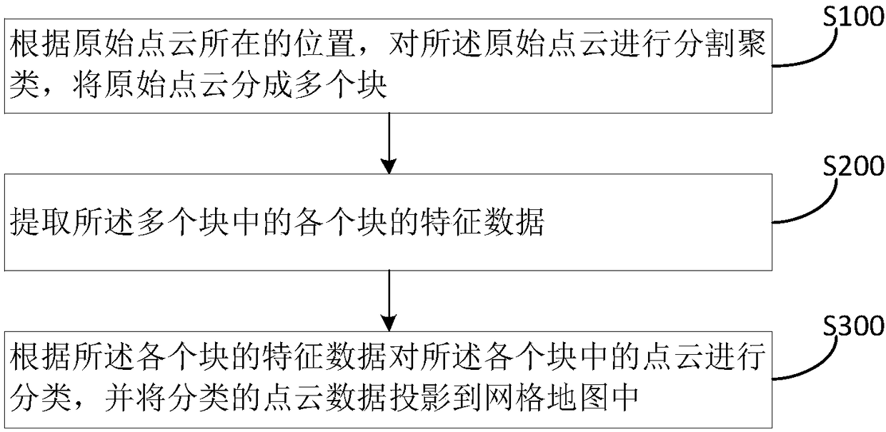
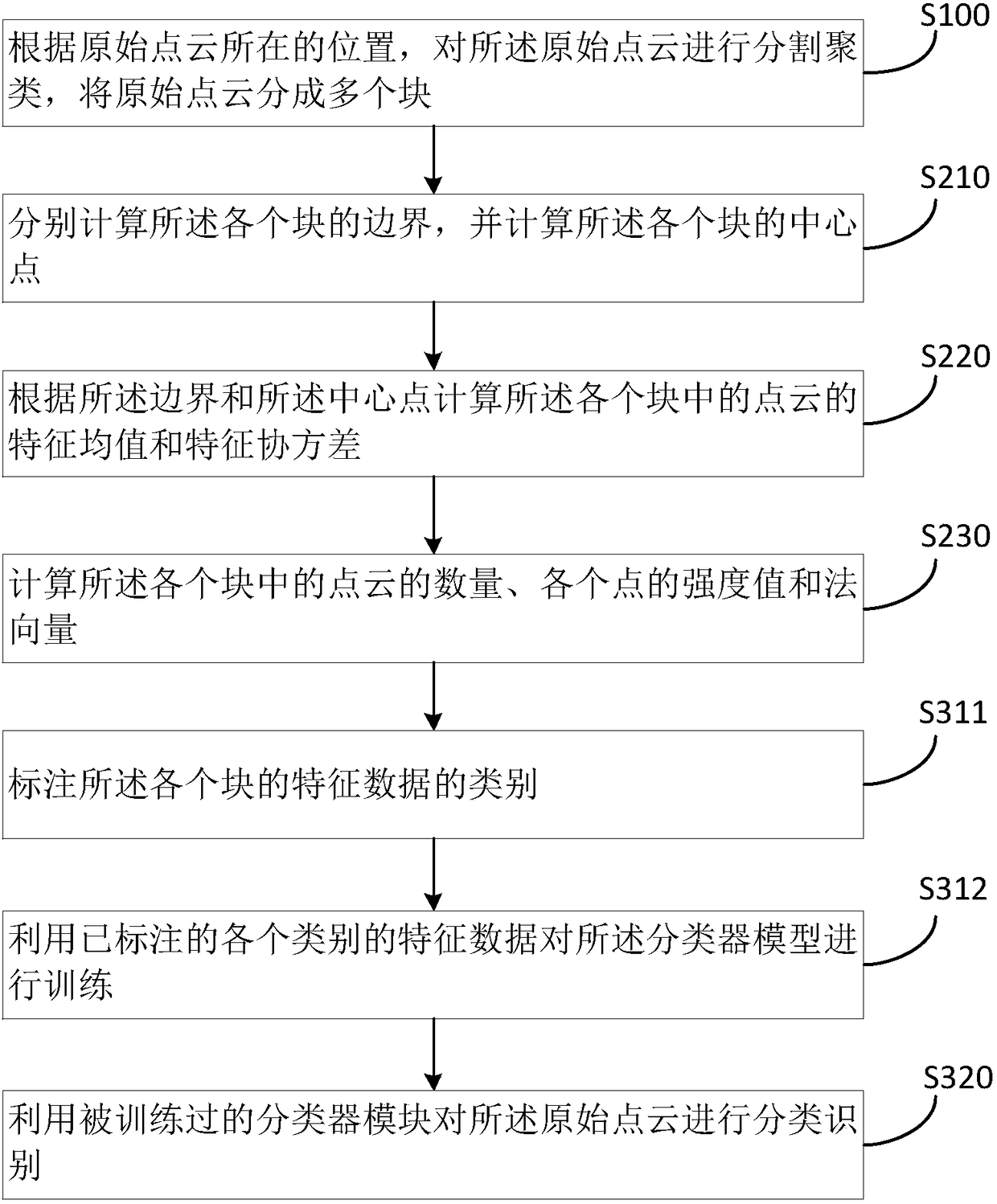
[0031] figure 1 It is a flowchart of a method for generating a grid map for unmanned vehicle navigation control according to the first embodiment of the present invention. Such as figure 1 As shown, the method includes the following steps:

[0032] In step S100, the original point cloud is segmented and clustered according to the location of the original point cloud, and the original point cloud is divided into multiple blocks. Among them, for example, the 3D point cloud obtained by lidar scanning can be projected onto the 2D plane where the unmanned vehicle is located, and the 2D plane can also...


PUM


Abstract

An embodiment of the invention provides a method for generating a grid map used for unmanned vehicle navigation control, and belongs to the field of automatic driving. The method comprises the steps of performing segmentation clustering on original point clouds according to the positions of the original point clouds, and dividing the original point clouds into multiple blocks; extracting feature data of each block in the blocks; and according to the feature data of each block, classifying point clouds in each block, and projecting classified point cloud data to the grid map. According to the method, regions occupied by barriers can be marked on the map accurately, and the type of the barrier in each region of the map can be marked.

Description

Technical field [0001] The present invention relates to the field of automatic driving, and in particular, to a method for generating a grid map for unmanned vehicle navigation control. Background technique [0002] Self-driving cars, also known as driverless cars (unmanned cars), computer-driven cars, or wheeled mobile robots, are smart cars that realize driverless driving through a computer system. Self-driving cars rely on artificial intelligence, visual computing, radar, monitoring devices, and global positioning systems to work together to allow computers to automatically and safely operate motor vehicles without any human active operation. [0003] Map technology is an indispensable part of the unmanned vehicle navigation technology. The current location information and destination information of the unmanned vehicle can be obtained through the map. At the same time, the map also includes modeling of the surrounding environment, such as lane lines, intersection information, ...

Claims


Application Information

Patent Timeline
Patent Type & Authority Applications(China)
IPC IPC(8): G06F17/30G06K9/62
CPCG06F16/29G06F18/214
Inventor 杜艳维
Owner FAFA AUTOMOBILE (CHINA) CO LTD
Why Eureka
Try Eureka