Three-dimensional GIS model displaying method and device

A three-dimensional display and three-dimensional technology, applied in 3D modeling, image data processing, instruments, etc., can solve the problems of data upgrade and expansion difficulties, large manual modeling costs, and large manual workload, so as to improve reducibility, The effect of reducing display costs and reducing storage capacity

Inactive Publication Date: 2018-08-31
BEIJING GREATMAP TECH
View PDF3 Cites 1 Cited by
  • Summary
  • Abstract
  • Description
  • Claims
  • Application Information

AI Technical Summary

Problems solved by technology

[0003] The size of 3D GIS data is usually much larger than the software itself. These data are stored in various formats in the user's workspace, and if they are unified in a 3D GIS software, they will face huge manual modeling costs.
This method has a huge amount of manual work, and the resulting data of the modeling cannot be returned to the original description form, and these description forms are exactly necessary for GIS analysis
At the same time, another disadvantage is that it is difficult to upgrade and expand the data. The result data of manual modeling needs to be updated following the update of the original descriptive data, and it faces long-term manual modeling.

Method used


Image

  • Three-dimensional GIS model displaying method and device
  • Three-dimensional GIS model displaying method and device
  • Three-dimensional GIS model displaying method and device

Examples


Embodiment Construction

[0020] Various exemplary embodiments of the present invention will now be described in detail with reference to the accompanying drawings. It should be noted that the relative arrangements of components and steps, numerical expressions and numerical values ​​set forth in these embodiments do not limit the scope of the present invention unless specifically stated otherwise.

[0021] At the same time, it should be understood that, for the convenience of description, the sizes of the various parts shown in the drawings are not drawn according to the actual proportional relationship.

[0022] The following description of at least one exemplary embodiment is merely illustrative in nature and in no way taken as limiting the invention, its application or uses.

[0023] Techniques, methods and devices known to those of ordinary skill in the relevant art may not be discussed in detail, but where appropriate, techniques, methods and devices should be considered part of the description. ...


PUM


Abstract

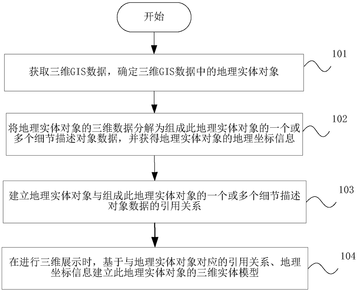
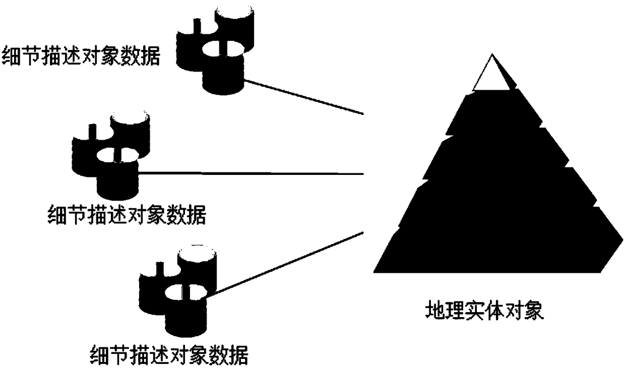
The invention discloses a three-dimensional GIS model displaying method and device; the method comprises the following steps: parsing three-dimensional GIS data of a geographic entity object into oneor more detail description object data, and obtaining geographic coordinate information of the geographic entity object; building a reference relation between the geographic entity object and one or more detail description object data that forms the geographic entity object, and building a three dimensional entity model of the geographic entity object according to the reference relation corresponding to the geographic entity object and the geographic coordinate information. The three-dimensional GIS model displaying method and device can batch-process massive GIS description type data, thus greatly reducing displaying costs of the description type GIS data, improving the data reducibility, reducing the data storage amount, and keeping a sufficient upgrading space.

Description

technical field [0001] The invention relates to the technical field of geospatial data processing, in particular to a three-dimensional GIS model display method and device. Background technique [0002] Geospatial data is a subject-oriented, integrated, dynamically updated, and persistent spatial data collection with geographic coordinates, which expresses the spatial characteristics of geographic entities as geometric (positioning) features (location, shape, location, etc.) of geographic entities. size and its distribution characteristics) and the spatial relationship between entities. GIS descriptive data can be divided into basic geometric types such as point, line, surface, and body according to its shape. Data in the natural geographic world can be classified into four basic geometric types: point, line, area, and body. These basic geometric types The assembled combination of GIS can describe the most complex GIS data. [0003] The size of 3D GIS data is usually much ...

Claims


Application Information

Patent Timeline
IPC IPC(8): G06T17/05G06T17/20
CPCG06T17/05G06T17/20
Inventor 陈阳羽魏强余文富樊文有
Owner BEIJING GREATMAP TECH
Why Eureka
Try Eureka